Category:Kirkby on Bain
Jump to navigation
Jump to search

village and civil parish in Lincolnshire, United Kingdom  | |||||
| Upload media | |||||
| Instance of | |||||
|---|---|---|---|---|---|
| Location | East Lindsey, Lincolnshire, East Midlands, England | ||||
| Population |
| ||||
| Area |
| ||||
| Said to be the same as | Kirkby on Bain (Wikimedia duplicated page, civil parish) | ||||
 | |||||
Subcategories
This category has the following 3 subcategories, out of 3 total.
Media in category "Kirkby on Bain"
The following 138 files are in this category, out of 138 total.
-
 A path to Haltham from Main Street - geograph.org.uk - 2577478.jpg 800 × 600; 326 KB
-
 Abandoned field off Wellsyke Lane - geograph.org.uk - 6400152.jpg 1,024 × 768; 155 KB
-
 Autumn sown cereal crop near Poplar Farm - geograph.org.uk - 6400159.jpg 1,024 × 768; 229 KB
-
 Birch with Fungus - geograph.org.uk - 464428.jpg 640 × 480; 114 KB
-
 Black House Farm - geograph.org.uk - 3595127.jpg 640 × 480; 71 KB
-
 Bridleway - geograph.org.uk - 6168776.jpg 480 × 640; 106 KB
-
 Burnt stump, Kirkby on Bain - geograph.org.uk - 6404386.jpg 1,024 × 768; 220 KB
-
 Campsite Entrance - geograph.org.uk - 2449247.jpg 3,264 × 2,448; 4.16 MB
-
 Car park, Ostler's Plantation - geograph.org.uk - 6400200.jpg 1,024 × 768; 243 KB
-

-

-
 Clearing, Moor Farm nature reserve - geograph.org.uk - 949634.jpg 640 × 480; 98 KB
-
 Clement's Farm - geograph.org.uk - 1959731.jpg 3,456 × 2,304; 2.62 MB
-
 Common Centaury - geograph.org.uk - 1961359.jpg 850 × 906; 826 KB
-
 Cottage at Red Mill Bridge - geograph.org.uk - 3022253.jpg 1,280 × 856; 221 KB
-

-

-
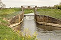
 Disused Lock - geograph.org.uk - 2439454.jpg 3,264 × 2,448; 4.96 MB
-
 Electricity pole in a field near Kirkby on Bain - geograph.org.uk - 6400157.jpg 1,024 × 768; 217 KB
-
 Elizabeth II postbox on Moor Lane - geograph.org.uk - 6668142.jpg 1,093 × 1,600; 657 KB
-
 Entering Kirkby on Bain - geograph.org.uk - 6666436.jpg 640 × 441; 76 KB
-
 Entrance to old sand pit, Kirkby Moor - geograph.org.uk - 6400154.jpg 1,024 × 768; 281 KB
-
 Entrance to Ostler's Plantation - geograph.org.uk - 2585825.jpg 1,280 × 960; 463 KB
-
-
 Farmland near Kirkby on Bain - geograph.org.uk - 3595142.jpg 640 × 480; 78 KB
-
 Farmland near Kirkby on Bain - geograph.org.uk - 3595144.jpg 640 × 480; 82 KB
-
 Farmland off Wellsyke Lane - geograph.org.uk - 5746681.jpg 1,600 × 1,200; 592 KB
-
 Farmland, Poplar Farm - geograph.org.uk - 3595132.jpg 640 × 480; 69 KB
-
 Field by Kirkby Lane, Kirkby on Bain - geograph.org.uk - 5385718.jpg 640 × 427; 44 KB
-

-
 Fields off Moor Lane - geograph.org.uk - 3533517.jpg 2,062 × 1,189; 2.17 MB
-
 Fingerpost at Red Mill Bridge - geograph.org.uk - 3022252.jpg 1,280 × 960; 309 KB
-
 Firebreak - geograph.org.uk - 464407.jpg 640 × 480; 103 KB
-
 Flooded gravel pit - geograph.org.uk - 3595145.jpg 640 × 480; 69 KB
-
 Footbridge over an old course of the River Bain - geograph.org.uk - 6404415.jpg 1,024 × 768; 224 KB
-
 Footbridge over the River Bain - geograph.org.uk - 6400107.jpg 1,024 × 768; 301 KB
-
 Footbridge to Haltham - geograph.org.uk - 4298225.jpg 1,024 × 682; 297 KB
-
 Footbridge, Moor Farm nature reserve - geograph.org.uk - 3507760.jpg 640 × 480; 101 KB
-
 Forestry Cottages access, Kirkby Moor - geograph.org.uk - 6400195.jpg 1,024 × 768; 304 KB
-
 Former chapel, Kirkby on Bain - geograph.org.uk - 6404402.jpg 1,024 × 768; 200 KB
-
 Grassland off Wellsyke Lane - geograph.org.uk - 6666449.jpg 1,024 × 768; 163 KB
-
 Grassland, Moor Farm nature reserve - geograph.org.uk - 949637.jpg 640 × 480; 95 KB
-

-
 Grazing, Kirkby on Bain - geograph.org.uk - 6666445.jpg 1,024 × 768; 173 KB
-
 Haltham fingerpost - geograph.org.uk - 4298527.jpg 1,024 × 682; 225 KB
-
 Haltham Lock - geograph.org.uk - 4298296.jpg 1,024 × 682; 264 KB
-
 Haltham Lock - geograph.org.uk - 4298518.jpg 1,024 × 682; 235 KB
-
 Haltham Lock - geograph.org.uk - 4889289.jpg 3,776 × 2,520; 3.92 MB
-
 Haltham, Red Mill Bridge - geograph.org.uk - 2129688.jpg 640 × 480; 116 KB
-

-
 Heather and bracken, Kirkby Moor - geograph.org.uk - 949598.jpg 640 × 480; 98 KB
-
 Heavy traffic, Wellsyke Lane - geograph.org.uk - 949431.jpg 640 × 475; 94 KB
-
 Horncastle Canal - geograph.org.uk - 2447880.jpg 3,264 × 2,448; 5.73 MB
-
 Horncastle Canal - geograph.org.uk - 6666431.jpg 1,024 × 768; 306 KB
-
 House in Kirkby on Bain - geograph.org.uk - 3595137.jpg 640 × 480; 80 KB
-
 Kirkby Gravel Pit Nature Reserve - geograph.org.uk - 1936467.jpg 640 × 480; 82 KB
-
 Kirkby Gravel Pits Nature Reserve - geograph.org.uk - 6399904.jpg 1,024 × 768; 213 KB
-
 Kirkby Lane, Kirkby on Bain - geograph.org.uk - 5385720.jpg 640 × 427; 52 KB
-
 Kirkby on Bain Landfill Site - geograph.org.uk - 4889335.jpg 3,776 × 2,520; 4.25 MB
-
 Landfill site, Kirkby on Bain - geograph.org.uk - 6404333.jpg 1,024 × 768; 184 KB
-
 Leafy driveway to Riverslea Farm - geograph.org.uk - 5385692.jpg 427 × 640; 99 KB
-
 Light traffic, Wellsyke Lane - geograph.org.uk - 949428.jpg 640 × 440; 87 KB
-
 Looking north along Roughton Road. - geograph.org.uk - 3022255.jpg 1,280 × 960; 253 KB
-
 Main Street, Kirkby on Bain - geograph.org.uk - 4889308.jpg 3,776 × 2,520; 3.93 MB
-
 Minor road heading south - geograph.org.uk - 3595128.jpg 640 × 480; 60 KB
-
 Minor road heading south - geograph.org.uk - 3595143.jpg 640 × 480; 59 KB
-
 Minor road heading south - geograph.org.uk - 3595146.jpg 640 × 480; 61 KB
-
 Moor Farm - Nature Reserve - geograph.org.uk - 2589010.jpg 640 × 427; 97 KB
-
 Moor Lane - geograph.org.uk - 3595141.jpg 640 × 480; 79 KB
-
 Moor Lane leaving Kirkby on Bain - geograph.org.uk - 4889297.jpg 3,776 × 2,520; 4.04 MB
-
 Moor Lane towards Kirkby on Bain - geograph.org.uk - 6668146.jpg 640 × 480; 96 KB
-
 Moor Lane towards Woodhall Spa - geograph.org.uk - 6666458.jpg 640 × 480; 103 KB
-
 Moor Lane towards Woodhall Spa - geograph.org.uk - 6666462.jpg 1,024 × 768; 287 KB
-
 Moor Lane, Kirkby on Bain - geograph.org.uk - 6666448.jpg 640 × 480; 70 KB
-
 Multi-service centre, Kirkby on Bain - geograph.org.uk - 4889300.jpg 3,776 × 2,520; 4.07 MB
-
 Near Kirkby on Bain. - geograph.org.uk - 162501.jpg 640 × 480; 99 KB
-
 Near Woodhall Spa - geograph.org.uk - 178894.jpg 640 × 480; 110 KB
-
-
 Poultry Houses (disused) - geograph.org.uk - 2449233.jpg 3,264 × 2,448; 5.05 MB
-
 Red Mill Bridge - geograph.org.uk - 3022251.jpg 1,280 × 960; 355 KB
-

-
 River Bain - geograph.org.uk - 147537.jpg 640 × 427; 93 KB
-
 River Bain - geograph.org.uk - 3939831.jpg 1,024 × 683; 246 KB
-
 River Bain - geograph.org.uk - 4298525.jpg 1,024 × 682; 169 KB
-
 River Bain at Kirkby on Bain - geograph.org.uk - 3506138.jpg 640 × 480; 75 KB
-
 River Bain at Kirkby on Bain - geograph.org.uk - 3506148.jpg 640 × 480; 111 KB
-
 River Bain footbridge - geograph.org.uk - 3939846.jpg 1,024 × 683; 355 KB
-
 River Bain from Redmill Bridge - geograph.org.uk - 197305.jpg 640 × 427; 90 KB
-

-
 Riverslea Farm and gravel pit - geograph.org.uk - 1959770.jpg 3,225 × 1,887; 3.24 MB
-
 Riverslea Lake - geograph.org.uk - 3022224.jpg 1,280 × 902; 201 KB
-
-
 Road junction, Red Mill Bridge - geograph.org.uk - 3595135.jpg 640 × 480; 56 KB
-
 Roughton Moor Wood Nature Reserve - geograph.org.uk - 5747581.jpg 1,600 × 1,200; 1,024 KB
-
 Sign for the Ebrington Arms, Kirkby on Bain - geograph.org.uk - 6666439.jpg 694 × 1,024; 138 KB
-
 Spring Arrives - geograph.org.uk - 773337.jpg 640 × 427; 118 KB
-
 Swampy area by Roughton Road - geograph.org.uk - 6404421.jpg 1,024 × 768; 322 KB
-
 The Ebrington Arms, Kirkby on Bain - geograph.org.uk - 6666438.jpg 1,024 × 634; 122 KB
-

-
 The Old River Bain - geograph.org.uk - 6404467.jpg 1,024 × 768; 184 KB
-
 The River Bain at Kirkby on Bain - geograph.org.uk - 6404383.jpg 1,024 × 768; 188 KB
-
 The River Bain at Kirkby on Bain - geograph.org.uk - 6404398.jpg 1,024 × 768; 186 KB
-
 The River Bain, Kirkby-on-Bain - geograph.org.uk - 3771670.jpg 640 × 480; 150 KB
-
 The River Bain, Kirkby-on-Bain - geograph.org.uk - 3771681.jpg 640 × 480; 117 KB
-
 The River Bain, Kirkby-on-Bain - geograph.org.uk - 3771773.jpg 640 × 480; 122 KB
-
 The River Bain, Kirkby-on-Bain - geograph.org.uk - 3771775.jpg 640 × 480; 127 KB
-

-

-
 Track (bridleway) into woodland, Kirkby Moor - geograph.org.uk - 6666460.jpg 1,024 × 768; 369 KB
-
 Vertical Conifers - geograph.org.uk - 464402.jpg 640 × 480; 123 KB
-

-
 Watering Hole - geograph.org.uk - 3940227.jpg 1,024 × 683; 252 KB
-
 Weir and disused watermill on river Bain - geograph.org.uk - 1959919.jpg 3,456 × 2,304; 3.95 MB
-
 Wellsyke Farm - geograph.org.uk - 1958922.jpg 3,584 × 2,072; 4.57 MB
-
 Wellsyke Lane - geograph.org.uk - 6666453.jpg 1,024 × 768; 276 KB
-
 Wellsyke Lane joins Moor Lane - geograph.org.uk - 3537704.jpg 2,256 × 1,504; 2.57 MB
-
 Wellsyke Lane, early summer - geograph.org.uk - 3507754.jpg 640 × 480; 141 KB
-
 Wellsyke Lane, early summer - geograph.org.uk - 3507755.jpg 640 × 480; 109 KB
-
 Wet Crop Field and Gates - geograph.org.uk - 2587140.jpg 1,280 × 960; 280 KB
-

-
 Woodhall Spa Camping ^ Caravan Club Site - geograph.org.uk - 1959750.jpg 3,388 × 2,336; 5.89 MB
-
 Woodland beside Moor Lane - geograph.org.uk - 6666455.jpg 768 × 1,024; 387 KB
-
 Woodland path - geograph.org.uk - 6168780.jpg 480 × 640; 127 KB
-
 Birches beyond scrub - geograph.org.uk - 773520.jpg 640 × 427; 111 KB
-
-
 Farm road at Roughton - geograph.org.uk - 555880.jpg 640 × 480; 105 KB
-
 Haltham Beck - geograph.org.uk - 418166.jpg 640 × 480; 78 KB
-
 Haltham footbridge - geograph.org.uk - 1422554.jpg 426 × 640; 79 KB
-
 Hay bales near Grange Farm - geograph.org.uk - 197308.jpg 640 × 427; 54 KB
-
 Marmion Arms - geograph.org.uk - 85764.jpg 640 × 427; 56 KB
-
 Moor Lane - geograph.org.uk - 464411.jpg 640 × 480; 89 KB
-
 Near Kirkby on Bain. - geograph.org.uk - 162497.jpg 640 × 480; 178 KB
-
 Near Tattershall Thorpe - geograph.org.uk - 178811.jpg 640 × 480; 108 KB
-
 No Information - geograph.org.uk - 464397.jpg 640 × 480; 97 KB
-
 Private residence off Church Lane - geograph.org.uk - 556785.jpg 640 × 480; 82 KB
-
 River Bain, Haltham - geograph.org.uk - 102301.jpg 640 × 480; 126 KB
-
 Road Junction - geograph.org.uk - 418177.jpg 640 × 480; 50 KB
-
 Wellsyke Lane. - geograph.org.uk - 163215.jpg 640 × 480; 153 KB


_-_geograph.org.uk_-_2449233.jpg)


_into_woodland,_Kirkby_Moor_-_geograph.org.uk_-_6666460.jpg)


