Category:Kirton, Lincolnshire
Jump to navigation
Jump to search
English: Kirton, or Kirton in Holland is a village and civil parish within the Borough of Boston, in Lincolnshire, England.
Main Wikipedia article: Kirton, Lincolnshire.

village and civil parish in Boston, Lincolnshire, England  | |||||
| Upload media | |||||
| Instance of | |||||
|---|---|---|---|---|---|
| Location | Boston, Lincolnshire, East Midlands, England | ||||
| Different from | |||||
| Said to be the same as | Kirton (Wikimedia duplicated page, civil parish) | ||||
 | |||||
Subcategories
This category has the following 10 subcategories, out of 10 total.
Media in category "Kirton, Lincolnshire"
The following 200 files are in this category, out of 311 total.
(previous page) (next page)-
 A descendant of Thomas Crapper's invention - geograph.org.uk - 4397578.jpg 4,320 × 3,240; 6 MB
-
 A small wood on Hill Lane near Kirton - geograph.org.uk - 4392725.jpg 4,320 × 3,240; 6 MB
-
 Apple Trees along Kirton Holme road - geograph.org.uk - 2768294.jpg 1,280 × 853; 353 KB
-
 Approaching Lentons Farm - geograph.org.uk - 3587598.jpg 3,264 × 2,448; 3.15 MB
-
 B1397 towards Boston - geograph.org.uk - 3621492.jpg 640 × 480; 78 KB
-
 Bailey Walls - geograph.org.uk - 5569345.jpg 640 × 480; 78 KB
-
 Barn and tank at Lentons Farm - geograph.org.uk - 3592899.jpg 2,802 × 2,083; 2.45 MB
-
 Beck Bank - geograph.org.uk - 1524942.jpg 640 × 426; 76 KB
-
 Beck Bank - geograph.org.uk - 1524949.jpg 640 × 426; 69 KB
-
 Bench on the sea bank - geograph.org.uk - 3661883.jpg 4,000 × 3,000; 3.43 MB
-
 Bend in Bucklegate Lane - geograph.org.uk - 3587590.jpg 3,081 × 2,249; 2.77 MB
-
 Bend in Bucklegate Lane - geograph.org.uk - 3592959.jpg 3,264 × 2,448; 3.72 MB
-
 Black Bull, Kirton (26497289342).jpg 3,853 × 2,901; 3.42 MB
-
 Boot Lane, Skeldyke - geograph.org.uk - 4599253.jpg 640 × 427; 66 KB
-
 Brent Geese - geograph.org.uk - 2746647.jpg 1,280 × 960; 584 KB
-
 Brent Geese on the wing - geograph.org.uk - 2746628.jpg 2,592 × 1,944; 1.64 MB
-

-
 Bucklegate Lane - geograph.org.uk - 5569298.jpg 640 × 480; 87 KB
-
 Bucklegate Lane and Marsh Road junction - geograph.org.uk - 3593003.jpg 2,807 × 2,024; 2.59 MB
-
 Bucklegate Lane meets Marsh Road - geograph.org.uk - 4393866.jpg 4,320 × 3,240; 5.94 MB
-
 Burnham Lane - geograph.org.uk - 5568645.jpg 640 × 480; 80 KB
-
 Cabbages - Wash Road south of Kirton in Lincolnshire - geograph.org.uk - 4395867.jpg 4,320 × 3,240; 5.72 MB
-
 Car park along Marsh Road - geograph.org.uk - 3575650.jpg 2,830 × 2,063; 2.34 MB
-
 Cattle grazing the salt marsh - geograph.org.uk - 3659097.jpg 3,201 × 2,857; 2.74 MB
-
 Cattle on the salt marsh - geograph.org.uk - 3660468.jpg 4,000 × 3,000; 3.49 MB
-
 Cattle trails near the sea bank - geograph.org.uk - 3659076.jpg 4,000 × 3,000; 3.55 MB
-
 Cemetery, Kirton - geograph.org.uk - 415861.jpg 640 × 469; 103 KB
-
 Chitting seed potatoes on Marsh Road, Kirton Marsh - geograph.org.uk - 4396480.jpg 4,320 × 3,240; 5.79 MB
-
 Clough Lane - geograph.org.uk - 4415980.jpg 3,022 × 2,373; 6.16 MB
-
 College Farm on Kirton Marsh - geograph.org.uk - 3575649.jpg 2,083 × 1,638; 1.38 MB
-
 College Farm on Kirton Marsh, Lincolnshire - geograph.org.uk - 4393854.jpg 4,320 × 3,240; 5.54 MB
-
 Concrete water tubs on Kirton Marsh, Lincolnshire - geograph.org.uk - 4398243.jpg 4,320 × 3,240; 5.65 MB
-
 Corner of a cabbage field - geograph.org.uk - 3660393.jpg 4,000 × 3,000; 3.77 MB
-
 Country road - geograph.org.uk - 5568665.jpg 640 × 480; 49 KB
-
 Country road - geograph.org.uk - 5568669.jpg 640 × 480; 60 KB
-
 Craven Avenue - geograph.org.uk - 5568612.jpg 640 × 480; 79 KB
-
 Crops near Sycamore House - geograph.org.uk - 3592980.jpg 2,090 × 1,632; 1.3 MB
-
 Daffs and Farm - geograph.org.uk - 149774.jpg 640 × 480; 101 KB
-
 Daisies near Lentons Farm - geograph.org.uk - 3587601.jpg 3,264 × 2,448; 3.12 MB
-
 Daisies near Lentons Farm - geograph.org.uk - 3592893.jpg 3,264 × 2,448; 4.02 MB
-
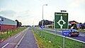
 Donington Road (B1391) - geograph.org.uk - 3621552.jpg 640 × 480; 46 KB
-
 Double gateway to farmland on Seadyke Lane - geograph.org.uk - 4393898.jpg 4,320 × 3,240; 5.42 MB
-
 Drain behind the sea bank - geograph.org.uk - 3575670.jpg 2,687 × 2,409; 2.54 MB
-
 Drainage pond, Kirton Marsh - geograph.org.uk - 1493748.jpg 640 × 480; 68 KB
-
 Drainside south - geograph.org.uk - 4415558.jpg 4,272 × 2,848; 5.07 MB
-
 Drainside South - geograph.org.uk - 5661513.jpg 640 × 480; 78 KB
-
 Drainside, along Kirton Drain - geograph.org.uk - 4414815.jpg 4,074 × 2,712; 6.38 MB
-
 Drilled farmland at Kirton Meeres in Lincolnshire - geograph.org.uk - 4392719.jpg 4,320 × 3,240; 5.67 MB
-
 Electricity Pylon on Nidd's Lane - geograph.org.uk - 4415863.jpg 4,073 × 2,715; 5.31 MB
-
 Electricity transmission line - geograph.org.uk - 5568653.jpg 640 × 480; 44 KB
-
 Electricity transmission line - geograph.org.uk - 5568656.jpg 640 × 480; 47 KB
-
 Eleven Acre Lane - geograph.org.uk - 5569334.jpg 640 × 480; 61 KB
-
 Entrance to farmland off Dances Bank - geograph.org.uk - 4328317.jpg 4,320 × 3,240; 5.73 MB
-
 Entrance to field - geograph.org.uk - 5569300.jpg 640 × 480; 84 KB
-
 Faded sign on the sea bank - geograph.org.uk - 3660452.jpg 3,991 × 2,819; 3.51 MB
-
 Farm buildings along Marsh Road - geograph.org.uk - 3593033.jpg 2,573 × 2,031; 1.9 MB
-
 Farm buildings along Marsh Road - geograph.org.uk - 3593058.jpg 2,654 × 1,822; 2.19 MB
-
 Farm track near Bucklegate House, Lincolnshire - geograph.org.uk - 4393874.jpg 4,320 × 3,240; 5.65 MB
-
 Farmland and drain behind the sea bank - geograph.org.uk - 3660403.jpg 4,000 × 3,000; 3.57 MB
-
 Farmland near College Farm - geograph.org.uk - 3660482.jpg 3,507 × 2,437; 2.6 MB
-
 Farmland near College Farm - geograph.org.uk - 3697379.jpg 1,200 × 1,600; 632 KB
-
 Farmland near Kirton End, Lincolnshire - geograph.org.uk - 4225659.jpg 4,320 × 3,240; 5.57 MB
-
 Farmland off the A16 near Kirton, Lincolnshire - geograph.org.uk - 4395882.jpg 4,320 × 3,240; 5.81 MB
-
 Farmland off Willington Road - geograph.org.uk - 3621536.jpg 640 × 480; 81 KB
-
 Farmland on Kirton Marsh - geograph.org.uk - 3577156.jpg 3,264 × 2,448; 2.88 MB
-
 Fence on the sea bank at Kirton Marsh, Lincolnshire - geograph.org.uk - 4397779.jpg 4,320 × 3,240; 5.81 MB
-
 Field of Cabbages off Sykemouth Drove - geograph.org.uk - 3642565.jpg 2,256 × 1,504; 2.13 MB
-
 Field of cauliflowers - geograph.org.uk - 5569343.jpg 640 × 480; 65 KB
-
 Field of oil seed rape near Seadyke Cottage - geograph.org.uk - 3585692.jpg 3,195 × 2,334; 2.97 MB
-
 Footbridge over Kirton Drain - geograph.org.uk - 1433938.jpg 640 × 426; 127 KB
-
 Footpath and stile - geograph.org.uk - 5568662.jpg 640 × 480; 94 KB
-
 Footpath at New Sea Bank - geograph.org.uk - 2746641.jpg 2,592 × 1,944; 2.31 MB
-

-
 Former Primitive Methodist Church, Skeldyke - geograph.org.uk - 4419710.jpg 3,776 × 2,520; 4.03 MB
-

-
 Frampton Marsh, aerial 2016 - geograph.org.uk - 5012848.jpg 1,024 × 683; 112 KB
-
 Frampton, aerial 2016 - geograph.org.uk - 5012831.jpg 1,600 × 1,067; 367 KB
-
 Fuddy Duck Brewery - geograph.org.uk - 6211684.jpg 480 × 640; 86 KB
-
 Garden centre on Boston Road - geograph.org.uk - 3621491.jpg 640 × 480; 86 KB
-
 Gate and water tub on Kirton Marsh, Lincolnshire - geograph.org.uk - 4398252.jpg 4,320 × 3,240; 5.81 MB
-
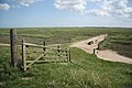
 Gate leading to the sea bank - geograph.org.uk - 3575667.jpg 2,822 × 2,223; 2.69 MB
-
 Gate on the sea bank - geograph.org.uk - 3661743.jpg 1,600 × 1,200; 700 KB
-
 Gated track off Skeldyke Road - geograph.org.uk - 2770565.jpg 682 × 1,024; 334 KB
-
 Gates on the sea bank - geograph.org.uk - 3660434.jpg 3,369 × 2,588; 2.64 MB
-
 Giant's causeway - geograph.org.uk - 1432518.jpg 640 × 480; 98 KB
-
 Grass path - geograph.org.uk - 5568641.jpg 640 × 480; 64 KB
-
 Greenhouse on the Horizon - geograph.org.uk - 149775.jpg 640 × 480; 83 KB
-
 Half cut crop - geograph.org.uk - 3621545.jpg 640 × 480; 82 KB
-
 Heading east along Marsh Road - geograph.org.uk - 3593026.jpg 2,145 × 1,444; 1.09 MB
-
 Heading south along Burnham Lane - geograph.org.uk - 3695414.jpg 1,600 × 1,200; 589 KB
-
 Heading south along the sea bank - geograph.org.uk - 3575698.jpg 2,826 × 2,101; 2.77 MB
-
 Heading west along the sea bank - geograph.org.uk - 3661910.jpg 3,000 × 4,000; 3.73 MB
-
 House along Nidd's Lane - geograph.org.uk - 3697077.jpg 1,600 × 1,142; 322 KB
-
 House at Skeldyke (geograph 2146500).jpg 1,024 × 758; 260 KB
-
 Houses along Nidd's Lane - geograph.org.uk - 3697121.jpg 1,600 × 1,169; 436 KB
-
 Houses in the village of Skeldyke - geograph.org.uk - 3695445.jpg 1,600 × 1,108; 521 KB
-
 Hubbert's Bridge - geograph.org.uk - 1883482.jpg 3,296 × 2,472; 1.93 MB
-
 Hubbert's Bridge - geograph.org.uk - 3431998.jpg 800 × 533; 125 KB
-
 Hubbert's Bridge - geograph.org.uk - 4253863.jpg 1,280 × 960; 286 KB
-
 Hubbert's Bridge over the South Forty Foot Drain - geograph.org.uk - 3272701.jpg 2,256 × 1,504; 802 KB
-
-
 Inland lagoon on Kirton Marsh, Lincolnshire - geograph.org.uk - 4398229.jpg 4,320 × 3,240; 5.43 MB
-
 Isolated tree behind the sea bank - geograph.org.uk - 3577086.jpg 3,264 × 2,448; 3.09 MB
-
 Junction of Kell's Drove and holmes Lane - geograph.org.uk - 3644988.jpg 2,256 × 1,504; 1.85 MB
-
 Junction of Nidd's Lane and Marsh Road - geograph.org.uk - 4415869.jpg 3,970 × 2,667; 5.15 MB
-
 Junction on Clough Lane - geograph.org.uk - 3587585.jpg 3,264 × 2,448; 3.41 MB
-
 Juvenile Mistle Thrush on Marsh Road - geograph.org.uk - 3697085.jpg 2,834 × 2,454; 1.98 MB
-
 Keel Drive - geograph.org.uk - 5568613.jpg 640 × 480; 56 KB
-
 Kell's Drove - geograph.org.uk - 3644974.jpg 2,256 × 1,504; 2.05 MB
-
 Kell's Drove - geograph.org.uk - 3651072.jpg 2,256 × 1,504; 1.99 MB
-
 Kirton Drain - geograph.org.uk - 1433943.jpg 640 × 426; 123 KB
-
 Kirton Drain - geograph.org.uk - 1435479.jpg 640 × 426; 107 KB
-
 Kirton Drain - geograph.org.uk - 1435484.jpg 640 × 426; 90 KB
-
 Kirton Drain, Lincolnshire - geograph.org.uk - 4225675.jpg 4,320 × 3,240; 5.63 MB
-

-
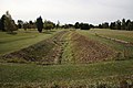 Kirton Holme golf course - geograph.org.uk - 1524933.jpg 640 × 426; 84 KB
-
 Kirton Marsh - geograph.org.uk - 1437188.jpg 640 × 426; 90 KB
-
 Kirton Marsh - geograph.org.uk - 1440057.jpg 640 × 426; 111 KB
-

-
 Kirton Marsh car park - geograph.org.uk - 1493702.jpg 640 × 480; 82 KB
-
 Kirton Marsh farmland - geograph.org.uk - 3593022.jpg 1,878 × 1,423; 1.15 MB
-
 Kirton Marsh Pumping Station - geograph.org.uk - 2746690.jpg 2,048 × 1,536; 1.47 MB
-

-
 Kirton Middle Fen - geograph.org.uk - 3598443.jpg 640 × 536; 54 KB
-
 Kirton salt marsh - geograph.org.uk - 3575700.jpg 3,036 × 2,438; 2.91 MB
-
 Kirton saltmarsh - geograph.org.uk - 1437147.jpg 640 × 426; 83 KB
-
 Kirton saltmarsh - geograph.org.uk - 1437173.jpg 640 × 426; 80 KB
-
 Kirton sea bank, site of the former Welland delta ^ - geograph.org.uk - 2189653.jpg 1,600 × 1,200; 181 KB
-
 Kirton Windmill - geograph.org.uk - 3621550.jpg 480 × 640; 89 KB
-
 Kirton, Lincolnshire geograph-3728354-by-Ben-Brooksbank.jpg 2,342 × 1,350; 2.42 MB
-
 KirtonMeresGatehouse Kirton Lincolnshire 1893.png 567 × 639; 581 KB
-
 Large barn along Marsh Road - geograph.org.uk - 3697340.jpg 1,600 × 1,200; 422 KB
-
 Large creek in Kirton Marsh, Lincolnshire - geograph.org.uk - 4398240.jpg 4,320 × 3,240; 5.87 MB
-
 Little Side Road near Holme Lodge Farm - geograph.org.uk - 2773271.jpg 682 × 1,024; 334 KB
-
 London Road (B1397) - geograph.org.uk - 3621494.jpg 640 × 480; 75 KB
-
 London Road (B1397) - geograph.org.uk - 3621515.jpg 640 × 480; 95 KB
-
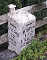 London Road mile stone, Kirton - geograph.org.uk - 720330.jpg 508 × 640; 115 KB
-
 Lonely Lincolnshire loo - Known locally as a Turdis ^^ - geograph.org.uk - 4395879.jpg 4,320 × 3,240; 5.51 MB
-
 Lonely South Forty trig point on the bank - geograph.org.uk - 3271092.jpg 1,504 × 2,256; 588 KB
-
 Looking north along the sea bank - geograph.org.uk - 3660487.jpg 4,000 × 3,000; 3.86 MB
-
 Looking west along Marsh Road - geograph.org.uk - 3575673.jpg 3,262 × 2,312; 3.01 MB
-
 Looking west along Marsh Road - geograph.org.uk - 3593057.jpg 3,264 × 2,448; 3.16 MB
-
 Macmillan Way - geograph.org.uk - 5568672.jpg 640 × 480; 63 KB
-
 Macmillan Way - geograph.org.uk - 5568682.jpg 640 × 480; 59 KB
-
 Macmillan Way footpath on the sea bank - geograph.org.uk - 3659054.jpg 3,907 × 2,713; 3.22 MB
-
 Macmillan Way footpath on the sea bank - geograph.org.uk - 3661955.jpg 4,000 × 3,000; 3.32 MB
-
 Manor Farm buildings - geograph.org.uk - 1433944.jpg 640 × 426; 53 KB
-
 Manor Road - geograph.org.uk - 3621499.jpg 640 × 480; 84 KB
-
 Manor Road, near Kirton - geograph.org.uk - 4414811.jpg 4,272 × 2,848; 7.44 MB
-
 Marsh Road - geograph.org.uk - 1437069.jpg 640 × 426; 69 KB
-
 Marsh Road - geograph.org.uk - 1437091.jpg 426 × 640; 50 KB
-
 Marsh Road heading towards the sea bank - geograph.org.uk - 3593066.jpg 2,685 × 1,940; 2.46 MB
-
 Marsh Road in Skeldyke - geograph.org.uk - 3696997.jpg 1,600 × 1,200; 612 KB
-
 Meeres Lane - geograph.org.uk - 3228978.jpg 3,088 × 2,056; 1.36 MB
-
 Muddy waters - geograph.org.uk - 2746633.jpg 2,592 × 1,944; 2.26 MB
-
 Nidd's Lane - geograph.org.uk - 2746595.jpg 2,592 × 1,944; 1.82 MB
-
 Nidds Lane junction - geograph.org.uk - 1421401.jpg 640 × 426; 60 KB
-
 Old Cemetery - geograph.org.uk - 415858.jpg 637 × 640; 148 KB
-
 Old gate posts on the sea bank - geograph.org.uk - 3659065.jpg 4,000 × 3,000; 4.59 MB
-
 Old King's Head, Kirton (26505631891).jpg 3,929 × 2,951; 3.51 MB
-
 Old Milestone - geograph.org.uk - 1189233.jpg 480 × 640; 126 KB
-

-
 Old warehouse at Hubbert's Bridge - geograph.org.uk - 4253906.jpg 1,280 × 960; 317 KB
-
 Orchard Park Caravan Site - geograph.org.uk - 160745.jpg 640 × 480; 107 KB
-
 Path leading away from the car park - geograph.org.uk - 3575646.jpg 2,982 × 2,324; 2.7 MB
-
 Pell's Drive - geograph.org.uk - 5568608.jpg 640 × 480; 57 KB
-
 Piling bridge - geograph.org.uk - 1432507.jpg 640 × 480; 93 KB
-
 Poles in a Lincolnshire field south of Kirton - geograph.org.uk - 4395851.jpg 4,320 × 3,240; 5.38 MB
-
 Pool on Frampton Marsh - geograph.org.uk - 1432436.jpg 640 × 480; 92 KB
-
 Pool on the salt marsh - geograph.org.uk - 3660419.jpg 4,000 × 2,525; 2.25 MB
-
 Poplar Farm near Kirton End, Lincolnshire - geograph.org.uk - 4225551.jpg 4,320 × 3,240; 5.39 MB
-
 Poplars of Marsh Lane, Kirton Marsh - geograph.org.uk - 4599261.jpg 427 × 640; 63 KB
-
 Potato field near College Farm - geograph.org.uk - 3661840.jpg 4,000 × 3,000; 3.54 MB
-
 Public footpath along Marsh Road - geograph.org.uk - 3593036.jpg 3,264 × 2,448; 3 MB
-

-
 Pylons crossing Kirton Marsh - geograph.org.uk - 3593028.jpg 2,767 × 2,052; 1.8 MB
-
 Recently flooded - Kirton Marsh on the edge of The Wash - geograph.org.uk - 4397706.jpg 4,320 × 3,240; 5.92 MB
-
 Reeds and farmland near Seadyke, Lincolnshire - geograph.org.uk - 4395828.jpg 4,320 × 3,240; 5.48 MB
-

-
 Riverbank at The Cots - geograph.org.uk - 1492503.jpg 640 × 480; 57 KB
-
 Road across Kirton Marsh - geograph.org.uk - 3593064.jpg 1,817 × 1,328; 741 KB
-
 Road junction - geograph.org.uk - 5569336.jpg 640 × 480; 58 KB
-
 Road junction - geograph.org.uk - 5661507.jpg 640 × 480; 65 KB
-
 Road junction - geograph.org.uk - 5661510.jpg 640 × 480; 62 KB
-
 Road junction and finger post - geograph.org.uk - 5568643.jpg 640 × 480; 51 KB
-
 Road junction and finger post - geograph.org.uk - 5569295.jpg 640 × 480; 64 KB
-
 Road junction in Skeldyke - geograph.org.uk - 3695458.jpg 1,600 × 1,207; 476 KB
-
 Roadside tree near Langley House, Kirton - geograph.org.uk - 4392446.jpg 4,320 × 3,240; 5.9 MB
-
 Salt marsh - geograph.org.uk - 5568676.jpg 640 × 480; 61 KB
-
 Salt marsh and tidal creek - geograph.org.uk - 3577593.jpg 3,264 × 2,448; 3.13 MB
-
 Salt marsh at Fosdyke Wash - geograph.org.uk - 3659071.jpg 4,000 × 3,000; 3.47 MB
-
 Salt Marsh near the River Welland - geograph.org.uk - 2746648.jpg 2,048 × 1,536; 1.34 MB
-
 Salt marshes - geograph.org.uk - 1440063.jpg 640 × 426; 78 KB
-
 Saltmarsh, Kirton Marsh, Lincs - geograph.org.uk - 195553.jpg 640 × 480; 332 KB
-
 Sea bank - geograph.org.uk - 1440061.jpg 426 × 640; 98 KB
-
 Sea Bank - geograph.org.uk - 2746689.jpg 2,048 × 1,536; 1.4 MB
-
 Sea Bank - geograph.org.uk - 5568649.jpg 640 × 480; 57 KB
-
 Sea bank along the Wash coast - geograph.org.uk - 3660410.jpg 4,000 × 3,000; 3.41 MB
-
 Sea bank and farmland at Kirton Marsh - geograph.org.uk - 3577232.jpg 3,264 × 2,448; 3.6 MB
-
 Sea bank footpath - geograph.org.uk - 1437078.jpg 640 × 426; 84 KB


.jpg)


_-_geograph.org.uk_-_3621552.jpg)


.jpg)


_to_Hubbert%27s_Bridge_(right_golf_course),_aerial_2017_-_geograph.org.uk_-_5444694.jpg)


_-_geograph.org.uk_-_3621494.jpg)
_-_geograph.org.uk_-_3621515.jpg)


.jpg)


,_aerial_2019_-_geograph.org.uk_-_6304253.jpg)


