Category:Borough of Boston
Jump to navigation
Jump to search
English: The Borough of Boston is a local government district with borough status in Lincolnshire, England. Its council is based in the town of Boston. It lies around N53°0'0" W0°0'0".
district in Lincolnshire, England | |||||
| Upload media | |||||
| Instance of | |||||
|---|---|---|---|---|---|
| Location | Lincolnshire, East Midlands, England | ||||
| Capital | |||||
| Legislative body |
| ||||
| Inception |
| ||||
| Population |
| ||||
| Area |
| ||||
| Different from | |||||
| official website | |||||
 | |||||
Subcategories
This category has the following 20 subcategories, out of 20 total.
A
B
F
H
K
L
O
S
W
Media in category "Borough of Boston"
The following 200 files are in this category, out of 755 total.
(previous page) (next page)-
12 and 10 London Road - geograph.org.uk - 4255921.jpg 1,280 × 989; 285 KB
-
12 London Road - geograph.org.uk - 3494899.jpg 640 × 427; 99 KB
-
2 and 4 Main Ridge, Boston - geograph.org.uk - 2277178.jpg 640 × 442; 177 KB
-
20 and 22 Wide Bargate, Boston - geograph.org.uk - 2277197.jpg 640 × 418; 231 KB
-
30 Church Street Boston - geograph.org.uk - 5226511.jpg 1,024 × 994; 194 KB
-
4, 3 and 2 London Road - geograph.org.uk - 4255925.jpg 1,280 × 905; 278 KB
-
5 Sleaford Road, Boston - geograph.org.uk - 4255933.jpg 1,280 × 956; 214 KB
-
86 and 88 Skirbeck Road, Boston - geograph.org.uk - 2277306.jpg 640 × 478; 206 KB
-
A bend in Tattershall Road - geograph.org.uk - 3598703.jpg 640 × 480; 58 KB
-
A complication of derricks - geograph.org.uk - 4255924.jpg 1,280 × 930; 328 KB
-
A full River Witham towards Boston - geograph.org.uk - 3239630.jpg 3,088 × 2,056; 1 MB
-
A topically named pub - geograph.org.uk - 6234370.jpg 2,000 × 1,333; 1.87 MB
-
A very old building - geograph.org.uk - 6234385.jpg 2,000 × 1,333; 2.4 MB
-
A16 Spilsby Road leaving Boston - geograph.org.uk - 5673309.jpg 640 × 480; 71 KB
-
Ancient graffiti on the down spiral staircase - geograph.org.uk - 4377477.jpg 2,000 × 1,333; 1.11 MB
-
Ann's chip shop - geograph.org.uk - 1806651.jpg 3,648 × 2,736; 2.08 MB
-
Asda superstore, Boston - geograph.org.uk - 3621615.jpg 640 × 480; 46 KB
-
ASDA, Boston - geograph.org.uk - 3655912.jpg 640 × 480; 57 KB
-
Assembly Rooms, Boston, Lincs - geograph.org.uk - 4218458.jpg 3,076 × 2,328; 1.35 MB
-
Assembly Rooms, Boston, Lincs - geograph.org.uk - 4218478.jpg 2,525 × 3,152; 1.35 MB
-
Assembly Rooms, Boston, Lincs - geograph.org.uk - 4218488.jpg 2,975 × 3,766; 1.99 MB
-
Bank Street, Boston - geograph.org.uk - 2917045.jpg 426 × 640; 78 KB
-
Bank Street, Boston - geograph.org.uk - 3676496.jpg 640 × 640; 107 KB
-
Barber's shop on Norfolk Street - geograph.org.uk - 6217890.jpg 1,024 × 683; 198 KB
-
Barclays Bank, Boston - geograph.org.uk - 2919772.jpg 426 × 640; 73 KB
-
Beech Wood - geograph.org.uk - 5225353.jpg 1,024 × 768; 159 KB
-
Beech, Boston - geograph.org.uk - 4760602.jpg 562 × 640; 297 KB
-
Black Sluice Lock - geograph.org.uk - 3494865.jpg 640 × 427; 108 KB
-
Black Sluice Lock - geograph.org.uk - 4255918.jpg 1,280 × 949; 227 KB
-
Black Sluice Lock, Boston - geograph.org.uk - 3240597.jpg 3,088 × 2,056; 1.15 MB
-
Black Sluice Pumping Station - geograph.org.uk - 3240704.jpg 3,088 × 2,056; 1.27 MB
-
Black Sluice Pumping Station - geograph.org.uk - 4255914.jpg 1,280 × 856; 230 KB
-
Black Sluice Pumping Station - geograph.org.uk - 4355467.jpg 640 × 427; 69 KB
-
Black Sluice Pumping Station - geograph.org.uk - 4355471.jpg 640 × 423; 73 KB
-
Blackfriars Theatre - geograph.org.uk - 2660094.jpg 800 × 530; 107 KB
-
Boats moored at South Quay - geograph.org.uk - 3132833.jpg 3,264 × 2,448; 2.89 MB
-
Boats on the Witham, alongside London Road - geograph.org.uk - 5070885.jpg 3,776 × 2,520; 3.95 MB
-
Boer War Memorial Plaque - geograph.org.uk - 5969647.jpg 1,600 × 1,256; 575 KB
-
Bond Street, Boston - ^1 of 2 - geograph.org.uk - 3264891.jpg 640 × 426; 63 KB
-
Bond Street, Boston - ^2 of 2 - geograph.org.uk - 3264898.jpg 640 × 426; 65 KB
-
Boston - 2013 - geograph.org.uk - 4085952.jpg 3,648 × 2,736; 1.33 MB
-
Boston - 2013 - geograph.org.uk - 4085957.jpg 3,648 × 2,736; 1.4 MB
-
Boston - 2013 - geograph.org.uk - 4085960.jpg 3,648 × 2,736; 1.2 MB
-
Boston - 2013 - geograph.org.uk - 4087529.jpg 3,648 × 2,736; 1.3 MB
-
Boston - 2013 - geograph.org.uk - 4087539.jpg 3,648 × 2,736; 1.17 MB
-
Boston - 2013 - geograph.org.uk - 4087550.jpg 3,648 × 2,736; 1.62 MB
-
Boston - 2013 - geograph.org.uk - 4087560.jpg 2,736 × 3,648; 985 KB
-
Boston - almshouse on Willoughby Road - geograph.org.uk - 3215592.jpg 1,600 × 1,205; 593 KB
-
Boston - Asda Supermarket Entrance - geograph.org.uk - 5228172.jpg 4,608 × 3,456; 5.38 MB
-
Boston - Exchange Buildings - geograph.org.uk - 3244386.jpg 1,600 × 1,212; 548 KB
-
Boston - footbridge over Grand Sluice - geograph.org.uk - 3187817.jpg 1,600 × 1,200; 606 KB
-
Boston - Grand Sluice Signal Box - geograph.org.uk - 3182002.jpg 763 × 1,024; 229 KB
-
Boston - house at southern end of Tattershall Road - geograph.org.uk - 3214488.jpg 1,600 × 1,221; 594 KB
-
Boston - houses on Station Street - geograph.org.uk - 3187814.jpg 1,600 × 1,167; 413 KB
-
Boston - in a nutshell - geograph.org.uk - 3191129.jpg 987 × 1,600; 430 KB
-
Boston - Lincolnshire - geograph.org.uk - 2233366.jpg 800 × 531; 87 KB
-
Boston - Lincolnshire - geograph.org.uk - 2233439.jpg 800 × 531; 71 KB
-
Boston - Lincolnshire - geograph.org.uk - 2233524.jpg 800 × 531; 75 KB
-
Boston - Maud Foster Drain from Bargate Bridge - geograph.org.uk - 3181001.jpg 1,600 × 1,200; 531 KB
-
Boston - Post Office - geograph.org.uk - 3223456.jpg 1,600 × 1,185; 549 KB
-
Boston - Shodfriars Lane - geograph.org.uk - 3248319.jpg 1,155 × 1,600; 593 KB
-
Boston - solicitors' office at 28 Wide Bargate - geograph.org.uk - 3223451.jpg 1,600 × 1,220; 560 KB
-
Boston - southern end of Trinity Street - geograph.org.uk - 3187810.jpg 1,600 × 1,190; 600 KB
-
Boston - Stump ^ Candle - geograph.org.uk - 3244383.jpg 1,600 × 1,200; 472 KB
-
Boston - West Street Junction Signal Box - geograph.org.uk - 3182006.jpg 1,172 × 1,600; 369 KB
-
Boston - Youth Centre on Union Place - geograph.org.uk - 3214491.jpg 1,600 × 1,195; 528 KB
-
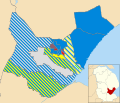
Boston Borough Council election 2011 map.svg 1,425 × 1,225; 414 KB
-
Boston Borough Council election, 2007.svg 1,425 × 1,225; 416 KB
-
Boston Chiropractic Clinic - geograph.org.uk - 2624904.jpg 640 × 474; 161 KB
-
Boston dock - geograph.org.uk - 2968895.jpg 640 × 427; 86 KB
-
Boston Dock with HM Bark Endeavour Replica - geograph.org.uk - 3432850.jpg 2,088 × 1,415; 896 KB
-
Boston Dock, aerial 2014 - geograph.org.uk - 4035542.jpg 427 × 640; 74 KB
-
Boston Docks, Boston - geograph.org.uk - 3680826.jpg 640 × 640; 105 KB
-
Boston Grammar School Playing Fields - geograph.org.uk - 4221986.jpg 3,395 × 2,386; 2.08 MB
-
Boston Harbour railway swing bridge - geograph.org.uk - 4253980.jpg 1,280 × 960; 231 KB
-
Boston Housing - geograph.org.uk - 2660089.jpg 800 × 530; 157 KB
-
Boston Industrial Estate, Boston - geograph.org.uk - 3683863.jpg 640 × 426; 64 KB
-
Boston Market Place - geograph.org.uk - 4770393.jpg 1,280 × 851; 246 KB
-
Boston Police Station - geograph.org.uk - 3598861.jpg 640 × 480; 58 KB
-
Boston Railway Social Club - geograph.org.uk - 2233309.jpg 800 × 531; 75 KB
-
Boston Railway Works - geograph.org.uk - 2233316.jpg 800 × 531; 94 KB
-
Boston Readymix Plant, Boston - geograph.org.uk - 3683851.jpg 640 × 426; 65 KB
-
Boston Readymix Plant, Boston - geograph.org.uk - 3683854.jpg 640 × 426; 60 KB
-
Boston Readymix Plant, Boston - geograph.org.uk - 3683858.jpg 640 × 426; 65 KB
-
Boston Readymix Plant, Boston - geograph.org.uk - 3683861.jpg 640 × 426; 55 KB
-
Boston Spice, South Street (geograph 7144377).jpg 1,024 × 768; 188 KB
-
Boston Standard, Boston - geograph.org.uk - 3916205.jpg 640 × 640; 109 KB
-
Boston Station - geograph.org.uk - 4770408.jpg 1,280 × 851; 225 KB
-
Boston Station from West Street - geograph.org.uk - 4255931.jpg 1,280 × 923; 304 KB
-
Boston Stump - geograph.org.uk - 4770413.jpg 851 × 1,280; 198 KB
-
Boston Stump - geograph.org.uk - 5980598.jpg 3,888 × 5,184; 3.38 MB
-
Boston Stump from John Adams Way - geograph.org.uk - 2457963.jpg 640 × 480; 63 KB
-
Boston Stump, aerial - geograph.org.uk - 3515553.jpg 427 × 640; 97 KB
-
Boston Town Centre (from Boston Stump) - geograph.org.uk - 3884441.jpg 1,062 × 1,600; 422 KB
-
Boston, Church Street - geograph.org.uk - 3617717.jpg 1,600 × 1,064; 480 KB
-
Boston, closed British Telecom building - geograph.org.uk - 3617756.jpg 1,600 × 1,064; 341 KB
-
Boston, house on Threadneedle Street - geograph.org.uk - 3617751.jpg 1,064 × 1,600; 446 KB
-
Boston, Lincolnshire - geograph.org.uk - 2660068.jpg 800 × 530; 141 KB
-
Boston, Lincolnshire - geograph.org.uk - 2660083.jpg 800 × 530; 140 KB
-
Boston, Looking towards St. Botolph's Church - geograph.org.uk - 5161363.jpg 3,556 × 2,336; 3.67 MB
-
Boston, main bridge over the Witham - geograph.org.uk - 3617707.jpg 1,600 × 1,064; 394 KB
-
Boston, Market Place - geograph.org.uk - 3617725.jpg 1,600 × 1,064; 310 KB
-
Boston, Market Place - geograph.org.uk - 3617728.jpg 1,600 × 1,064; 326 KB
-
Boston, signs on Stanbow Lane - geograph.org.uk - 3617723.jpg 1,600 × 1,064; 283 KB
-
Boston, South Street and the Haven from the main bridge - geograph.org.uk - 3617710.jpg 1,600 × 1,064; 419 KB
-
Boston, South Street and the Haven from the main bridge - geograph.org.uk - 3617713.jpg 1,600 × 1,064; 444 KB
-
Boston, translation centre, Wide Bargate - geograph.org.uk - 3617736.jpg 1,600 × 1,064; 482 KB
-
Boston, Wide Bargate - geograph.org.uk - 3617732.jpg 1,600 × 1,064; 450 KB
-
Boundary Farm - geograph.org.uk - 3678346.jpg 1,024 × 697; 139 KB
-
Brewster Road, Boston - geograph.org.uk - 3897375.jpg 640 × 480; 55 KB
-
Building from the Stump - geograph.org.uk - 2660061.jpg 800 × 530; 141 KB
-
Building on Trinity Street, Boston - geograph.org.uk - 5965887.jpg 1,600 × 1,064; 557 KB
-
Building on Trinity Street, Boston - geograph.org.uk - 5965891.jpg 1,600 × 1,064; 350 KB
-
Buoy Yard, Boston - geograph.org.uk - 3678829.jpg 640 × 426; 73 KB
-
Buoy Yard, Boston - geograph.org.uk - 3678835.jpg 640 × 426; 71 KB
-
Busking in Boston - geograph.org.uk - 4770525.jpg 1,280 × 851; 253 KB
-
Cammacks, Boston - geograph.org.uk - 2277206.jpg 640 × 627; 219 KB
-
Car dealership on Liquorpond Street - geograph.org.uk - 3621610.jpg 640 × 480; 54 KB
-
Castle Street, Boston - geograph.org.uk - 3598810.jpg 640 × 480; 63 KB
-
Catching the last sun - geograph.org.uk - 4255928.jpg 1,280 × 1,280; 343 KB
-
Central Park, Boston, Lincs - geograph.org.uk - 4221702.jpg 3,312 × 2,448; 1.98 MB
-
Chain Bridge Pumping Station - geograph.org.uk - 4253964.jpg 1,280 × 960; 329 KB
-
Chapel Passage, Boston - geograph.org.uk - 3675680.jpg 640 × 640; 78 KB
-
Chapel Passage, Boston - geograph.org.uk - 3675684.jpg 640 × 426; 83 KB
-
Chapel Passage, Boston - geograph.org.uk - 3675696.jpg 426 × 640; 103 KB
-
Christmas lights in Dolphin Lane - geograph.org.uk - 3267642.jpg 768 × 1,024; 156 KB
-
Church Lane, Boston - geograph.org.uk - 2916917.jpg 426 × 640; 72 KB
-
Church Lane, Boston - geograph.org.uk - 2916924.jpg 426 × 640; 70 KB
-
Church Lane, Boston - geograph.org.uk - 2916966.jpg 426 × 640; 67 KB
-
Church Street, Boston - geograph.org.uk - 2916935.jpg 640 × 426; 80 KB
-
Church Street, Boston - geograph.org.uk - 2916942.jpg 640 × 426; 80 KB
-
Church Street, Boston - geograph.org.uk - 2916949.jpg 426 × 640; 66 KB
-
Church Street, Boston - geograph.org.uk - 3779797.jpg 480 × 640; 92 KB
-
Church Street, Boston - geograph.org.uk - 3779799.jpg 480 × 640; 90 KB
-
Church Street, Boston - geograph.org.uk - 3916262.jpg 426 × 640; 82 KB
-
Church Street, Boston - geograph.org.uk - 3916300.jpg 640 × 426; 84 KB
-
Church Street, Boston - geograph.org.uk - 5226504.jpg 1,024 × 772; 179 KB
-
Church Street, Boston, Lincs - geograph.org.uk - 4218452.jpg 2,566 × 4,032; 2.21 MB
-
Control cabin and foot crossing - geograph.org.uk - 5894214.jpg 1,024 × 768; 469 KB
-
County Council Offices, Boston - geograph.org.uk - 2919769.jpg 640 × 426; 61 KB
-
Crane at the Port of Boston - geograph.org.uk - 3669939.jpg 3,269 × 2,750; 2.75 MB
-
Cromwell Close - geograph.org.uk - 3598720.jpg 640 × 480; 56 KB
-
Crop field off Green Lane - geograph.org.uk - 3598712.jpg 640 × 480; 73 KB
-
Crop field off Tattershall Road - geograph.org.uk - 3598699.jpg 640 × 480; 71 KB
-
Currys PC World, Boston - geograph.org.uk - 5965864.jpg 1,600 × 1,064; 621 KB
-
Custom House Quay - geograph.org.uk - 5467146.jpg 640 × 480; 65 KB
-
Disused car showroom, Boston - geograph.org.uk - 2277613.jpg 640 × 359; 123 KB
-
Disused warehouses, Boston - geograph.org.uk - 2277316.jpg 640 × 393; 129 KB
-
Docks, Boston - geograph.org.uk - 3673159.jpg 640 × 461; 116 KB
-
Dolly on a post - geograph.org.uk - 4255930.jpg 1,280 × 960; 363 KB
-
Doughty Quay - geograph.org.uk - 3494853.jpg 640 × 427; 87 KB
-
Doughty Quay - geograph.org.uk - 3494858.jpg 640 × 427; 72 KB
-
Drain beside Washdyke Lane - geograph.org.uk - 3678349.jpg 640 × 480; 76 KB
-
Dropping off the end - geograph.org.uk - 4253984.jpg 1,280 × 960; 364 KB
-
Dudley Close, Boston - geograph.org.uk - 3897377.jpg 640 × 480; 65 KB
-
Electricity substation - geograph.org.uk - 3669947.jpg 3,425 × 2,579; 2.55 MB
-
Emery Lane, Boston - geograph.org.uk - 3779659.jpg 640 × 480; 85 KB
-
Emery Lane, Boston - geograph.org.uk - 3779673.jpg 640 × 480; 89 KB
-
Emery Lane, Boston - geograph.org.uk - 3779688.jpg 480 × 640; 95 KB
-
Entrance to Boston High School - geograph.org.uk - 2457951.jpg 640 × 480; 85 KB
-
Ex Lincolnshire Loop Line - geograph.org.uk - 2233579.jpg 800 × 531; 98 KB
-
Ex Lincolnshire Loop Line - geograph.org.uk - 2233582.jpg 800 × 531; 112 KB
-
Ex Lincolnshire Loop Line - geograph.org.uk - 2233584.jpg 800 × 531; 95 KB
-
Ex Lincolnshire Loop Line - geograph.org.uk - 2233590.jpg 800 × 531; 119 KB
-
Ex Lincolnshire Loop Line - geograph.org.uk - 2233591.jpg 800 × 531; 195 KB
-
Ex Lincolnshire Loop Line - geograph.org.uk - 2233610.jpg 800 × 531; 101 KB
-
Exchange Buildings, Boston - geograph.org.uk - 2277220.jpg 640 × 417; 163 KB
-
Fairground comes to Boston - geograph.org.uk - 4959563.jpg 480 × 640; 67 KB
-
Farm building off Tattershall Road - geograph.org.uk - 3598698.jpg 640 × 432; 95 KB
-
Farmland off Punchbowl Lane - geograph.org.uk - 3678353.jpg 640 × 480; 71 KB
-
Fingerpost along the Macmillan Way footpath - geograph.org.uk - 3668240.jpg 3,249 × 2,603; 3.01 MB
-
Flush bracket bench mark G4136, Black Sluice, Boston - geograph.org.uk - 4255913.jpg 1,280 × 1,280; 598 KB
-
Football Club Ground, Boston, Lincs - geograph.org.uk - 4222192.jpg 3,127 × 2,826; 1.95 MB
-
Footpath near Skirbeck - geograph.org.uk - 3680916.jpg 640 × 426; 96 KB
-
Footpath near Skirbeck - geograph.org.uk - 3680922.jpg 640 × 426; 96 KB
-
Footpath sign - geograph.org.uk - 5226521.jpg 1,024 × 768; 229 KB
-
Footpath sign by Fenside Road - geograph.org.uk - 5226515.jpg 1,024 × 768; 250 KB
-
Footprints by The Haven, Boston - geograph.org.uk - 3680816.jpg 640 × 426; 128 KB
-
Former Corporation Baths, Boston - geograph.org.uk - 3679928.jpg 640 × 426; 91 KB
-
Former Corporation Baths, Boston - geograph.org.uk - 3679940.jpg 640 × 426; 70 KB
-
Former Corporation Baths, Boston - geograph.org.uk - 3679952.jpg 640 × 426; 73 KB
-
Former Corporation Baths, Boston - geograph.org.uk - 3680022.jpg 640 × 426; 124 KB
-
Former Junction - geograph.org.uk - 2233608.jpg 800 × 531; 123 KB
-
Former Post Office, Boston - geograph.org.uk - 3915213.jpg 426 × 640; 71 KB
-
Former pub sign, London Road - geograph.org.uk - 4255920.jpg 910 × 1,280; 282 KB
-
Former Railway Goods Warehouse - geograph.org.uk - 3683900.jpg 640 × 426; 95 KB
-
Former Sessions House, Boston - geograph.org.uk - 3676643.jpg 640 × 640; 94 KB
-
Former Sessions House, Boston - geograph.org.uk - 3676647.jpg 426 × 640; 83 KB
-
Former Wellington, Boston - geograph.org.uk - 2277621.jpg 640 × 475; 165 KB
-
Freiston Road, Boston - geograph.org.uk - 4338158.jpg 640 × 480; 105 KB
-
Fydell Street (A1137), Boston - geograph.org.uk - 3598838.jpg 640 × 480; 54 KB


