Category:Kloster Handrup
Jump to navigation
Jump to search
| Object location | | View all coordinates using: OpenStreetMap |
|---|
Subcategories
This category has the following 2 subcategories, out of 2 total.
G
- Gymnasium Leoninum (3 F)
P
Media in category "Kloster Handrup"
The following 16 files are in this category, out of 16 total.
-
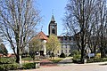
 Handrup - Hestruper Straße - Kloster + Gymnasium 01 ies.jpg 5,616 × 3,744; 21.84 MB
-
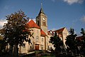
 Handrup - Hestruper Straße - Kloster + Pfarr- und Klosterkirche 01 ies.jpg 5,616 × 3,743; 27.83 MB
-
 Handrup - Hestruper Straße - Kloster + Pfarr- und Klosterkirche 02 ies.jpg 3,743 × 5,616; 19.76 MB
-
 Handrup - Hestruper Straße - Kloster 01 ies.jpg 5,616 × 3,744; 17.93 MB
-
 Handrup - Hestruper Straße - Kloster 02 ies.jpg 5,616 × 3,743; 20.61 MB
-
 Handrup - Hestruper Straße - Kloster 03 ies.jpg 5,616 × 3,744; 19.28 MB
-
 Handrup - Hestruper Straße - Kloster 04 ies.jpg 5,616 × 3,744; 30.5 MB
-
 Handrup - Hestruper Straße - Kloster 05 ies.jpg 5,616 × 3,744; 20.28 MB
-
 Handrup - Hestruper Straße - Kloster 06 ies.jpg 5,616 × 3,744; 24.28 MB
-
 Handrup - Hestruper Straße - Kloster 07 ies.jpg 5,616 × 3,744; 25.42 MB
-
 Handrup gimnazio Leoninum a.JPG 4,608 × 3,456; 6.31 MB
-
 Handrup gimnazio Leoninum b.JPG 4,608 × 3,456; 6.17 MB
-
 Handrup gimnazio Leoninum c.JPG 4,608 × 3,456; 5.95 MB
-
 Handrup gimnazio Leoninum d.JPG 4,608 × 3,456; 5.98 MB
-
 Handrup gimnazio Leoninum e.JPG 3,456 × 4,608; 5.73 MB
-
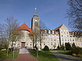
 Leoninum Schule.JPG 800 × 532; 109 KB


