Category:Knipescar Common
Jump to navigation
Jump to search
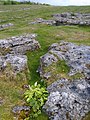
English: Knipescar Common is an upland area in the civil parish of Bampton, in the Eden district, in the county of Cumbria, England.
| Upload media | |||||
| Location | Lake District, North Yorkshire, Yorkshire and the Humber, England | ||||
|---|---|---|---|---|---|
 | |||||
Media in category "Knipescar Common"
The following 10 files are in this category, out of 10 total.
-
 Glacial Erratic - geograph.org.uk - 1310414.jpg 640 × 480; 103 KB
-
 Knipe Scar - geograph.org.uk - 1309691.jpg 640 × 480; 114 KB
-
 Knipescar Common - geograph.org.uk - 989209.jpg 640 × 480; 121 KB
-
 Limestone Pavement - geograph.org.uk - 1310407.jpg 480 × 640; 115 KB
-
 Limestone Pavement on Knipe Moor - geograph.org.uk - 549717.jpg 600 × 450; 94 KB
-
 On Knipe Scar - geograph.org.uk - 1309705.jpg 640 × 480; 98 KB
-
 On Knipe Scar - geograph.org.uk - 1310403.jpg 640 × 480; 74 KB
-
 On Knipe Scar - geograph.org.uk - 1310405.jpg 640 × 480; 58 KB
-
 Stone Circle - geograph.org.uk - 1310410.jpg 640 × 480; 87 KB
-
 Trig Ring, Knipe Scar - geograph.org.uk - 1309711.jpg 480 × 640; 94 KB


