Category:Knockeen Portal Tomb
Jump to navigation
Jump to search
| Object location | | View all coordinates using: OpenStreetMap |
|---|
megalith in County Waterford, Ireland  | |||||
| Upload media | |||||
| Instance of | |||||
|---|---|---|---|---|---|
| Location | County Waterford, Munster, Ireland | ||||
| Heritage designation | |||||
 | |||||
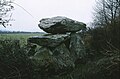
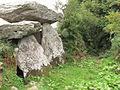
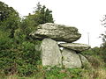
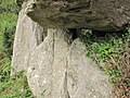
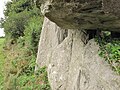
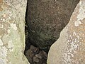
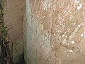
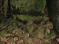
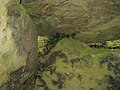
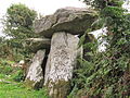
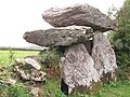
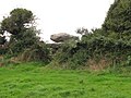
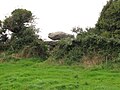
English: Knockeen Portal Tomb, Ireland.
Media in category "Knockeen Portal Tomb"
The following 32 files are in this category, out of 32 total.
-
 Dolmen at Knockeen, Co. Waterford - geograph.org.uk - 1013202.jpg 640 × 419; 72 KB
-
 Knockeen Dolmen IMG 4715.jpg 3,648 × 2,736; 3.17 MB
-
 Knockeen Dolmen IMG 4716.jpg 3,648 × 2,736; 3.65 MB
-
 Knockeen Dolmen IMG 4717.jpg 3,648 × 2,736; 4.01 MB
-
 Knockeen Dolmen IMG 4718.jpg 3,648 × 2,736; 3.69 MB
-
 Knockeen Dolmen IMG 4719.jpg 3,648 × 2,736; 3.08 MB
-
 Knockeen Dolmen IMG 4720.jpg 3,648 × 2,736; 3.06 MB
-
 Knockeen Dolmen IMG 4721.jpg 3,648 × 2,736; 2.72 MB
-
 Knockeen Dolmen IMG 4722.jpg 3,648 × 2,736; 2.82 MB
-
 Knockeen Dolmen IMG 4723.jpg 3,648 × 2,736; 3.15 MB
-
 Knockeen Dolmen IMG 4724.jpg 3,648 × 2,736; 3.46 MB
-
 Knockeen Dolmen IMG 4725.jpg 3,648 × 2,736; 3.53 MB
-
 Knockeen Dolmen IMG 4726.jpg 3,648 × 2,736; 3.35 MB
-
 Knockeen Dolmen IMG 4728.jpg 3,648 × 2,736; 3.7 MB
-
 Knockeen Dolmen IMG 4729.jpg 3,648 × 2,736; 3.09 MB
-
 Knockeen Dolmen IMG 4730.jpg 2,736 × 3,648; 2.63 MB
-
 Knockeen Dolmen IMG 4731.jpg 3,648 × 2,736; 2.45 MB
-
 Knockeen Dolmen IMG 4732.jpg 3,648 × 2,736; 2.93 MB
-
 Knockeen Dolmen IMG 4733.jpg 3,648 × 2,736; 2.52 MB
-
 Knockeen Dolmen IMG 4734.jpg 2,736 × 3,648; 3.11 MB
-
 Knockeen Dolmen IMG 4735.jpg 3,648 × 2,736; 3.38 MB
-
 Knockeen Dolmen IMG 4736.jpg 3,648 × 2,736; 3.45 MB
-
 Knockeen Dolmen IMG 4737.jpg 3,648 × 2,736; 3.99 MB
-
 Knockeen Dolmen IMG 4738.jpg 2,736 × 3,648; 3.42 MB
-
 Knockeen Dolmen IMG 4739.jpg 3,648 × 2,736; 2.76 MB
-
 Knockeen Dolmen IMG 4740.jpg 3,648 × 2,736; 3 MB
-
 Knockeen Dolmen IMG 4742.jpg 3,648 × 2,736; 2.78 MB
-
 Knockeen Dolmen IMG 4743.jpg 3,648 × 2,736; 2.75 MB
-
 Knockeen Dolmen IMG 4744.jpg 3,648 × 2,736; 2.19 MB
-
 Knockeen Dolmen IMG 4745.jpg 3,648 × 2,736; 2.3 MB
-
 Knockeen Dolmen IMG 4746.jpg 3,648 × 2,736; 2.16 MB
-
 Megawal37.jpg 639 × 604; 74 KB


