Category:Knowsley Expressway
Jump to navigation
Jump to search
| Object location | | View all coordinates using: OpenStreetMap |
|---|

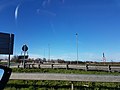
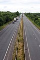
Knowsley Expressway is a dual carriageway designated A5300 connecting Tarbock Island to Speke Road, Ditton (A562).
road in Knowsley, Merseyside, England, United Kingdom   | |||||
| Upload media | |||||
| Instance of | |||||
|---|---|---|---|---|---|
| Location | Knowsley, Merseyside, North West England, England | ||||
| Transport network |
| ||||
| Maintained by |
| ||||
| Inception |
| ||||
| Length |
| ||||
| Terminus | |||||
 | |||||
Media in category "Knowsley Expressway"
The following 9 files are in this category, out of 9 total.
-
 A5300.jpg 4,032 × 3,024; 3.66 MB
-
 Knowsley Expressway from Brook House Farm footbridge.jpg 4,528 × 2,539; 6.84 MB
-
 Knowsley Expressway north from Netherley Road bridge.jpg 3,324 × 4,956; 13.11 MB
-
 Knowsley Expressway north from Water Lane bridge.jpg 3,318 × 5,046; 10.14 MB
-
 Knowsley Expressway south from Netherley Road.jpg 3,456 × 5,184; 10.57 MB
-
 Knowsley Expressway south from Water Lane bridge.jpg 3,456 × 4,164; 10.63 MB
-
 Slip road from Knowsley Expressway at Tarbock Island.jpg 5,020 × 3,216; 7.9 MB
-
 Start of Knowsley Expressway at Tarbock Island 1.jpg 5,024 × 3,224; 8.23 MB
-
 Start of Knowsley Expressway at Tarbock Island 2.jpg 5,184 × 3,456; 10.18 MB


