Category:Kohlekraftwerk Pulverfabrik Rottweil
Jump to navigation
Jump to search
| Object location | | View all coordinates using: OpenStreetMap |
|---|
 | |||||
| Upload media | |||||
| Instance of | |||||
|---|---|---|---|---|---|
| Location | Rottweil, Rottweil VVG, Rottweil, Freiburg Government Region, Baden-Württemberg, Germany | ||||
| Street address |
| ||||
| Architect | |||||
 | |||||
Media in category "Kohlekraftwerk Pulverfabrik Rottweil"
The following 18 files are in this category, out of 18 total.
-
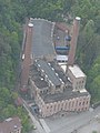
 AIMG 0550 Fabrikblick vom Rottweiler Aufzugsturm.jpg 1,945 × 2,856; 976 KB
-

-
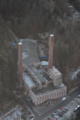
 Ehemaliges Kraftwerk der Pulverfabrik Rottweil.JPG 3,745 × 2,897; 2.02 MB
-
 Kraftwerk der Pulverfabrik Rottweil vom Aufzugstestturm.jpg 3,000 × 4,000; 4.76 MB
-
 Kraftwerk Rottweil 2014 Brecher 1.jpg 4,152 × 2,875; 4.24 MB
-
 Kraftwerk Rottweil 2014 Brecher 2.jpg 4,213 × 2,917; 4.09 MB
-
 Kraftwerk Rottweil 2014 Brecher 3.jpg 4,928 × 3,264; 6.93 MB
-
 Kraftwerk Rottweil 2014 links.jpg 3,264 × 4,406; 4.11 MB
-
 Kraftwerk Rottweil 2014 lins 2.jpg 3,264 × 4,928; 6.87 MB
-
 Kraftwerk Rottweil 2014 rechts.jpg 3,264 × 4,928; 7.1 MB
-
 Kraftwerk Rottweil 2014 Rückseite.jpg 3,264 × 4,928; 6.69 MB
-
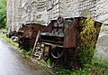
 Kraftwerk Rottweil 2014 Schrott.jpg 4,928 × 3,264; 6.83 MB
-
 Kraftwerk Rottweil 2014.jpg 4,928 × 3,264; 7.53 MB
-
 Kraftwerk Rottweil Inspektorenhaus 2014 1.jpg 3,264 × 4,928; 6.65 MB
-
 Kraftwerk Rottweil Inspektorenhaus 2014 2.jpg 2,821 × 4,074; 3.66 MB
-
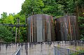 Kraftwerk Rottweil Öltanks.jpg 4,928 × 3,264; 6.8 MB
-
 Kraftwerk Rottweil06122019.png 2,786 × 4,179; 15.04 MB
-
 Testturm Rottweil April 23 Kraftwerk.jpg 3,024 × 4,032; 4.64 MB
_850_Arbeiter,_6000_Tonnen_Pulver,_ab_1919_auch_Kunstseide-Viskose,_z._B._f%C3%BCr_Fallschirme,_schrittweise_Umnutzung_des_Areals_ab_1993_-_panoramio.jpg)


