Category:Kolkstraat 8, Nijkerk
Jump to navigation
Jump to search
| Object location | | View all coordinates using: OpenStreetMap |
|---|
 | |||||
| Upload media | |||||
| Instance of | |||||
|---|---|---|---|---|---|
| Location | Nijkerk, Gelderland, Netherlands | ||||
| Street address |
| ||||
| Located on street |
| ||||
| Heritage designation |
| ||||
 | |||||
|
This is a category about rijksmonument number 30989
|
| Address |
|
Media in category "Kolkstraat 8, Nijkerk"
The following 3 files are in this category, out of 3 total.
-
 Aanzicht - Nijkerk - 20166585 - RCE.jpg 1,200 × 810; 253 KB
-
 Nijkerk-Kolkstraat 8.jpg 2,421 × 1,742; 852 KB
-
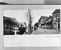 Overzicht, reproductie van prentbriefkaart - Nijkerk - 20166583 - RCE.jpg 1,200 × 979; 221 KB

