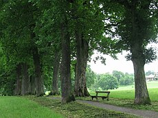
Category:Kottmüllerallee
Jump to navigation
Jump to search
| Upload media | |||||
| Instance of | |||||
|---|---|---|---|---|---|
| Location | Murnau am Staffelsee, Garmisch-Partenkirchen, Upper Bavaria, Bavaria, Germany | ||||
| Street address |
| ||||
| Heritage designation | |||||
 | |||||
Media in category "Kottmüllerallee"
The following 11 files are in this category, out of 11 total.
-
20220319 Murnau am Staffelsee 03.jpg 6,016 × 4,016; 17.14 MB
-
Kottmuellerallee Murnau-1.jpg 2,592 × 1,944; 1.26 MB
-
Kottmuellerallee Murnau-2.jpg 1,944 × 2,592; 1.79 MB
-
Kottmuellerallee Murnau-3.jpg 1,944 × 2,592; 1.56 MB
-
Kottmuellerallee Murnau-4.jpg 2,349 × 1,896; 1.33 MB
-
Kottmuellerallee Murnau-5.jpg 2,583 × 1,653; 849 KB
-
Kottmüllerallee D-1-80-124-133.jpg 2,667 × 4,000; 5.47 MB
-
Kottmüllerallee Hinweistafel.JPG 1,944 × 2,592; 2.01 MB
-
Kottmüllerallee im Winter.JPG 1,944 × 2,592; 2.39 MB
-
Kottmüllerallee zu Murnauer Moos.JPG 2,592 × 1,944; 3.48 MB
-
Murnau - Kottmüller-Allee.JPG 1,536 × 2,048; 2.44 MB


