Category:Kozohlody
Jump to navigation
Jump to search
village in Kutná Hora District of Central Bohemian region  | |||||
| Upload media | |||||
| Instance of | |||||
|---|---|---|---|---|---|
| Location | Vlkaneč, Kutná Hora District, Central Bohemian Region, Czechia | ||||
| Population |
| ||||
| Area |
| ||||
 | |||||
Subcategories
This category has only the following subcategory.
C
Media in category "Kozohlody"
The following 12 files are in this category, out of 12 total.
-
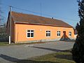
 Kozohlody A. Obecní dům.jpg 4,000 × 3,000; 4.52 MB
-
 Kozohlody B. Obecní dům.jpg 4,000 × 3,000; 3.86 MB
-
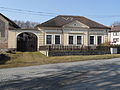
 Kozohlody C. Hasičská zbrojnice.jpg 4,000 × 3,000; 4.91 MB
-
 Kozohlody D. Hasičská zbrojnice.jpg 4,000 × 3,000; 4.87 MB
-
 Kozohlody E. Domy a strom u rybníka.jpg 3,936 × 2,904; 4.61 MB
-
 Kozohlody F. Brána.jpg 4,000 × 2,920; 4.66 MB
-
 Kozohlody G. Hřbitov.jpg 4,000 × 3,000; 4.53 MB
-
 Kozohlody H. Dům čp. 1.jpg 4,000 × 3,000; 5.06 MB
-
 Kozohlody I. Detail stromu.jpg 3,000 × 4,000; 5.65 MB
-
 Kozohlody J. Zátiší u křížku.jpg 3,000 × 4,000; 5.7 MB
-
 Kozohlody K. Křížek.jpg 3,000 × 4,000; 5.44 MB
-
 Kozohlody L. Křížek detail.jpg 3,000 × 4,000; 5.18 MB


