Category:Kreuzkopf (Ammergauer Alpen)
Jump to navigation
Jump to search
mountain in the Ammergau Alps at the border Tyrol / Bavaria  | |||||
| Upload media | |||||
| Instance of | |||||
|---|---|---|---|---|---|
| Location | |||||
| Mountain range | |||||
| Topographic isolation |
| ||||
| Elevation above sea level |
| ||||
 | |||||
Media in category "Kreuzkopf (Ammergauer Alpen)"
The following 12 files are in this category, out of 12 total.
-
 2011-05-09 10-12-23 Austria Tirol Boden.jpg 4,288 × 2,848; 7.96 MB
-
 Auf dem Säuling (On Säuling).jpg 3,789 × 432; 399 KB
-
 Füssen - Eschach v NW, Säuling, Abendsonne.jpg 2,428 × 1,533; 880 KB
-
 Hopfensee pano.jpg 5,008 × 1,623; 1.13 MB
-
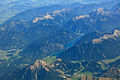
 Kreuzkopf Berg.jpg 2,832 × 2,128; 3.05 MB
-
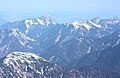
 Kreuzkopf Gipfel.jpg 764 × 1,024; 239 KB
-
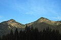 Kreuzkopf Ochsenaelple.jpg 2,048 × 1,369; 877 KB
-
 Neuschwanstein-JR-E-5522-2021-07-02.jpg 3,658 × 2,688; 6.32 MB
-
 Pflach - Säuling - Gipfel Ri Plansee.jpg 3,264 × 1,840; 1.7 MB
-
 Schwangau-3.jpg 4,864 × 3,243; 8.89 MB
-
 Zugspitze, Blick westnordwestwärts, mit Aggenstein im Hintergrund.JPG 4,264 × 2,789; 3.41 MB
-
 Zugspitze, view westnorthwestwards, in the background the mountain Aggenstein.JPG 4,272 × 2,848; 3.2 MB


.jpg)