Category:Kreuzspitze (Ötztaler Alpen)
Jump to navigation
Jump to search
mountain in the Ötztal Alps in Tyrol  Kreuzspitze (vpravo) v hřebenu Kreuzkamm | |||||
| Upload media | |||||
| Instance of | |||||
|---|---|---|---|---|---|
| Location | Sölden, Imst District, Tyrol, Austria | ||||
| Significant event |
| ||||
| Mountain range | |||||
| Topographic prominence |
| ||||
| Topographic isolation |
| ||||
| Elevation above sea level |
| ||||
| Parent peak | |||||
 | |||||
Subcategories
This category has the following 2 subcategories, out of 2 total.
A
V
Media in category "Kreuzspitze (Ötztaler Alpen)"
The following 43 files are in this category, out of 43 total.
-
 At the summit of Kreuzspitze.jpg 800 × 531; 283 KB
-
 Brizzihütte Ruine.jpg 4,000 × 3,000; 4.75 MB
-
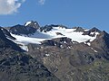
 Brizzisee and Similaun.jpg 800 × 531; 333 KB
-
 Eisferner Kreuzspitze.jpg 4,000 × 3,000; 4.61 MB
-
 Gipfel Kreuzspitze 2018.jpg 4,000 × 3,000; 4.71 MB
-
 Hinteres Rofental Hintereisferner.jpg 12,513 × 2,756; 8.37 MB
-
 Hinteres Rofental.jpg 12,152 × 2,866; 10.01 MB
-
 Karte Samoarhütte 1875.png 1,242 × 1,365; 2.49 MB
-
 Keuzspitz-Gipfel von Norden.jpg 4,000 × 3,000; 4.81 MB
-
 Kreuzkamm HQ.jpg 741 × 478; 77 KB
-
 Kreuzkamm.jpg 6,577 × 2,911; 5.15 MB
-
 Kreuzkogel c.JPG 3,008 × 2,000; 2.89 MB
-
 Kreuzkogel, Kreuzspitze.JPG 3,008 × 2,000; 2.51 MB
-
 Kreuzspitz-Gipfel.jpg 4,000 × 3,000; 4.46 MB
-
 Kreuzspitze (oberhalb der Bildmitte) von Norden.jpg 3,264 × 2,448; 1.97 MB
-
 Kreuzspitze (rechts der Mitte) von der Wildspitze.jpg 3,264 × 2,448; 1.86 MB
-
 Kreuzspitze - Von Süden.JPG 3,008 × 2,000; 1.28 MB
-
 Kreuzspitze 3457m template.jpg 333 × 317; 16 KB
-
 Kreuzspitze 3457m.jpg 2,157 × 1,500; 1.46 MB
-
 Kreuzspitze b.JPG 3,008 × 2,000; 2.61 MB
-
 Kreuzspitze c.JPG 3,008 × 2,000; 2.58 MB
-
 Kreuzspitze d.JPG 3,008 × 2,000; 2.49 MB
-
 Kreuzspitze from Marzellkamm.jpg 531 × 800; 313 KB
-
 Kreuzspitze Gipfel 2018.jpg 4,000 × 3,000; 4.93 MB
-
 Kreuzspitze Rofenache.jpg 3,000 × 4,000; 4.56 MB
-
 Kreuzspitze vom Hochjochhospiz.jpg 4,000 × 3,000; 4.04 MB
-
 Kreuzspitze Westgrat.JPG 2,000 × 3,008; 2.7 MB
-
 Kreuzspitze, Brizzisee, Ramolkogel.JPG 3,008 × 2,000; 2.41 MB
-
 MapOfOetztalGlaciers bySonklar 1860.jpg 800 × 726; 182 KB
-
 Martin-Busch-Hütte mit Kreuzspitze.jpg 4,000 × 3,000; 4.97 MB
-
 Niedertalbach Kreuzspitze 2018.jpg 4,000 × 3,000; 4.64 MB
-
 Niedertalbach Kreuzspitze.jpg 4,000 × 3,000; 4.44 MB
-
 Panorama mit Breslauer Hütte.jpg 15,974 × 3,139; 12.66 MB
-
 Rofenbergalm Kreuzspitze.jpg 4,000 × 3,000; 4.55 MB
-
 Rofental Talleitspitze Kreuzspitze.jpg 4,000 × 3,000; 4.67 MB
-
 Schaftrieb zum Niederjoch 2018 Kreuzspitze.jpg 4,000 × 3,000; 4.77 MB
-
 Schlagintweit Gletscher Ötztaler Alpen 1850.jpg 8,350 × 6,010; 26.68 MB
-
 Sennkogel, Saykogel, Fineilspitze and others.jpg 800 × 531; 319 KB
-
 Similaun vom Vorderem Brochkogel, Kreuzspitze links davor.jpg 3,264 × 2,448; 1.86 MB
-
 Specialkarte der Ostalpen Section Similaun.jpg 5,229 × 5,804; 11.24 MB
-
 Talleitspitze Kreuzspitze Rofental.jpg 4,000 × 3,000; 4.9 MB
-
 Talleitspitze Kreuzspitze Roter Bach.jpg 3,000 × 4,000; 4.21 MB
-
 Vernagtbach Kreuzspitze.jpg 3,264 × 2,448; 3.45 MB


_von_Norden.jpg)
_von_der_Wildspitze.jpg)


