Category:Kriegerdenkmal, Alt St. Katharina, Köln-Niehl
Jump to navigation
Jump to search
| Object location | | View all coordinates using: OpenStreetMap |
|---|
Media in category "Kriegerdenkmal, Alt St. Katharina, Köln-Niehl"
The following 6 files are in this category, out of 6 total.
-
 Koeln-Niehl Sebastianstr.231 Kriegerdenkmal.jpg 2,112 × 2,816; 952 KB
-
 Kriegerdenkmal, Alt St. Katharina, Köln-Niehl-1176.jpg 2,147 × 3,222; 6.65 MB
-
 Kriegerdenkmal, Alt St. Katharina, Köln-Niehl-1177.jpg 3,293 × 3,293; 6.72 MB
-
 Kriegerdenkmal, Alt St. Katharina, Köln-Niehl-1178.jpg 3,182 × 4,243; 8.38 MB
-
 Kriegerdenkmal, Alt St. Katharina, Köln-Niehl-1179.jpg 3,532 × 3,532; 7.96 MB
-
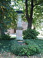 Köln-niehl-kriegerdenkmal-sebastianstr.jpg 1,920 × 2,560; 1.48 MB


