Category:Krýsuvík (volcanic system)
Jump to navigation
Jump to search
| NO WIKIDATA ID FOUND! Search for Krýsuvík (volcanic system) on Wikidata | |
| Upload media |
Subcategories
This category has the following 29 subcategories, out of 29 total.
*
+
A
B
- Borgarhóll (3 F)
D
H
K
M
N
- Near Krýsuvíkurberg (6 F)
S
- Selalda (3 F)
- Skriða (Krýsuvík) (1 F)
- Spákonuvatn (2 F)
Pages in category "Krýsuvík (volcanic system)"
The following 2 pages are in this category, out of 2 total.
Media in category "Krýsuvík (volcanic system)"
The following 99 files are in this category, out of 99 total.
-
Krýsuvík pronunciation.ogg 2.8 s; 168 KB
-
 2006-05-20-175308 Iceland Þorkötlustaðir.jpg 2,048 × 1,536; 2.37 MB
-
 2006-05-20-175424 Iceland Þorkötlustaðir.jpg 2,048 × 1,536; 2.62 MB
-
 2006-05-20-182121 Iceland Stóra-Vatnsléysa.jpg 2,048 × 1,470; 2.34 MB
-
 2014-04-27 10-33-08 Iceland - Grindavík Grindavík.jpg 2,848 × 4,288; 7.97 MB
-
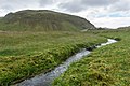 A small stream in a volcanic landscape, taken from the hiking trail Reykjavegur, Iceland 12.jpg 5,500 × 3,667; 12.22 MB
-
 Batface overlooking the lake - panoramio.jpg 4,928 × 3,264; 10.96 MB
-
 Djupavatn BW (16012981475).jpg 960 × 960; 246 KB
-
 Elborg-Lavachannels 57.jpg 1,320 × 2,200; 814 KB
-
 Fúlipollur.JPG 3,264 × 2,448; 2.75 MB
-
 Global subaerial volcanic carbon dioxide emissions.pdf 1,500 × 1,125; 70 KB
-
 Grindavik-Krysuvik 2.jpg 3,264 × 2,448; 2.44 MB
-
 Hvassahraun (Krýsuvík) 06.jpg 2,560 × 1,920; 1.73 MB
-
 Hvassahraun (Krýsuvík) 07.jpg 2,560 × 1,920; 1.36 MB
-
 Hvassahraun (Krýsuvík) 08.jpg 2,560 × 1,920; 1.42 MB
-
 Hvassahraun (Krýsuvík) 09.jpg 2,560 × 1,920; 1.19 MB
-
 Hvassahraun (Krýsuvík) 10.jpg 2,560 × 1,920; 1.34 MB
-
 Hvassahraun (Krýsuvík) 2019 - 22.jpg 2,560 × 1,920; 1.48 MB
-
 Hvassahraun (Krýsuvík) 2019 - 23.jpg 2,560 × 1,920; 1.62 MB
-
 Hvassahraun (Krýsuvík) 2019 - 28.jpg 2,560 × 1,920; 2.17 MB
-
 Iceland (19857554618).jpg 3,264 × 2,448; 1.86 MB
-
 Iceland Höfdi Skolahraun Nupshlid from south IMG 0165.JPG 4,790 × 3,257; 5.83 MB
-
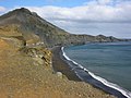
 Iceland road 427 Hraunsvik Festarfjall from south IMG 0169.JPG 4,626 × 3,456; 7.4 MB
-

-
 Iceland road 427 Hraunsvik Skalabot Borgarfjall Langihryggur IMG 0168.JPG 5,184 × 3,456; 7.97 MB
-
 Iceland Skolahraun Nupshlid Selsvallafjall from south IMG 0164.JPG 4,076 × 2,801; 4.1 MB
-
 Iceland Tryggholamyri plain Krysuvikurberg cliffs IMG 0156.JPG 4,379 × 2,428; 6.16 MB
-
 Keilir in shades of grey (15339325704).jpg 1,440 × 960; 378 KB
-
 Kleifarvatn Straße.jpg 3,258 × 2,238; 2.11 MB
-
 Krysuvik (3023436594).jpg 1,800 × 1,350; 647 KB
-
 Krysuvik Iceland 014.JPG 1,200 × 900; 218 KB
-
 Krysuvik Iceland 041.JPG 1,200 × 900; 223 KB
-
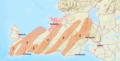
 Krísuvík eldstöðvakerfi kort.png 3,507 × 2,480; 339 KB
-
 Krísuvík.--The Maccalub or Mud Volcano. (4558936426).jpg 1,536 × 1,121; 229 KB
-
 Krýsuvík (220955009).jpeg 2,048 × 1,365; 1.61 MB
-
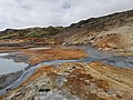
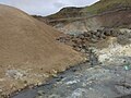
 Krýsuvík geothermal area 01.jpg 5,120 × 3,840; 6.3 MB
-
 Krýsuvík geothermal area 02.jpg 5,120 × 3,840; 5.8 MB
-
 Krýsuvík geothermal area 03.jpg 5,120 × 3,840; 5.87 MB
-
 Krýsuvík geothermal area 04.jpg 5,120 × 3,840; 6.78 MB
-
 Krýsuvík geothermal area 05.jpg 5,120 × 3,840; 5.77 MB
-
 Krýsuvík geothermal area 06.jpg 2,736 × 3,648; 2.67 MB
-
 Krýsuvík geothermal area 07.jpg 5,120 × 3,840; 5.91 MB
-
 Krýsuvík geothermal area 08.jpg 5,120 × 3,840; 4.39 MB
-
 Krýsuvík geothermal area 09.jpg 5,120 × 3,840; 5 MB
-
 Krýsuvík geothermal area 10.jpg 3,648 × 2,736; 5 MB
-
 Krýsuvík geothermal area 11.jpg 5,120 × 3,840; 7.27 MB
-
 Krýsuvík geothermal area 12.jpg 5,120 × 3,840; 7.74 MB
-
 Krýsuvík geothermal area 13.jpg 5,120 × 3,840; 5.41 MB
-
 Krýsuvík geothermal area 14.jpg 5,120 × 3,840; 7.78 MB
-
 Krýsuvík geothermal area 15.jpg 5,120 × 3,840; 10.26 MB
-
 Krýsuvík geothermal area 16.jpg 3,648 × 2,736; 4.37 MB
-
 Krýsuvík geothermal area 17.jpg 5,120 × 3,840; 6.68 MB
-
 Krýsuvík geothermal area 18.jpg 5,120 × 3,840; 6.18 MB
-
 Krýsuvík geothermal area 19.jpg 3,648 × 2,736; 3.6 MB
-
 Krýsuvík geothermal area 20.jpg 3,648 × 2,736; 3.52 MB
-
 Krýsuvík geothermal area 21.jpg 3,648 × 2,736; 3.35 MB
-
 Krýsuvík geothermal area 22.jpg 5,120 × 3,840; 9.13 MB
-
 Krýsuvík geothermal area 23.jpg 5,120 × 3,840; 7.79 MB
-
 Krýsuvík geothermal area 24.jpg 3,648 × 2,736; 3.64 MB
-
 Krýsuvík geothermal area 25.jpg 5,120 × 3,840; 7.25 MB
-
 Krýsuvík geothermal area 26.jpg 3,648 × 2,736; 6.17 MB
-
 Krýsuvík geothermal area 27.jpg 5,120 × 3,840; 6.33 MB
-
 Krýsuvík geothermal area 28.jpg 5,120 × 3,840; 6.9 MB
-
 Krýsuvík geothermal area 29.jpg 5,120 × 3,840; 6.67 MB
-
 Krýsuvík geothermal area 30.jpg 5,120 × 3,840; 6.25 MB
-
 Krýsuvík geothermal area 31.jpg 5,120 × 3,840; 5.95 MB
-
 Krýsuvík geothermal area 32.jpg 5,120 × 3,840; 5.75 MB
-
 Krýsuvík geothermal area 33.jpg 5,120 × 3,840; 7.91 MB
-
 Krýsuvík geothermal area 34.jpg 3,648 × 2,736; 4.27 MB
-
 Krýsuvík II 2018-05.jpg 2,560 × 1,920; 1.79 MB
-
 Krýsuvík volcanic system 2014 21.jpg 1,223 × 435; 226 KB
-
 Krýsuvíkurbjarg01(ws).jpg 3,840 × 2,160; 2.5 MB
-
 Litla-Eldborg 01.jpg 2,200 × 1,320; 692 KB
-
 Litla-Eldborg 04.jpg 2,200 × 1,320; 665 KB
-
 Litla-Eldborg 05.jpg 2,200 × 1,320; 603 KB
-
 Litla-Eldborg 06.jpg 2,200 × 1,320; 829 KB
-
 Litla-Eldborg 08.jpg 2,200 × 1,320; 1.4 MB
-
 Natural Wall - panoramio (1).jpg 4,928 × 3,264; 12.07 MB
-
 Nose falling off the mountain - panoramio.jpg 4,928 × 3,264; 10.78 MB
-
 Reykjanes volcanic systems.png 2,360 × 1,196; 2.37 MB
-
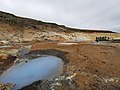
 Seltun, geothermal area Krýsuvík - panoramio.jpg 1,600 × 1,200; 900 KB
-
 Seltún Aug. 2018 02.jpg 2,560 × 1,920; 2.21 MB
-
 Seltún Aug. 2018 06.jpg 2,560 × 1,920; 2.6 MB
-
 Seltún Aug. 2018 08.jpg 2,560 × 1,920; 2 MB
-
 Seltún Aug. 2018 10.jpg 2,560 × 1,920; 2.51 MB
-
 Seltún Aug. 2018 12.jpg 2,560 × 1,920; 2.72 MB
-
 Seltún Aug. 2018 15.jpg 1,920 × 2,560; 2.29 MB
-
 Seltún Aug. 2018 17.jpg 1,920 × 2,560; 2 MB
-
 Small stream flows in wavy pattern - panoramio.jpg 3,264 × 4,928; 10.37 MB
-
 Sogin - panoramio.jpg 1,600 × 1,067; 292 KB
-
 Spákonuvatn, taken from the hiking trail Reykjavegur, Iceland 10.jpg 5,593 × 3,217; 9.49 MB
-
 The pattern is completely natural - panoramio (1).jpg 4,928 × 3,264; 12.27 MB
-
 The road to Laekjarvellir - panoramio.jpg 4,928 × 3,264; 11.45 MB
-
 Vigdísarvallavegur, Iceland - panoramio (1).jpg 4,928 × 3,264; 11.18 MB
-
 Vigdísarvallavegur, Iceland - panoramio.jpg 4,928 × 3,264; 10.35 MB
-
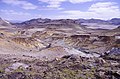
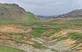
 Volcanic landscape taken from the hiking trail Reykjavegur, Iceland 08.jpg 6,000 × 4,000; 13.86 MB
-
 Volcanic landscape taken from the hiking trail Reykjavegur, Iceland 09.jpg 6,000 × 3,801; 11.69 MB
-
 Volcanic landscape taken from the hiking trail Reykjavegur, Iceland 14.jpg 6,000 × 3,302; 11.11 MB
-
 Volcanic landscape taken from the hiking trail Reykjavegur, Iceland 17.jpg 5,773 × 3,849; 11.93 MB


.jpg)


_06.jpg)
_07.jpg)
_08.jpg)
_09.jpg)
_10.jpg)
_2019_-_22.jpg)
_2019_-_23.jpg)
_2019_-_28.jpg)
.jpg)


_-_Fagradalsfjall.JPG)


.jpg)

.jpg)


.jpg)
.jpeg)


.jpg)


.jpg)


.jpg)

.jpg)


