Category:Kwinana Freeway
Jump to navigation
Jump to search
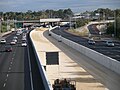
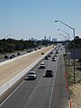
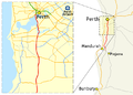
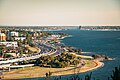
English: Kwinana Freeway is the main southern outlet feeder from the CBD of Perth. It crosses the Swan River at the Narrows Bridge, and the w:Canning River, Western Australia at the Mount Henry Bridge
it then continues to the southern metropolitan suburbs
freeway in Perth, Western Australia    | |||||
| Upload media | |||||
| Instance of | |||||
|---|---|---|---|---|---|
| Location | Western Australia, AUS | ||||
| Inception |
| ||||
| Length |
| ||||
| Partially coincident with |
| ||||
 | |||||
Subcategories
This category has the following 2 subcategories, out of 2 total.
B
Media in category "Kwinana Freeway"
The following 68 files are in this category, out of 68 total.
-

-
 Blocked underpass on the Kwinana Freeway, Karnup, August 2023 01.jpg 4,608 × 3,456; 7.12 MB
-
 Blocked underpass on the Kwinana Freeway, Karnup, August 2023 02.jpg 4,608 × 3,456; 6.56 MB
-
 Blocked underpass on the Kwinana Freeway, Karnup, August 2023 03.jpg 4,608 × 3,456; 3.39 MB
-
 Blocked underpass on the Kwinana Freeway, Karnup, August 2023 04.jpg 4,608 × 3,456; 2.56 MB
-
 Canning Bridge looking N from highway.jpg 4,000 × 3,000; 3.21 MB
-
 Canning Bridge stn roof looking N.jpg 1,600 × 1,200; 637 KB
-
 Canning Bridge, seen from Central Park, January 2021.jpg 3,264 × 2,448; 2.3 MB
-
 Central Perth from Kings Park.jpg 2,032 × 1,048; 543 KB
-
 Cockburn Central wet S platform.jpg 2,560 × 1,440; 1.55 MB
-
 Cockburn stn2.png 2,058 × 1,544; 3.86 MB
-
 Cockburn stn2019.jpg 1,727 × 980; 569 KB
-
 Kwinana Freeway 002 N South Perth near Narrows (panoramio 2010).jpg 3,072 × 2,304; 1.42 MB
-
 Kwinana Freeway 046 N Como, March 2022 02.jpg 4,032 × 3,024; 2.47 MB
-
 Kwinana Freeway 046 N Como, March 2022 03.jpg 4,032 × 2,796; 2.67 MB
-
 Kwinana Freeway 046 S Como, March 2022 01.jpg 4,032 × 3,024; 2.68 MB
-
 Kwinana Freeway 046 S Como, March 2022 04.jpg 4,032 × 2,876; 3.21 MB
-
 Kwinana Freeway 078 S entering Mount Henry Bridge 2005.jpg 3,040 × 2,014; 1.01 MB
-
 Kwinana Freeway 090 S Brentwood Cranford Ave April 2006.jpg 1,024 × 768; 128 KB
-
 Kwinana Freeway 097 S Bull Creek Station.jpg 2,880 × 2,160; 1.98 MB
-
 Kwinana Freeway 132 N Leeming Farrington SMC 2006.jpg 1,920 × 2,560; 1.16 MB
-
 Kwinana Freeway 167 Bibra Lake Berrigan Drv 2005.jpg 1,024 × 681; 187 KB
-
 Kwinana Freeway 185 S Cockburn Central 2005.jpg 1,024 × 681; 177 KB
-
 Kwinana Freeway and Mandurah railway Como.JPG 1,280 × 614; 315 KB
-
 Kwinana Freeway bridge at Millar Road, November 2019.jpg 5,152 × 3,864; 6.42 MB
-
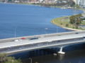
 Kwinana Freeway crossing Swan River to South Perth.jpg 2,048 × 1,536; 1.11 MB
-
 Kwinana Freeway cyclist.jpg 800 × 349; 91 KB
-
 Kwinana Freeway cyclist2.jpg 801 × 342; 101 KB
-
 Kwinana Freeway map.png 700 × 500; 114 KB
-
 Kwinana Freeway N from under South Street bridge.jpg 2,880 × 2,160; 1.58 MB
-
 Kwinana Freeway north end narrows peak.jpg 1,600 × 985; 315 KB
-
 Kwinana Freeway Perth small.jpg 1,200 × 900; 313 KB
-
 Kwinana Freeway S from Cockburn Central.jpg 2,560 × 1,440; 1.25 MB
-
 Kwinana freeway S from murdoch works.jpg 1,600 × 1,200; 537 KB
-
 Kwinana Freeway S from Narrows closeup.jpg 1,570 × 1,160; 1.1 MB
-
 Kwinana Freeway S from Narrows.jpg 1,600 × 1,200; 663 KB
-
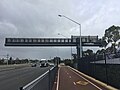 Kwinana Freeway smart freeway gantry in Como viewed from behind.jpg 4,032 × 3,024; 2.13 MB
-
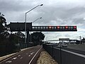 Kwinana Freeway smart freeway gantry in Como viewed from front.jpg 4,032 × 3,024; 1.84 MB
-
 Kwinana Freeway south from Canning Bridge 2012.jpg 2,048 × 1,536; 1.41 MB
-
 Kwinana Freeway traffic from PCEC.jpg 2,048 × 1,152; 887 KB
-
 Kwinana Freeway Widening works 2019.jpg 4,032 × 1,960; 2.08 MB
-
 Kwinana Freeway-Kings Park.jpg 1,280 × 848; 302 KB
-
 Kwinana Fwy S from South Tce.jpg 1,600 × 1,200; 689 KB
-
 Kwinana Narrows heavy traffic Dec 2020.jpg 2,746 × 970; 650 KB
-
Kwinana nth como train gnangarra.ogv 21 s, 960 × 540; 22.04 MB
-
Kwinana sth exit Roe east gnangarra.ogv 1 min 34 s, 960 × 540; 67.52 MB
-
 Mandurah railway and Kwinana Freeway como.JPG 1,280 × 661; 360 KB
-
 Midday traffic on Kwinana Freeway Cockburn 2018.jpg 2,560 × 1,440; 1.23 MB
-
Mill pt Mounts bay gnangarra.ogv 1 min 45 s, 960 × 540; 33.22 MB
-
Mkt st to mill pt gnangarra.ogv 2 min 39 s, 960 × 540; 168.68 MB
-
 Mount Henry Bridge from southern shore of Canning River looking northwest.jpg 3,264 × 2,448; 3.27 MB
-
 Mount Henry Bridge, April 2006.JPG 2,592 × 477; 189 KB
-
Mt Henry south gnangarra.ogv 1 min 36 s, 960 × 540; 82.75 MB
-
 Narrows Bridge, Perth WA.jpg 3,039 × 2,017; 858 KB
-
 Narrows Interchange looking south while under construction.jpg 1,801 × 1,200; 2.22 MB
-
 NarrowsTransitway.JPG 2,592 × 1,944; 2 MB
-
 OIC kwinana fwy works murdoch 2012-05-23.jpg 1,600 × 1,200; 604 KB
-
 Perth skyline and Kwinana Freeway 2009.jpg 4,000 × 3,000; 1.37 MB
-
 Perth,Kwinana freeway.jpg 1,500 × 996; 1.66 MB
-
 Rail track north of Cockburn Central railway station, July 2023 02.jpg 4,608 × 3,456; 4.01 MB
-
 South Perth from Kings Park panorama.jpg 2,642 × 1,514; 1.48 MB
-
 South Perth from Kings Park.jpg 2,048 × 928; 652 KB
-
 South Perth Kwinana pedestrian overpass.jpg 4,928 × 3,264; 4.35 MB
-
 Train arriving at Cockburn station.jpg 2,560 × 1,440; 2 MB
-
 Transperth B-series train on the Mandurah Line in Como, Western Australia, March 2022 05.jpg 2,537 × 1,708; 1.11 MB
-
 View from Mount Henry Bridge.jpg 4,624 × 3,468; 4.11 MB
-
 View of South Perth from Kings Park by M.Griffiths.jpg 5,392 × 3,594; 1.3 MB
-
 Walley Bridge Kwinana Freeway.jpg 1,024 × 681; 136 KB
.jpg)


.jpg)


