Category:La Brigue
Jump to navigation
Jump to search
commune in Alpes-Maritimes, France  .svg)  | |||||
| Upload media | |||||
| Instance of | |||||
|---|---|---|---|---|---|
| Location |
| ||||
| Head of government |
| ||||
| Population |
| ||||
| Area |
| ||||
| Elevation above sea level |
| ||||
| official website | |||||
 | |||||
Subcategories
This category has the following 12 subcategories, out of 12 total.
B
G
- Gare de La Brigue (7 F)
H
- Historical images of La Brigue (13 F)
L
- Lintels in La Brigue (32 F)
M
- Maps of La Brigue (3 F)
P
- Giovanni Pastorelli (2 F)
R
- Ruches à La Brigue (3 F)
S
- Street signs in La Brigue (12 F)
- Streets in La Brigue (14 F)
Media in category "La Brigue"
The following 45 files are in this category, out of 45 total.
-
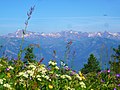
 06430 La Brigue, France - panoramio.jpg 3,648 × 2,736; 2.33 MB
-
 150928 028NS Brigue.jpg 3,504 × 2,336; 5.55 MB
-
 At the French - Italian border - panoramio.jpg 3,072 × 2,304; 2.26 MB
-
 Barcon de marta - panoramio.jpg 1,920 × 1,440; 784 KB
-
 Barcon de marta en automne - panoramio.jpg 1,920 × 1,380; 512 KB
-
 Blason ville fr La Brigue (Alpes-Maritimes).svg 600 × 660; 164 KB
-
 Briga Marittima.jpg 500 × 333; 72 KB
-
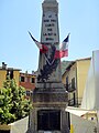
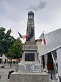
 Briga monumento.JPG 600 × 800; 83 KB
-
 Chevaux cachés - panoramio.jpg 1,440 × 1,080; 466 KB
-
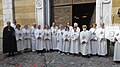 Confrérie des Pénitents Blancs de La Brigue (Alpes-Maritimes).jpg 2,560 × 1,440; 1.41 MB
-
 Dal Saccarello - panoramio.jpg 2,560 × 1,920; 1.69 MB
-
 Flag of Tera Brigasca.svg 851 × 566; 4 KB
-
 FR-IT border near Mt. Saccarel - panoramio.jpg 3,072 × 2,304; 1.51 MB
-
 Holy Family (la Brigue).jpg 2,256 × 2,720; 824 KB
-
 Jesus dans la collégiale Baroque de La Brigue - panoramio.jpg 1,920 × 1,440; 706 KB
-
 La Brigue - Colonne et chapiteau de la rue Filippi.JPG 4,896 × 3,672; 7.21 MB
-
 La Brigue - Plaque commémorative -1.JPG 3,515 × 3,812; 2.55 MB
-
 La brigue.jpg 1,200 × 1,600; 242 KB
-
 La Roya La Brigue Chateau Lascaris Vue Village - panoramio.jpg 1,600 × 1,200; 589 KB
-
 La Roya La Brigue Place Musee Patrimoine Linteau - panoramio.jpg 1,600 × 1,200; 963 KB
-
 La Roya La Brigue Pont Vallon Ru Sec Ca Arbinee Ruches - panoramio.jpg 1,600 × 1,200; 873 KB
-
 Le bego - panoramio.jpg 1,920 × 1,440; 651 KB
-
 Matin d'automne sur La Brigue - panoramio.jpg 1,920 × 1,440; 759 KB
-
 Melirius.JPG 640 × 424; 60 KB
-
 Military Road (degli alpini) - panoramio.jpg 3,072 × 2,304; 2.14 MB
-
 Military Road (looking to North) - panoramio.jpg 3,072 × 2,304; 2.17 MB
-
 Military Road ^ Mt. Bertrand from Mt. Marguerais - panoramio.jpg 3,072 × 2,304; 1.91 MB
-
 Monumento a Giovanni Pastorelli particolare.jpg 1,368 × 1,026; 248 KB
-
 Monumento a Giovanni Pastorelli.jpg 720 × 960; 93 KB
-
 Monumento agli Alpini Briga.jpg 1,368 × 1,026; 299 KB
-
 Mt. Bégo from the FR-IT border - panoramio.jpg 3,072 × 2,304; 1.59 MB
-
 Mt. Marguerais - panoramio.jpg 3,072 × 2,304; 2.11 MB
-
 Mt. Roche de l'Abysse from Mt. Marguerais summit - panoramio.jpg 3,072 × 2,304; 1.79 MB
-
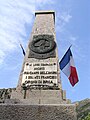
 Munument' ai mort da prüméra e da sëgunda guèra mundiàle (Ra Briga).jpg 3,096 × 4,128; 2.62 MB
-
 Méditerranée vue de Marta - panoramio.jpg 1,920 × 1,440; 422 KB
-
 N-D des Fontaines Canavesio.JPG 2,672 × 2,758; 3.66 MB
-
 Panoramic Mt. Bégo - Roche Abysse from Mt. Saccarello - panoramio.jpg 5,664 × 2,153; 6.24 MB
-
 PmLaBrigue02.jpg 3,214 × 4,888; 2.96 MB
-
 Population - Municipality code 06162.svg 475 × 355; 13 KB
-
 Sunset at Refuge Don Barbera (CAI) from the French border - panoramio.jpg 3,072 × 2,304; 1.75 MB
-
 The IT-FR border from Mt. Marguerais summit - panoramio.jpg 3,072 × 2,304; 1.76 MB
-
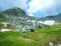 The Refuge of the Speleology Section of C.A.F. Nice - panoramio.jpg 3,072 × 2,304; 2.34 MB
-
 Tèrra Brigasca.png 154 × 194; 13 KB
-
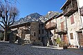
 Vue du village de La Brigue depuis la colline au-dessus de la rue de l'Authion.JPG 4,896 × 3,264; 2.56 MB
-
 Vue orientée nord-ouest dans la placette au pied du château Lascaris.JPG 4,896 × 3,264; 2.65 MB


.jpg)


.jpg)


_-_panoramio.jpg)
_-_panoramio.jpg)


.jpg)


_from_the_French_border_-_panoramio.jpg)


