Category:Lake Chad
Jump to navigation
Jump to search
العربية: بحيرة تشاد
Français : Lac Tchad
lake in Africa  | |||||
| Upload media | |||||
| Instance of | |||||
|---|---|---|---|---|---|
| Location |
| ||||
| Heritage designation |
| ||||
| Area |
| ||||
| Elevation above sea level |
| ||||
| Inflows | |||||
| Drainage basin |
| ||||
 | |||||
Subcategories
This category has the following 4 subcategories, out of 4 total.
Media in category "Lake Chad"
The following 56 files are in this category, out of 56 total.
-
De-Tschadsee.ogg 1.6 s; 16 KB
-
De-Tschadsee2.ogg 1.8 s; 17 KB
-
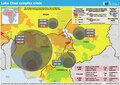 20230118 LakeChad ComplexCrisis.pdf 1,754 × 1,239; 9.18 MB
-

-

-

-

-
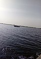 A canoe in the middle of the lake chad.jpg 3,744 × 5,376; 5.47 MB
-
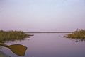
 A serene lake chad shore.jpg 2,448 × 2,712; 1.15 MB
-
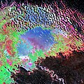
 Altitude of Lake Chad south pool and precipitations in 4 gauge stations.webp 1,496 × 936; 182 KB
-
 An evergreen lake chad shore (detilt).jpg 4,917 × 2,222; 3.04 MB
-
 An evergreen lake chad shore.jpg 5,376 × 3,744; 3.95 MB
-
 At the mouth of the lake chad.jpg 3,744 × 5,376; 5.85 MB
-
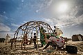 Building a house in lake Chad region.jpg 3,600 × 2,400; 2.02 MB
-
 Caballos abrevando en las orillas del lago Chad (1900).jpg 1,117 × 1,793; 805 KB
-
 Dwellings on the lake chad shore.jpg 3,338 × 4,408; 1.02 MB
-
 ETH-BIB-Dorf mitten im Tschadsee aus 50 m Flughöhe-Tschadseeflug 1930-31-LBS MH02-08-0802.tif 4,961 × 3,562; 50.69 MB
-

-
 ETH-BIB-Ufer des Tschadsee-Tschadseeflug 1930-31-LBS MH02-08-0797.tif 3,871 × 5,393; 59.84 MB
-
 ETH-BIB-Ufer des Tschadsee-Tschadseeflug 1930-31-LBS MH02-08-0805.tif 4,961 × 3,600; 51.22 MB
-
 ETH-BIB-Ufer des Tschadsee-Tschadseeflug 1930-31-LBS MH02-08-0976.tif 4,961 × 3,623; 51.6 MB
-
 ETH-BIB-Ufer des Tschadsees-Tschadseeflug 1930-31-LBS MH02-08-0785.tif 4,961 × 3,586; 50.99 MB
-
 ETH-BIB-Ufer des Tschadsees-Tschadseeflug 1930-31-LBS MH02-08-0793.tif 4,958 × 3,604; 51.2 MB
-
 ETH-BIB-Ufer des Tschadsees-Tschadseeflug 1930-31-LBS MH02-08-0933.tif 4,961 × 3,606; 51.28 MB
-
 ETH-BIB-Ufer des Tschadsees-Tschadseeflug 1930-31-LBS MH02-08-0974.tif 4,961 × 3,607; 51.3 MB
-
 ETH-BIB-Ufer des Tschadsees-Tschadseeflug 1930-31-LBS MH02-08-0977.tif 4,961 × 3,611; 51.38 MB
-
 Island in Lake Chad. Water-colour by E. M. Heims.jpg 3,040 × 2,036; 1.42 MB
-
 ISS012-E-10934 - View of Nigeria.jpg 1,520 × 1,008; 63 KB
-
 Lake Chad (50710742982).jpg 7,680 × 7,680; 84.15 MB
-
 Lake Chad (Baga site) borno state.jpg 800 × 600; 286 KB
-
 Lake chad shore.jpg 5,376 × 3,744; 4.8 MB
-
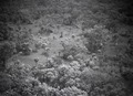
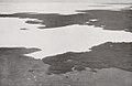
 LakeChadBolaerialphoto.jpg 450 × 324; 104 KB
-
 LakeChadCameroonTown.jpg 450 × 324; 227 KB
-
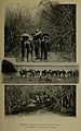
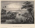
 Le Tour du monde-02-p208.jpg 820 × 608; 181 KB
-
 Meyers Universum Band 20 04.jpg 3,808 × 3,037; 6.48 MB
-
 Mittelholzer-tschadsee.jpg 1,200 × 775; 324 KB
-

-

-
 Potash boat on the Lake Chad.jpg 4,970 × 3,084; 3.51 MB
-
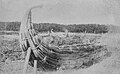 Reed boats at Lake Chad.jpg 5,288 × 3,243; 4.17 MB
-
 Rives du Tsad - 26 Avril 1851.jpg 500 × 378; 38 KB
-
 S66-38444 Lake Chad.jpg 5,731 × 5,747; 7.81 MB
-
 Some small part of Lake Chad borno state.jpg 600 × 399; 59 KB
-
 Tchad. Portions navigables des cours d'eau - btv1b8458995h.jpg 9,379 × 6,247; 4.27 MB
-
 Tripoli–Murzuk–Lake Chad route map by Monteil 1895.jpg 750 × 1,428; 380 KB
-
 Water hyancinth on the lakechad.jpg 2,448 × 3,264; 2.36 MB
-
 Waving fisherman on Lake Chad (detilt).jpg 1,440 × 998; 819 KB
-
 Waving fisherman on the lakechad.jpg 2,356 × 1,572; 1.12 MB
-
 Brzeg jeziora - Jezioro Czad - 001265s.jpg 1,920 × 1,293; 249 KB
-
 Bydło u wodopoju na trasie Jezioro Czad - Maiduguri - Nigeria - 001289s.jpg 1,920 × 1,293; 321 KB
-
 Kanał doprowadzający do jeziora - Jezioro Czad - 001267s.jpg 1,920 × 1,293; 225 KB
-
 Kanał doprowadzający do jeziora - Jezioro Czad - 001269s.jpg 1,920 × 1,293; 264 KB
-
 Obóz ekspedycji nad jeziorem - Jezioro Czad - 001279s.jpg 1,920 × 1,293; 259 KB
-
 Łodzie rybaków przy wyjściu na jezioro - Jezioro Czad - 001268s.jpg 1,920 × 1,293; 220 KB
-
 Łódź rybaków Kanuri - Jezioro Czad - 001264s.jpg 1,874 × 1,224; 380 KB
-
 Łódź rybaków Kanuri - Jezioro Czad - 001266s.jpg 1,920 × 1,294; 256 KB
_-_Barca_in_papiro_dal_lago_Ciad_-_Foto_Giovanni_Dall%27Orto,_19_mar_2014.jpg)
_-_Barca_in_papiro_dal_lago_Ciad_-_Foto_Giovanni_Dall%27Orto,_19_mar_2014.jpg)
_-_Barca_in_papiro_dal_lago_Ciad_-_Foto_Giovanni_Dall%27Orto,_19_mar_2014.jpg)
_-_Barca_in_papiro_dal_lago_Ciad_-_Foto_Giovanni_Dall%27Orto,_19_mar_2014.jpg)


.jpg)


.jpg)


.jpg)
_borno_state.jpg)


_-_Iridinidae_-_Mollusc_shell.jpeg)
_-_Iridinidae_-_Mollusc_shell.jpeg)


.jpg)


