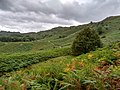
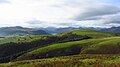
Category:Lake District
Vai alla navigazione
Vai alla ricerca
|
Questo sito è inserito nell'elenco del Patrimonio Mondiale dell'UNESCO sotto l'intitolazione :
The English Lake District.
|
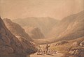
regione montuosa del nord ovest dell'Inghilterra  Masiv Skiddaw, město Keswick a jezero Derwent Water jsou patrné z Walla Crag.  | |||||
| Carica un file multimediale | |||||
| Istanza di |
| ||||
|---|---|---|---|---|---|
| Area protetta | |||||
| Luogo |
| ||||
| Operatore |
| ||||
| Designazione del patrimonio |
| ||||
| Data di fondazione o creazione |
| ||||
| Larghezza |
| ||||
| Lunghezza |
| ||||
| Punto più alto | |||||
| Superficie |
| ||||
| Altezza sul mare |
| ||||
| sito web ufficiale | |||||
 | |||||
Sottocategorie
Questa categoria contiene le 69 sottocategorie indicate di seguito, su un totale di 69.
- Maps of the Lake District (51 F)
*
- Landscapes of the Lake District (33 F)
A
- Andy Goldsworthy's sheepfolds (10 F)
B
- Boredale Beck, Cumbria (6 F)
- Borrow Beck (10 F)
- Buscoe Sike (3 F)
C
- Corney Fell Road (21 F)
- Crook Beck (4 F)
D
- Dalehead Tarn (1 F)
- Deepdale, Cumbria (13 F)
E
F
- Fell Foot Park (63 F)
- Fusedale (7 F)
G
- Grains Gill, Cumbria (8 F)
- Great Moss, Eskdale (20 F)
- Greenburn Tarn (5 F)
- Grisedale Tarn (31 F)
H
- Herdwick (52 F)
- Holme Beck, Cumbria (1 F)
K
L
- Lingmell gill (41 F)
- Lowbridge Estate (2 F)
M
- Moss Force (5 F)
P
R
- Red Gill Beck (River Eden) (5 F)
- Rigg Beck (6 F)
S
- Sour Howes (12 F)
- Sour Milk Gill (48 F)
- St. John's Beck (1 F)
- Stickle Tarn (64 F)
- Stoneycroft Gill (2 F)
T
- The Lakeland Experience (11 F)
- Tongue Valley (1 F)
U
W
- Wasdale Beck (5 F)
Y
- Yewdale Beck (3 F)
File nella categoria "Lake District"
Questa categoria contiene 200 file, indicati di seguito, su un totale di 628.
(pagina precedente) (pagina successiva)-
 4749458695 Jpg (165456661).jpeg 1 920 × 1 281; 837 KB
-
 4749460593 Jpg (165456675).jpeg 1 920 × 1 281; 554 KB
-
 4749464183 Jpg (165456653).jpeg 1 920 × 1 281; 567 KB
-
 4750098408 Jpg (165456663).jpeg 1 920 × 1 281; 546 KB
-
 A protest against the extension of railways in the Lake District - Somervell (1876).djvu 1 058 × 1 500, 88 pagine; 10,96 MB
-
 A rainbow to brighten Thunacar Knott (6164182370).jpg 3 072 × 2 304; 2,2 MB
-
 A spectrum of natural colour (6998024273).jpg 2 816 × 1 584; 2,75 MB
-
 A591 road, Lake District - June 2009 Edit 1.jpg 5 000 × 2 573; 4,04 MB
-
 A591 road, Lake District - June 2009.jpg 5 500 × 2 600; 6,99 MB
-
 Across Threlkeld to central Lakeland (6851835784).jpg 2 195 × 1 234; 863 KB
-
 Alder tree at Ullswater.jpg 3 024 × 4 032; 6,11 MB
-
 Alexander Dennis Enviro300.jpg 4 096 × 2 304; 1,05 MB
-
-
 Ard crags from newlands.jpg 2 304 × 1 728; 116 KB
-
 Arthur's Pike from Hallin Fell 1.jpg 3 648 × 2 736; 2,76 MB
-
 Autumnal Langdale (6163647149).jpg 2 048 × 1 152; 937 KB
-
 Baa (4569318258).jpg 3 492 × 2 395; 4,31 MB
-
 Base Brown from Seathwaite.jpg 1 382 × 1 037; 109 KB
-
 Between Lonscale and Blease Fells (8024799257).jpg 2 816 × 1 584; 1,11 MB
-
 Binsey sunset from the Saharan dust clouds.jpg 1 024 × 768; 74 KB
-
 Black Beck - geograph.org.uk - 1146702.jpg 640 × 480; 70 KB
-
 Black Sike - geograph.org.uk - 367977.jpg 640 × 480; 92 KB
-
 Blackbeck Tarn - geograph.org.uk - 47025.jpg 640 × 480; 102 KB
-
 Blackbeck Tarn.jpg 931 × 698; 308 KB
-
 Bleacove Beck - geograph.org.uk - 1188761.jpg 480 × 640; 106 KB
-
 By Cat Gills - geograph.org.uk - 1609393.jpg 480 × 640; 65 KB
-
 Cairn, Stoupdale Head - geograph.org.uk - 796430.jpg 640 × 480; 82 KB
-
 Calder valley from whoap.jpg 1 024 × 682; 313 KB
-
 Camping by Lambfoot Dub - geograph.org.uk - 992246.jpg 640 × 480; 66 KB
-
 Castle crag.jpg 640 × 480; 97 KB
-
 Castle Rock of Triermain and Watson's Dodd.jpg 600 × 450; 51 KB
-

-
 Chalet, Lake District, Cumbria, England.jpg 4 032 × 3 024; 10,43 MB
-
 Climbers scale the walls of Deep Gill (7826638740).jpg 1 584 × 2 112; 1,47 MB
-
 Cock Cove.jpg 640 × 454; 108 KB
-
 Codale Tarn ^ Easedale Tarn - panoramio.jpg 1 920 × 1 080; 935 KB
-
 Cold Pike from Great Knott.jpg 1 600 × 1 200; 391 KB
-
 Coledale Fells from Robinson.jpg 3 648 × 2 736; 2,69 MB
-
 Coledale from Coledale Hause 1.jpg 3 648 × 2 736; 2,07 MB
-
 Coltsfoot - Tussilago farfara - geograph.org.uk - 1255598.jpg 640 × 480; 110 KB
-
 Common Fell from N.JPG 1 024 × 768; 425 KB
-
 Common Red Soldier Beetle, Lake District, UK.jpg 2 416 × 3 624; 3,13 MB
-
 Constable - View in the Lake District, 186-1888.jpg 2 500 × 1 832; 941 KB
-
 Constable - View in the Lake District, 349-1888, 2013GC0497.jpg 2 500 × 1 875; 929 KB
-
 Continuous Cover Forestry in the Lake District, Cumbria, England.jpeg 1 024 × 759; 587 KB
-
 Cooling a cup of tea Worm Gill - geograph.org.uk - 73966.jpg 640 × 480; 115 KB
-
 Crag Hill summit 1.JPG 3 008 × 2 000; 3,02 MB
-
 Crookdale Fold - geograph.org.uk - 929879.jpg 640 × 480; 96 KB
-
 Dale Head.jpg 600 × 399; 61 KB
-
 Day 3- Just arrived at Grasmere, The Lake District (8399461911).jpg 4 928 × 3 280; 6,7 MB
-
 Day 3- Just arrived at Grasmere, The Lake District (8400552880).jpg 4 928 × 3 280; 8,47 MB
-
 Day 4- A chessboard (8433241361).jpg 4 928 × 3 280; 5,44 MB
-
 Day 4- A clock and candles (8446449906).jpg 4 928 × 3 280; 5,39 MB
-
 Day 4- A fireplace (8434327722).jpg 4 928 × 3 280; 8,73 MB
-
 Day 4- A house and Lake Grasmere (8424572493).jpg 4 826 × 3 212; 5,92 MB
-
 Day 4- A perfect place to take pictures of stars (8422194240).jpg 4 928 × 3 280; 5,85 MB
-
 Day 4- A sheep in Grasmere (8415905724).jpg 4 928 × 3 280; 5,74 MB
-
 Day 4- A view during a hiking -1 (8412938344).jpg 4 928 × 3 280; 7,49 MB
-
 Day 4- A view during a hiking -2 (8412939108).jpg 4 928 × 3 280; 7,66 MB
-
 Day 4- At the top of a mountain (8417789091).jpg 3 280 × 4 928; 8,04 MB
-
 Day 4- Blue sky (8418900864).jpg 4 928 × 3 280; 5,63 MB
-
 Day 4- Cows (8428656926).jpg 4 928 × 3 280; 8,62 MB
-
 Day 4- Grasmere Village from a hill (8449389244).jpg 4 928 × 3 280; 7,33 MB
-
 Day 4- Grasses and a house (8425661754).jpg 4 928 × 3 280; 8,75 MB
-
 Day 4- Stairs at Forest Side Hotel (8410013066).jpg 3 280 × 4 928; 6,27 MB
-
 Day 4- Stars -1 (8431511252).jpg 4 928 × 3 280; 9,26 MB
-
 Day 4- Stars -2 (8431511862).jpg 3 280 × 4 928; 9,05 MB
-
 Day 4- Stars -3 (8431512626).jpg 3 280 × 4 928; 9,51 MB
-
 Day 4- Streams in Grasmere (8415905172).jpg 4 928 × 3 280; 7,26 MB
-
 Dead Crags on Bakestall 1.jpg 2 000 × 1 500; 950 KB
-
 Descending over Lining Crag - geograph.org.uk - 1546906.jpg 427 × 640; 100 KB
-
 Dodd from near Keswick.jpg 2 304 × 1 728; 100 KB
-
 Don't you think their faces look just like little koala bears?.jpg 1 600 × 1 199; 995 KB
-
 Drizzly Day Reflection over Buttermere - Lake District - May 2019.jpg 6 000 × 3 376; 6,04 MB
-
 Dry stone walls, Lake District.JPG 1 600 × 1 200; 596 KB
-
 DryStoneWallWansfell.jpg 880 × 660; 162 KB
-
 DSC 1941 - panoramio.jpg 2 102 × 1 356; 531 KB
-
 Dwarf birch trees (betula nana) - geograph.org.uk - 1761249.jpg 712 × 537; 203 KB
-
 East ridge of Lonscale Fell (8024798901).jpg 2 816 × 1 584; 923 KB
-
 English SkyLine.JPG 5 184 × 3 888; 7,58 MB
-
 Eskdale Framed and Coloured 4.jpg 1 280 × 929; 280 KB
-
 Exterieur van huis Townend aan de Troutbeck in het Lake District, RP-F-F01135-F.jpg 2 533 × 1 645; 659 KB
-
 Fallen tree in Great Langdale - geograph.org.uk - 505703.jpg 640 × 426; 152 KB
-
 Fawe Park - panoramio.jpg 1 620 × 1 080; 1,41 MB
-
 Fitz Park, Keswick. - panoramio.jpg 3 594 × 2 514; 4,13 MB
-
 Flickr - don macauley - Striding Edge on Helvellyn.jpg 3 648 × 2 736; 4,92 MB
-
 Flour Gill - geograph.org.uk - 407911.jpg 640 × 480; 69 KB
-

-
 From Beacon Tarn.jpg 1 800 × 1 350; 345 KB
-
 From Silver How to Langdale (6164178580).jpg 2 048 × 1 152; 889 KB
-
 Furry cows (5627559812).jpg 4 848 × 3 012; 8,49 MB
-
 Gate into the forest - geograph.org.uk - 1232645.jpg 640 × 480; 109 KB
-
 Gate View, Eskdale.jpg 800 × 566; 214 KB
-
 Gavel Fell from Great Borne.jpg 1 500 × 1 069; 181 KB
-
 Geoff Somers (M.B.E) British Explorer 01.jpg 1 239 × 1 890; 569 KB
-
 George Barrett - Landscape With Travellers - 8502.jpg 2 048 × 1 581; 582 KB
-
 Getting Ready to Fly (35555382730).jpg 1 878 × 2 257; 2,97 MB
-
 Gezelschap met paardenkoetsen in de Honister Pass in het Lake District, RP-F-F01135-O.jpg 2 853 × 2 333; 1,04 MB
-
 Gills from Scafell (7826646020).jpg 2 629 × 1 493; 1,59 MB
-
 Glenridding from Angletarn Pikes.JPG 1 024 × 768; 205 KB
-
 Goat's Hawse - geograph.org.uk - 1373110.jpg 640 × 480; 87 KB
-
 Grange Fell from Rosthwaite.JPG 1 382 × 1 037; 92 KB
-
 Grasmere - panoramio (1).jpg 1 620 × 1 080; 631 KB
-
 Grasmere and Silver How.jpg 1 711 × 1 192; 116 KB
-
 Grasmere and the southern fells (5995081551).jpg 1 536 × 1 152; 1,71 MB
-
 Graystones from Whinlatter Road.jpg 2 200 × 1 650; 1,04 MB
-
 Great Calva from Bakestall.jpg 2 000 × 1 500; 1,06 MB
-
 Great Crag.jpg 1 180 × 841; 88 KB
-
 Great Langdale (7177982983).jpg 2 608 × 1 467; 1,51 MB
-
 Great Langdale and beyond (7088462435).jpg 2 816 × 1 584; 1,21 MB
-
 Great Langdale, a jewel of the Lakes (6942389988).jpg 2 816 × 1 584; 1,11 MB
-
 Great Mell Fell with Rainbow.jpg 1 973 × 1 405; 220 KB
-
 Great Rigg and Fairfield from Heron Pike (2).jpg 990 × 702; 114 KB
-
 Greatmellfell.jpg 640 × 480; 181 KB
-
 Green Crag - geograph.org.uk - 1259379.jpg 640 × 480; 87 KB
-
 Green Green Grass.jpg 3 648 × 2 736; 3,25 MB
-
 Greenburn Copper Mine 2.jpg 640 × 425; 181 KB
-
 Greenburn Copper Mine.jpg 640 × 425; 211 KB
-
 Grike from Crag Fell.jpg 800 × 533; 236 KB
-
 Grike summit cairns.jpg 1 500 × 1 067; 178 KB
-
 Guest House front garden, Keswick. - panoramio.jpg 3 852 × 2 540; 4,65 MB
-
 Gummers How, Lake District, Windermere (200449) (9451340645).jpg 4 118 × 2 490; 2,93 MB
-
Hart Side summit.ogv 30 s, 640 × 480; 6,89 MB
-
 Hen Comb from Mosedale 1.JPG 3 648 × 2 736; 2,07 MB
-
 Herdwicks Lake District.jpg 2 048 × 1 536; 1,48 MB
-
 Here comes the rain - panoramio.jpg 10 290 × 3 817; 15,5 MB
-
 High Crag from Ruthwaite Cove.JPG 1 600 × 1 200; 897 KB
-
 High Pike from Bowscale Fell.jpg 2 500 × 1 875; 850 KB
-
Highland midge (Culicoides impunctatus) swarm biting me!.webm 25 s, 3 413 × 1 920; 7,88 MB
-
 HighRigg HelvellynRange.JPG 2 560 × 1 920; 301 KB
-
 Hiking path - panoramio (1527).jpg 3 264 × 2 448; 3,56 MB
-
 Holehird Gardens Pathway.jpg 2 288 × 1 712; 850 KB
-
 Holiday Homes Pooley - panoramio.jpg 4 164 × 1 872; 1,61 MB
-
 Hyacinthoides non-scripta Lake District.jpg 1 024 × 768; 555 KB
-
 I had no idea these squirrels were dangerous^ Threlkeld. - panoramio.jpg 2 668 × 3 643; 4,54 MB
-
 Kemp Tarn - geograph.org.uk - 1749556.jpg 2 848 × 2 136; 1,71 MB
-
 Keswick UK.jpg 2 336 × 4 160; 2,8 MB
-
 King of the castle (7826639986).jpg 2 684 × 1 510; 1,87 MB
-
 Knott Rigg from Rigg Beck.jpg 3 648 × 2 736; 2,83 MB
-
 Knott Rigg from Wandope.jpg 1 016 × 725; 108 KB
-
 Lady's Pillar - geograph.org.uk - 1586245.jpg 640 × 480; 59 KB
-
 Lake District (46589178074).jpg 3 851 × 2 567; 8,52 MB
-
 Lake district - Flickr - Ray B's world.jpg 5 938 × 3 088; 6,59 MB
-
 Lake District - panoramio (528).jpg 3 072 × 2 304; 2,85 MB
-
 Lake District - panoramio (548).jpg 3 072 × 2 304; 2,76 MB
-
 Lake District - panoramio (549).jpg 3 072 × 2 304; 2,95 MB
-
 Lake District - panoramio (550).jpg 3 072 × 2 304; 2,88 MB
-
 Lake District - panoramio (561).jpg 3 072 × 2 304; 2,83 MB
-
 Lake District - panoramio (562).jpg 3 072 × 2 304; 2,68 MB
-
 Lake District - panoramio (566).jpg 3 072 × 2 304; 2,76 MB
-
 Lake District - panoramio (567).jpg 3 072 × 2 304; 2,83 MB
-
 Lake District - panoramio (568).jpg 3 072 × 2 304; 2,92 MB
-
 Lake District - panoramio (569).jpg 3 072 × 2 304; 2,6 MB
-
 Lake district 2012 4.jpg 2 880 × 1 920; 2,78 MB
-
 Lake district 2012 44.jpg 2 880 × 1 920; 2,76 MB
-
 Lake district 2012 45.jpg 2 880 × 1 920; 2,81 MB
-
 Lake district 2012 53.jpg 2 880 × 1 920; 3,65 MB
-
 Lake district 2012 54.jpg 2 880 × 1 724; 4,81 MB
-
 Lake district 2012 55.jpg 2 880 × 1 920; 4,35 MB
-
 Lake district 2012 58.jpg 2 880 × 1 854; 2,93 MB
-
 Lake district 2012 60.jpg 2 880 × 1 602; 3,32 MB
-
 Lake district 2012 66.jpg 2 880 × 1 887; 2,7 MB
-
 Lake district 2012 7.jpg 2 880 × 1 920; 3,72 MB
-
 Lake district 2012 71.jpg 2 880 × 1 850; 2,54 MB
-
 Lake district 2012 75.jpg 2 880 × 1 920; 3 MB
-
 Lake District 3D Winter frost 1 SL33 09R08L small.jpg 10 944 × 3 648; 5,28 MB
-
 Lake District 3D Winter frost 2 SL33 07R06L small.jpg 10 944 × 3 648; 5,26 MB
-
 Lake District Cumberland.png 608 × 410; 331 KB
-
 Lake District Dusted (64876799).jpeg 2 048 × 1 151; 1,06 MB
-
 Lake district evening.jpg 4 256 × 2 832; 2,98 MB
-
 Lake District mountains 2017.jpg 1 080 × 608; 87 KB
-
 Lake District National Park - A walk in the woods (48992358473).jpg 3 577 × 2 385; 12,12 MB
-
 Lake District National Park Sign. - geograph.org.uk - 101130.jpg 640 × 480; 75 KB
-
 Lake District picture.JPG 2 592 × 1 944; 2,09 MB
-
 Lake District World Heritage Site Sign.jpg 3 024 × 4 032; 4,21 MB
-
 Lake District, Cumbria, England - Explore - Flickr - cattan2011.jpg 4 032 × 3 024; 6,67 MB
-
 Lake District, Cumbria, view.jpg 1 920 × 1 080; 296 KB
-
 Lake District, Enjoying the view (14848601198).jpg 2 400 × 1 600; 5,81 MB
-
 Lake District, near Windermere (3721731320).jpg 1 600 × 1 088; 376 KB
-
 Lake District.JPG 3 872 × 2 592; 3,85 MB
-
 Lake district.jpg 4 000 × 3 000; 5,44 MB
-
 Lake District.jpg 4 000 × 3 000; 3,48 MB
-
 LakeDistrict.JPG 5 444 × 3 649; 6,5 MB
-
 Lakeland Landscape near Hartsop.jpg 3 724 × 2 521; 1,83 MB
-
 Lakes Aquarium.jpg 4 032 × 3 024; 4,34 MB
-
 Landing stage, Derwentwater, Keswick. - panoramio (1).jpg 4 331 × 2 891; 4,01 MB
-
 Landing stage, Derwentwater, Keswick. - panoramio.jpg 3 986 × 2 671; 4,37 MB
-
 Langdale Youth Hostel 1.jpg 3 888 × 2 592; 3,88 MB
-
 Langdale Youth Hostel.jpg 3 888 × 2 592; 3,27 MB
-
 Langdale.jpg 2 560 × 1 920; 2,07 MB
-
 Langdales, Westmorland.jpg 3 264 × 2 448; 2,22 MB
-
 Latrigg and the mountains of Keswick (8024794586).jpg 2 816 × 1 584; 847 KB
-
 Latrigg from Fitz Park, Keswick.jpg 1 958 × 1 469; 113 KB
-
 Latrigg in the green (8024794735).jpg 2 816 × 1 584; 1,04 MB
-
 Launchy Tarn - geograph.org.uk - 895297.jpg 640 × 480; 67 KB
-
 Letters from England, Lake cows.jpg 796 × 486; 242 KB
-
 Letters from England, Lake sheep.jpg 790 × 449; 224 KB
-
 Levers Hawse - geograph.org.uk - 1373139.jpg 640 × 480; 77 KB
-
 Levers Hawse - geograph.org.uk - 1373157.jpg 640 × 480; 59 KB
-
 Levers Water.jpg 1 350 × 1 800; 437 KB
.jpeg)
.jpeg)
.jpeg)
.jpeg)
.jpg)
.jpg)


.jpg)


.jpg)
.jpg)

.jpg)


_(seen_from_Wren_Crag_on_High_Rigg.jpg)

.jpg)


.jpg)
.jpg)
.jpg)
.jpg)
.jpg)
.jpg)
.jpg)
.jpg)
.jpg)
.jpg)
.jpg)
.jpg)
.jpg)
.jpg)
.jpg)
.jpg)
.jpg)
.jpg)
.jpg)
.jpg)


_-_geograph.org.uk_-_1761249.jpg)
.jpg)


.jpg)
.jpg)


_British_Explorer_01.jpg)

.jpg)

.jpg)


.jpg)

.jpg)


.jpg)
.jpg)
.jpg)

.jpg)


_(9451340645).jpg)


.jpg)


.jpg)


.jpg)

.jpg)
.jpg)
.jpg)
.jpg)
.jpg)
.jpg)
.jpg)
.jpg)
.jpg)
.jpg)


.jpeg)


.jpg)


.jpg)
.jpg)


.jpg)


.jpg)

.jpg)


