Category:Rydal Water
Jump to navigation
Jump to search
lake in the United Kingdom  | |||||
| Upload media | |||||
| Instance of | |||||
|---|---|---|---|---|---|
| Located in protected area | |||||
| Location |
| ||||
| Owned by | |||||
| Operator | |||||
| Width |
| ||||
| Length |
| ||||
| Mountain range | |||||
| Inflows | |||||
| Outflows | |||||
| Basin country | |||||
 | |||||
Subcategories
This category has the following 2 subcategories, out of 2 total.
H
- Heron Island, Cumbria (5 F)
L
- Little Isle (7 F)
Media in category "Rydal Water"
The following 200 files are in this category, out of 242 total.
(previous page) (next page)-
 'Rydalwater, a Sketch' by Sanford Robinson Gifford, 1855.JPG 2,825 × 1,370; 523 KB
-
 A bend in the path above Rydal Water - geograph.org.uk - 2320113.jpg 3,872 × 2,592; 4.63 MB
-
 A walk around Rydal Water (1) - geograph.org.uk - 6236832.jpg 4,320 × 3,240; 4.27 MB
-
 A walk around Rydal Water (10) - geograph.org.uk - 6237611.jpg 3,240 × 4,320; 4.19 MB
-
 A walk around Rydal Water (11) - geograph.org.uk - 6237612.jpg 4,320 × 3,240; 4.07 MB
-
 A walk around Rydal Water (12) - geograph.org.uk - 6237613.jpg 4,320 × 3,240; 2.78 MB
-
 A walk around Rydal Water (13) - geograph.org.uk - 6237614.jpg 4,320 × 3,240; 3.98 MB
-
 A walk around Rydal Water (14) - geograph.org.uk - 6237615.jpg 4,320 × 3,240; 4.79 MB
-
 A walk around Rydal Water (15) - geograph.org.uk - 6237616.jpg 4,320 × 3,240; 4.73 MB
-
 A walk around Rydal Water (16) - geograph.org.uk - 6237617.jpg 4,320 × 3,240; 2.67 MB
-
 A walk around Rydal Water (17) - geograph.org.uk - 6237622.jpg 4,320 × 3,240; 3.9 MB
-
 A walk around Rydal Water (18) - geograph.org.uk - 6237626.jpg 4,320 × 3,240; 4.67 MB
-
 A walk around Rydal Water (19) - geograph.org.uk - 6237628.jpg 4,320 × 3,240; 4.45 MB
-
 A walk around Rydal Water (2) - geograph.org.uk - 6236870.jpg 4,320 × 3,240; 4.03 MB
-
 A walk around Rydal Water (20) - geograph.org.uk - 6237631.jpg 4,320 × 3,240; 3.79 MB
-
 A walk around Rydal Water (21) - geograph.org.uk - 6237635.jpg 4,320 × 3,240; 5.42 MB
-
 A walk around Rydal Water (22) - geograph.org.uk - 6237637.jpg 4,320 × 3,240; 5 MB
-
 A walk around Rydal Water (23) - geograph.org.uk - 6237639.jpg 4,320 × 3,240; 4.92 MB
-
 A walk around Rydal Water (24) - geograph.org.uk - 6237641.jpg 4,320 × 3,240; 4.66 MB
-
 A walk around Rydal Water (25) - geograph.org.uk - 6237644.jpg 4,320 × 3,240; 4.59 MB
-
 A walk around Rydal Water (26) - geograph.org.uk - 6237647.jpg 4,320 × 3,240; 4.37 MB
-
 A walk around Rydal Water (27) - geograph.org.uk - 6237648.jpg 4,320 × 3,240; 4.86 MB
-
 A walk around Rydal Water (28) - geograph.org.uk - 6237654.jpg 4,320 × 3,240; 3.7 MB
-
 A walk around Rydal Water (29) - geograph.org.uk - 6237656.jpg 4,320 × 3,240; 2.34 MB
-
 A walk around Rydal Water (3) - geograph.org.uk - 6236886.jpg 4,320 × 3,240; 4.08 MB
-
 A walk around Rydal Water (30) - geograph.org.uk - 6238468.jpg 3,234 × 3,233; 3.1 MB
-
 A walk around Rydal Water (31) - geograph.org.uk - 6238471.jpg 4,310 × 3,232; 4.04 MB
-
 A walk around Rydal Water (32) - geograph.org.uk - 6238474.jpg 4,320 × 3,240; 5.17 MB
-
 A walk around Rydal Water (33) - geograph.org.uk - 6238476.jpg 4,320 × 3,240; 4.98 MB
-
 A walk around Rydal Water (34) - geograph.org.uk - 6238499.jpg 4,320 × 3,240; 4.45 MB
-
 A walk around Rydal Water (35) - geograph.org.uk - 6238504.jpg 4,320 × 3,240; 4.65 MB
-
 A walk around Rydal Water (36) - geograph.org.uk - 6238508.jpg 4,320 × 3,240; 4.55 MB
-
 A walk around Rydal Water (37) - geograph.org.uk - 6238510.jpg 4,320 × 3,240; 4.4 MB
-
 A walk around Rydal Water (38) - geograph.org.uk - 6238527.jpg 4,320 × 3,240; 4.13 MB
-
 A walk around Rydal Water (39) - geograph.org.uk - 6238530.jpg 4,320 × 3,240; 4.08 MB
-
 A walk around Rydal Water (4) - geograph.org.uk - 6236893.jpg 4,320 × 3,240; 2.8 MB
-
 A walk around Rydal Water (40) - geograph.org.uk - 6238533.jpg 3,234 × 3,233; 3.12 MB
-
 A walk around Rydal Water (41) - geograph.org.uk - 6238536.jpg 4,310 × 3,232; 4.63 MB
-
 A walk around Rydal Water (42) - geograph.org.uk - 6238957.jpg 4,320 × 3,240; 4.29 MB
-
 A walk around Rydal Water (43) - geograph.org.uk - 6238958.jpg 4,320 × 3,240; 4.42 MB
-
 A walk around Rydal Water (44) - geograph.org.uk - 6238959.jpg 4,320 × 3,240; 4.37 MB
-
 A walk around Rydal Water (45) - geograph.org.uk - 6238960.jpg 4,320 × 3,240; 3.8 MB
-
 A walk around Rydal Water (46) - geograph.org.uk - 6238961.jpg 4,320 × 3,240; 4.72 MB
-
 A walk around Rydal Water (47) - geograph.org.uk - 6238962.jpg 4,320 × 3,240; 3.84 MB
-
 A walk around Rydal Water (48) - geograph.org.uk - 6238963.jpg 4,320 × 3,240; 5.05 MB
-
 A walk around Rydal Water (49) - geograph.org.uk - 6239012.jpg 4,320 × 3,240; 4.56 MB
-
 A walk around Rydal Water (5) - geograph.org.uk - 6236898.jpg 4,320 × 3,240; 4.46 MB
-
 A walk around Rydal Water (50) - geograph.org.uk - 6239021.jpg 4,320 × 3,240; 5.17 MB
-
 A walk around Rydal Water (51) - geograph.org.uk - 6239025.jpg 4,320 × 3,240; 4.32 MB
-
 A walk around Rydal Water (52) - geograph.org.uk - 6239030.jpg 4,320 × 3,240; 4.43 MB
-
 A walk around Rydal Water (53) - geograph.org.uk - 6239711.jpg 3,240 × 4,320; 4.44 MB
-
 A walk around Rydal Water (54) - geograph.org.uk - 6239712.jpg 4,143 × 3,107; 4.03 MB
-
 A walk around Rydal Water (55) - geograph.org.uk - 6239713.jpg 4,209 × 3,157; 4.59 MB
-
 A walk around Rydal Water (56) - geograph.org.uk - 6239715.jpg 4,320 × 3,240; 2.99 MB
-
 A walk around Rydal Water (57) - geograph.org.uk - 6239716.jpg 4,320 × 3,240; 4.92 MB
-
 A walk around Rydal Water (58) - geograph.org.uk - 6239717.jpg 3,240 × 4,320; 4.69 MB
-
 A walk around Rydal Water (59) - geograph.org.uk - 6239718.jpg 3,240 × 4,320; 4.69 MB
-
 A walk around Rydal Water (6) - geograph.org.uk - 6237607.jpg 4,320 × 3,240; 3.1 MB
-
 A walk around Rydal Water (60) - geograph.org.uk - 6239719.jpg 4,320 × 3,240; 3.21 MB
-
 A walk around Rydal Water (61) - geograph.org.uk - 6239720.jpg 4,320 × 3,240; 4.1 MB
-
 A walk around Rydal Water (62) - geograph.org.uk - 6239721.jpg 4,320 × 3,240; 4.6 MB
-
 A walk around Rydal Water (63) - geograph.org.uk - 6239722.jpg 4,320 × 3,240; 4.67 MB
-
 A walk around Rydal Water (64) - geograph.org.uk - 6239723.jpg 4,320 × 3,240; 4.43 MB
-
 A walk around Rydal Water (65) - geograph.org.uk - 6239724.jpg 4,320 × 3,240; 4.78 MB
-
 A walk around Rydal Water (66) - geograph.org.uk - 6239725.jpg 4,320 × 3,240; 4.71 MB
-
 A walk around Rydal Water (67) - geograph.org.uk - 6239726.jpg 4,320 × 3,240; 3.58 MB
-
 A walk around Rydal Water (68) - geograph.org.uk - 6239728.jpg 3,240 × 4,320; 3.92 MB
-
 A walk around Rydal Water (69) - geograph.org.uk - 6239730.jpg 4,320 × 3,240; 3.98 MB
-
 A walk around Rydal Water (7) - geograph.org.uk - 6237608.jpg 4,320 × 3,240; 3.5 MB
-
 A walk around Rydal Water (70) - geograph.org.uk - 6239731.jpg 4,320 × 3,240; 4.78 MB
-
 A walk around Rydal Water (71) - geograph.org.uk - 6239733.jpg 3,240 × 4,320; 4.77 MB
-
 A walk around Rydal Water (8) - geograph.org.uk - 6237609.jpg 4,320 × 3,240; 3.99 MB
-
 A walk around Rydal Water (9) - geograph.org.uk - 6237610.jpg 4,320 × 3,240; 3.71 MB
-
 Above Rydal Water - geograph.org.uk - 2821724.jpg 3,648 × 2,736; 3.18 MB
-
 Above Rydal Water - geograph.org.uk - 3707249.jpg 640 × 480; 257 KB
-
 Above Rydal Water - geograph.org.uk - 4086123.jpg 640 × 427; 97 KB
-
 Above Rydal Water - geograph.org.uk - 4714933.jpg 530 × 800; 570 KB
-
 Above Rydal Water - geograph.org.uk - 4714943.jpg 800 × 530; 476 KB
-
 Above Rydal Water - geograph.org.uk - 6128336.jpg 1,024 × 683; 460 KB
-
 Across Rydal Water - geograph.org.uk - 2042091.jpg 640 × 467; 104 KB
-
 Across Rydal water to Nab scar. - geograph.org.uk - 5947508.jpg 1,024 × 683; 170 KB
-
 Autumn Morning on Rydal Water. - panoramio.jpg 3,804 × 2,148; 2.88 MB
-
 Autumn on Rydal Water - geograph.org.uk - 266937.jpg 640 × 480; 128 KB
-
 Beside Rydal Water - geograph.org.uk - 1392769.jpg 640 × 480; 53 KB
-
 Bird life at Rydal Water - geograph.org.uk - 2379104.jpg 640 × 426; 215 KB
-
 Chinook over Rydal Water - geograph.org.uk - 1176776.jpg 640 × 427; 43 KB
-
 Chinook Playing Over Rydal Water - geograph.org.uk - 1175579.jpg 640 × 427; 39 KB
-
 Close Up of Money Tree above Rydal Water - geograph.org.uk - 3178073.jpg 2,448 × 3,264; 4.09 MB
-
 Cumbria 2007 035.jpg 2,560 × 1,920; 1.19 MB
-
 Daffodils at Rydal Water - geograph.org.uk - 5749096.jpg 1,024 × 771; 317 KB
-
 Duck and duckings in Rydal Water (28th April 2019).jpg 5,152 × 3,864; 7.94 MB
-
 East end of Rydal Water - geograph.org.uk - 2042191.jpg 640 × 480; 129 KB
-
 East end of Rydal Water - geograph.org.uk - 2109180.jpg 640 × 445; 63 KB
-
 Fairfield above Rydal Head - geograph.org.uk - 5327260.jpg 1,024 × 769; 130 KB
-
 Golden Light on Rydal Water - panoramio.jpg 2,401 × 1,669; 3.83 MB
-
 Grazing geese, Rydal Water - geograph.org.uk - 874110.jpg 640 × 470; 222 KB
-
 Heron Island - geograph.org.uk - 2133007.jpg 640 × 482; 81 KB
-
 Heron Island in Rydal Water from the Corpse Road - geograph.org.uk - 1959586.jpg 1,600 × 1,198; 603 KB
-
 Joseph Wright of Derby Rydal Waterfall.jpg 598 × 436; 78 KB
-
 Lakeside, Rydal Water - geograph.org.uk - 1174716.jpg 640 × 425; 79 KB
-

-
 Looking across Rydal Water - geograph.org.uk - 5415486.jpg 640 × 427; 244 KB
-

-
 Mist over Rydal (1) - geograph.org.uk - 1984894.jpg 640 × 480; 111 KB
-
 Mist over Rydal (2) - geograph.org.uk - 1984898.jpg 640 × 480; 61 KB
-
 Mist over Rydal Water. Surface still largely frozen. - geograph.org.uk - 2234510.jpg 2,816 × 2,112; 1.35 MB
-
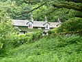
 Nab Cottage - geograph.org.uk - 1175572.jpg 640 × 427; 55 KB
-
 Nab Cottage, Rydal.jpg 1,024 × 768; 233 KB
-
 Over Rydal Water - geograph.org.uk - 5688270.jpg 3,264 × 2,448; 1.28 MB
-
 Panorama of Rydal Water (28th April 2019).jpg 4,912 × 1,080; 2.37 MB
-
 Panorama of Rydal Water - panoramio.jpg 2,000 × 1,012; 704 KB
-
 Path around Rydal Water (28th April 2019) 001.jpg 5,152 × 3,864; 7.13 MB
-
 Path around Rydal Water (28th April 2019) 002.jpg 5,152 × 3,864; 7.35 MB
-
 Path around south side of Rydal Water - geograph.org.uk - 3284096.jpg 1,024 × 768; 164 KB
-
 Path on south bank of Rydal Water - geograph.org.uk - 1959623.jpg 1,600 × 1,198; 413 KB
-
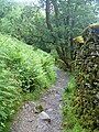
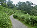
 Public Bridleway, Rydal Water - geograph.org.uk - 110404.jpg 640 × 480; 94 KB
-
 Rain above Rydal water - geograph.org.uk - 6128338.jpg 1,024 × 683; 383 KB
-
 Rain Clouds over Rydal Water - geograph.org.uk - 1392660.jpg 640 × 480; 76 KB
-
 Red Sky over Rydal Water. - panoramio.jpg 3,000 × 1,639; 2.52 MB
-
 Return to Ambleside on the Coffin route (27th April 2019) 001.jpg 4,912 × 1,080; 2.61 MB
-

-

-
 River linking Grasmere with Rydal Water, Cumbria - geograph.org.uk - 5189175.jpg 1,570 × 981; 481 KB
-
 Ruin South of Rydal Water - geograph.org.uk - 5749248.jpg 1,024 × 770; 440 KB
-
 Rydal - shoreline view of Rydal Water - geograph.org.uk - 4683839.jpg 4,608 × 3,456; 3.14 MB
-
 Rydal calm - geograph.org.uk - 1556052.jpg 640 × 420; 86 KB
-
-
 Rydal to Grasmere and back to Ambleside 4 - geograph.org.uk - 5944274.jpg 4,000 × 3,000; 2.87 MB
-
 Rydal Water (11994197914).jpg 1,620 × 1,080; 629 KB
-
 Rydal Water (11994642256).jpg 1,920 × 1,080; 649 KB
-
 Rydal Water (28th April 2019) 001.jpg 5,152 × 3,864; 6.94 MB
-
 Rydal Water (28th April 2019) 002.jpg 4,912 × 1,080; 2.27 MB
-
 Rydal Water (28th April 2019) 003.jpg 5,152 × 3,864; 7.77 MB
-
 Rydal Water (28th April 2019) 004.jpg 4,912 × 1,080; 2.41 MB
-
 Rydal Water (28th April 2019) 005.jpg 4,912 × 1,080; 2.51 MB
-
 Rydal Water (28th April 2019) 006.jpg 4,912 × 1,080; 2.25 MB
-
 Rydal Water - geograph.org.uk - 1008135.jpg 480 × 640; 58 KB
-
 Rydal Water - geograph.org.uk - 1008136.jpg 640 × 480; 59 KB
-
 Rydal Water - geograph.org.uk - 110521.jpg 640 × 480; 60 KB
-
 Rydal Water - geograph.org.uk - 1544864.jpg 640 × 480; 99 KB
-
 Rydal Water - geograph.org.uk - 1755366.jpg 2,272 × 1,712; 799 KB
-
 Rydal Water - geograph.org.uk - 1860076.jpg 1,000 × 640; 293 KB
-
 Rydal Water - geograph.org.uk - 1860078.jpg 1,000 × 670; 227 KB
-
 Rydal Water - geograph.org.uk - 1860099.jpg 848 × 616; 189 KB
-
 Rydal Water - geograph.org.uk - 2029142.jpg 3,648 × 2,736; 2.11 MB
-
 Rydal Water - geograph.org.uk - 2042105.jpg 640 × 480; 113 KB
-
 Rydal Water - geograph.org.uk - 2042120.jpg 457 × 640; 114 KB
-
 Rydal Water - geograph.org.uk - 2130400.jpg 3,872 × 2,592; 1.49 MB
-
 Rydal Water - geograph.org.uk - 2133011.jpg 640 × 482; 67 KB
-
 Rydal Water - geograph.org.uk - 2169626.jpg 640 × 278; 130 KB
-
 Rydal Water - geograph.org.uk - 2428575.jpg 1,024 × 657; 167 KB
-
 Rydal Water - geograph.org.uk - 30273.jpg 640 × 440; 70 KB
-
 Rydal Water - geograph.org.uk - 3180075.jpg 640 × 425; 100 KB
-
 Rydal Water - geograph.org.uk - 3384649.jpg 640 × 480; 439 KB
-
 Rydal Water - geograph.org.uk - 3817864.jpg 4,608 × 3,456; 2.88 MB
-
 Rydal Water - geograph.org.uk - 3825108.jpg 640 × 480; 363 KB
-
 Rydal Water - geograph.org.uk - 4481925.jpg 800 × 530; 581 KB
-
 Rydal Water - geograph.org.uk - 4603426.jpg 640 × 425; 192 KB
-
 Rydal Water - geograph.org.uk - 4714858.jpg 800 × 530; 450 KB
-
 Rydal Water - geograph.org.uk - 4714916.jpg 530 × 800; 652 KB
-
 Rydal Water - geograph.org.uk - 4714925.jpg 800 × 530; 590 KB
-
 Rydal Water - geograph.org.uk - 481065.jpg 640 × 408; 50 KB
-
 Rydal Water - geograph.org.uk - 481067.jpg 640 × 418; 50 KB
-
 Rydal Water - geograph.org.uk - 5164113.jpg 4,896 × 3,672; 6.5 MB
-
 Rydal Water - geograph.org.uk - 5332435.jpg 1,024 × 768; 255 KB
-
 Rydal Water - geograph.org.uk - 5332456.jpg 1,024 × 768; 388 KB
-
 Rydal Water - geograph.org.uk - 5749132.jpg 1,024 × 770; 209 KB
-
 Rydal Water - geograph.org.uk - 5798071.jpg 640 × 425; 78 KB
-
 Rydal Water - geograph.org.uk - 5858272.jpg 4,689 × 2,637; 3.2 MB
-
 Rydal Water - geograph.org.uk - 5940994.jpg 1,280 × 720; 587 KB
-
 Rydal Water - geograph.org.uk - 6026591.jpg 2,000 × 1,514; 2.08 MB
-
 Rydal Water - geograph.org.uk - 946939.jpg 640 × 480; 93 KB
-
 Rydal Water - geograph.org.uk - 946976.jpg 640 × 480; 129 KB
-
 Rydal Water - geograph.org.uk - 989271.jpg 464 × 640; 122 KB
-
 Rydal Water 1.jpg 4,032 × 3,024; 10.48 MB
-
 Rydal Water 2.jpg 3,581 × 2,686; 5.08 MB
-
 Rydal Water 3.jpg 4,032 × 3,024; 10.99 MB
-
 Rydal Water and Nab Scar - geograph.org.uk - 5807059.jpg 640 × 425; 99 KB
-
 Rydal Water Cumbria.jpg 3,328 × 1,824; 2.05 MB
-
 Rydal Water early morning - geograph.org.uk - 1548662.jpg 640 × 427; 270 KB
-
 Rydal Water from Loughrigg Terraces - geograph.org.uk - 5165425.jpg 1,066 × 800; 203 KB
-
 Rydal Water from Low Pike - geograph.org.uk - 1187456.jpg 640 × 427; 154 KB
-
 Rydal Water from Nab Scar - geograph.org.uk - 2631427.jpg 640 × 425; 272 KB
-
 Rydal Water from Nab Scar - geograph.org.uk - 3817871.jpg 4,435 × 3,034; 3.1 MB
-
 Rydal Water from Nab Scar - geograph.org.uk - 4711791.jpg 4,608 × 3,456; 3.41 MB
-
 Rydal Water from Nab Scar - geograph.org.uk - 5806991.jpg 640 × 425; 98 KB
-
 Rydal Water from Nab Scar - geograph.org.uk - 781616.jpg 640 × 480; 58 KB
-
 Rydal Water from the corpse road - geograph.org.uk - 1767278.jpg 640 × 480; 128 KB
-
 Rydal Water from the east - geograph.org.uk - 5325673.jpg 1,024 × 768; 242 KB
-
 Rydal Water from the south bank (28th April 2019) 001.jpg 5,152 × 3,864; 7.48 MB
-
 Rydal Water From White Moss Common - geograph.org.uk - 1175518.jpg 640 × 427; 71 KB
-
 Rydal Water from White Moss Common - geograph.org.uk - 5661994.jpg 1,280 × 853; 535 KB
-
 Rydal Water I. Lake District England.jpg 1,075 × 843; 193 KB
-
 Rydal Water II. Lake District England.jpg 1,070 × 829; 168 KB
-
 Rydal Water III. Lake District England.jpg 1,073 × 835; 199 KB
-
 Rydal Water looking towards Little Isle - geograph.org.uk - 5858277.jpg 5,009 × 2,817; 3.44 MB
-
 Rydal Water near Ambleside (27th September 2020) 003.jpg 5,152 × 3,864; 3.98 MB
-
 Rydal Water near Ambleside (28th September 2020) 002.jpg 5,152 × 3,864; 5.35 MB
-
 Rydal Water near Ambleside (28th September 2020) 003.jpg 5,152 × 3,864; 4.14 MB
-
 Rydal Water path - geograph.org.uk - 5415504.jpg 640 × 427; 221 KB


_-_geograph.org.uk_-_6236832.jpg)
_-_geograph.org.uk_-_6237611.jpg)
_-_geograph.org.uk_-_6237612.jpg)
_-_geograph.org.uk_-_6237613.jpg)
_-_geograph.org.uk_-_6237614.jpg)
_-_geograph.org.uk_-_6237615.jpg)
_-_geograph.org.uk_-_6237616.jpg)
_-_geograph.org.uk_-_6237617.jpg)
_-_geograph.org.uk_-_6237622.jpg)
_-_geograph.org.uk_-_6237626.jpg)
_-_geograph.org.uk_-_6237628.jpg)
_-_geograph.org.uk_-_6236870.jpg)
_-_geograph.org.uk_-_6237631.jpg)
_-_geograph.org.uk_-_6237635.jpg)
_-_geograph.org.uk_-_6237637.jpg)
_-_geograph.org.uk_-_6237639.jpg)
_-_geograph.org.uk_-_6237641.jpg)
_-_geograph.org.uk_-_6237644.jpg)
_-_geograph.org.uk_-_6237647.jpg)
_-_geograph.org.uk_-_6237648.jpg)
_-_geograph.org.uk_-_6237654.jpg)
_-_geograph.org.uk_-_6237656.jpg)
_-_geograph.org.uk_-_6236886.jpg)
_-_geograph.org.uk_-_6238468.jpg)
_-_geograph.org.uk_-_6238471.jpg)
_-_geograph.org.uk_-_6238474.jpg)
_-_geograph.org.uk_-_6238476.jpg)
_-_geograph.org.uk_-_6238499.jpg)
_-_geograph.org.uk_-_6238504.jpg)
_-_geograph.org.uk_-_6238508.jpg)
_-_geograph.org.uk_-_6238510.jpg)
_-_geograph.org.uk_-_6238527.jpg)
_-_geograph.org.uk_-_6238530.jpg)
_-_geograph.org.uk_-_6236893.jpg)
_-_geograph.org.uk_-_6238533.jpg)
_-_geograph.org.uk_-_6238536.jpg)
_-_geograph.org.uk_-_6238957.jpg)
_-_geograph.org.uk_-_6238958.jpg)
_-_geograph.org.uk_-_6238959.jpg)
_-_geograph.org.uk_-_6238960.jpg)
_-_geograph.org.uk_-_6238961.jpg)
_-_geograph.org.uk_-_6238962.jpg)
_-_geograph.org.uk_-_6238963.jpg)
_-_geograph.org.uk_-_6239012.jpg)
_-_geograph.org.uk_-_6236898.jpg)
_-_geograph.org.uk_-_6239021.jpg)
_-_geograph.org.uk_-_6239025.jpg)
_-_geograph.org.uk_-_6239030.jpg)
_-_geograph.org.uk_-_6239711.jpg)
_-_geograph.org.uk_-_6239712.jpg)
_-_geograph.org.uk_-_6239713.jpg)
_-_geograph.org.uk_-_6239715.jpg)
_-_geograph.org.uk_-_6239716.jpg)
_-_geograph.org.uk_-_6239717.jpg)
_-_geograph.org.uk_-_6239718.jpg)
_-_geograph.org.uk_-_6237607.jpg)
_-_geograph.org.uk_-_6239719.jpg)
_-_geograph.org.uk_-_6239720.jpg)
_-_geograph.org.uk_-_6239721.jpg)
_-_geograph.org.uk_-_6239722.jpg)
_-_geograph.org.uk_-_6239723.jpg)
_-_geograph.org.uk_-_6239724.jpg)
_-_geograph.org.uk_-_6239725.jpg)
_-_geograph.org.uk_-_6239726.jpg)
_-_geograph.org.uk_-_6239728.jpg)
_-_geograph.org.uk_-_6239730.jpg)
_-_geograph.org.uk_-_6237608.jpg)
_-_geograph.org.uk_-_6239731.jpg)
_-_geograph.org.uk_-_6239733.jpg)
_-_geograph.org.uk_-_6237609.jpg)
_-_geograph.org.uk_-_6237610.jpg)


.jpg)


_-_geograph.org.uk_-_1984894.jpg)
_-_geograph.org.uk_-_1984898.jpg)


_001.jpg)
_002.jpg)


.jpg)
.jpg)
_001.jpg)
_003.jpg)


_001.jpg)


_003.jpg)
_002.jpg)
_003.jpg)

.jpg)
_001.jpg)
_002.jpg)
_004.jpg)
_005.jpg)
_006.jpg)