Category:Lake Manitoba
Jump to navigation
Jump to search
lake in Manitoba, Canada  | |||||
| Upload media | |||||
| Instance of | |||||
|---|---|---|---|---|---|
| Location | Manitoba, Canada | ||||
| Width |
| ||||
| Length |
| ||||
| Area |
| ||||
| Elevation above sea level |
| ||||
| Inflows | |||||
| Outflows | |||||
| Drainage basin |
| ||||
| Basin country | |||||
 | |||||
Subcategories
This category has the following 4 subcategories, out of 4 total.
D
- Delta Marsh (31 F)
S
- Steep Rock Cliffs (31 F)
T
- The Narrows, Manitoba (2 F)
- Twin Lakes Beach, Manitoba (28 F)
Media in category "Lake Manitoba"
The following 24 files are in this category, out of 24 total.
-
 Delta Beach Manitoba Canada (2).JPG 3,264 × 2,448; 2.52 MB
-
 Delta Beach Manitoba Canada (3).JPG 2,448 × 3,264; 1.97 MB
-
 Delta Beach Manitoba Canada (4).JPG 2,448 × 3,264; 1.86 MB
-
 Delta Beach Manitoba Canada (5).JPG 3,264 × 2,448; 2.4 MB
-
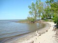 Delta Beach Manitoba Canada.JPG 3,264 × 2,448; 2.16 MB
-
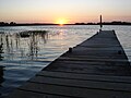 Dock at white lake manitoba.JPG 1,279 × 959; 171 KB
-
 ISS017-E-19669 - View of Manitoba.jpg 3,072 × 2,040; 607 KB
-
 ISS059-E-19273 - View of Manitoba.jpg 5,568 × 3,712; 4.83 MB
-
 Lake Manitoba comin' at ya near Steep Rock, Manitoba, Canada. (36378663843).jpg 5,312 × 2,988; 2.96 MB
-
 Lake Winnipeg map DE.png 1,000 × 1,043; 213 KB
-
 Lake Winnipeg map ES.png 1,000 × 1,043; 218 KB
-
 Lake Winnipeg map FR.png 1,000 × 1,043; 215 KB
-
 Lake Winnipeg map IT.png 1,000 × 1,043; 217 KB
-
 Lake Winnipeg map NL.png 1,000 × 1,043; 214 KB
-
 Lake Winnipeg map PL.png 1,000 × 1,043; 218 KB
-
 Lake Winnipeg map.png 1,000 × 1,043; 92 KB
-
 Lumber raft with sails, Lake Manitoba, 1891.png 1,096 × 761; 325 KB
-
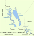
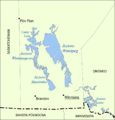
 Manitoba outline.gif 21 × 29; 1 KB
-
 Proposed Supply Routes from Lake Winnipeg and Lake Manitoba (1967).jpg 6,604 × 3,233; 2.62 MB
-
 Satellite picture of Lake Manitoba.jpg 517 × 856; 158 KB
-
 StAmbroiseProvPark.jpg 4,608 × 3,456; 3.2 MB
-
 TBTREE.JPG 3,072 × 2,304; 2.14 MB
-
 TBWD.JPG 3,072 × 2,304; 1.62 MB
-
 WatchornProvPark.jpg 3,264 × 2,448; 2.64 MB
.JPG)
.JPG)
.JPG)
.JPG)


.jpg)


.jpg)


