Category:Lake Urmia maps
Jump to navigation
Jump to search
Media in category "Lake Urmia maps"
The following 33 files are in this category, out of 33 total.
-
 Fenner, Rest. Persis, Parthia, Armenia. 1835 (N).jpg 315 × 284; 27 KB
-

-
 Antoine Philippe Houze . L'Empire des Perses. 1844 (J).jpg 506 × 449; 39 KB
-
 Anville, Jean Baptiste Bourguignon. Turkey in Asia. 1794 (J).jpg 551 × 340; 52 KB
-
 Azerbajan in Abbasid Caliphate.jpg 457 × 474; 63 KB
-
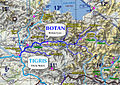 Botan River.jpg 1,376 × 976; 869 KB
-

-
 C+B-Assyria-DetailedMap.JPG 1,897 × 1,350; 757 KB
-
 C+B-Mesopotamia-Map.JPG 1,672 × 1,079; 484 KB
-
 Cary, John, ca. Turkey in Asia. 1801 (E).jpg 339 × 341; 28 KB
-

-
 Culture ceramiche del Vicino Oriente nel medio Halaf - 5200-4500 a.C.jpg 3,820 × 2,900; 1.06 MB
-
 Daniel Lizars. Turkey in Asia. 1831 (N).JPG 700 × 371; 74 KB
-
 Encyclopaedia Biblica map of Syria, Mesopotamia, Babylonia, and Assyria.jpg 2,383 × 1,703; 1.59 MB
-
 Garnier, F A , Turquie, Syrie, Liban, Caucase 1862 (H).jpg 167 × 246; 16 KB
-
 Heinrich Kiepert. Imperia Persarum et Macedonum. 1903 (DD).jpg 577 × 419; 205 KB
-
 Heinrich Kiepert. Imperia Persarum et Macedonum. 1903 (KC).jpg 547 × 871; 314 KB
-

-
 Kâtip Çelebi's Cihannümâ - map of Lake Urmia and Tabriz.tif 3,503 × 5,101; 38.3 MB
-
 Lake Urmia Shrinkage.png 468 × 599; 34 KB
-

-
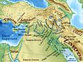
 Near East topographic map with toponyms 3000bc-pt.svg 1,426 × 1,083; 10.04 MB
-
 Neolitico ceramico, calcolitico e bronzo antico nel Vicino Oriente.jpg 3,814 × 2,900; 1.31 MB
-
 Rigobert Bonne. Turquie d'Asie. 1791 (M).jpg 535 × 367; 74 KB
-
 Siti neolitici del Vicino Oriente.jpg 4,425 × 2,900; 1.14 MB
-
-

-
 Stanford, Edward. Asia Minor, Caucasus, Black Sea. 1901 (W).jpg 962 × 984; 380 KB
-
 Stanford, Edward. Asia Minor, Caucasus, Black Sea. 1901 (Z).jpg 1,149 × 1,505; 599 KB
-
 Stein, Christ. Gottfr. Dan.West-Asien. 1865 J.jpg 577 × 473; 75 KB
-
 Urmia outline.gif 21 × 27; 1,006 bytes
-
 UrmiaM2KP.jpg 1,872 × 1,796; 1.36 MB
-
 Van-Mosul.jpg 3,200 × 2,048; 3.66 MB
.jpg)
.jpg)
.jpg)
.jpg)


.jpg)


.jpg)
.jpg)

.JPG)

.jpg)
.jpg)
.jpg)

.jpg)


.jpg)

._Turkish_Empire,_Greece._1843.DA.jpg)
.jpg)
.jpg)
.jpg)


._Turkey_in_Asia,_Transcaucasia._1861_(GFB).jpg)