Category:Lambley, Nottinghamshire
Jump to navigation
Jump to search
English: Lambley is a small village near Nottingham, England and is mentioned in the Domesday Book of 1086 by the name of Lambeleia. One of its most famous "children" was Lord Ralph Cromwell. Born in the village in 1394, he became the Lord Treasurer of England to Henry VI, and was responsible for submitting the first budget to Parliament.
village and civil parish in Gedling, Nottinghamshire, England | |||||
| Upload media | |||||
| Instance of | |||||
|---|---|---|---|---|---|
| Location | Gedling, Nottinghamshire, East Midlands, England | ||||
 | |||||
Subcategories
This category has only the following subcategory.
Media in category "Lambley, Nottinghamshire"
The following 200 files are in this category, out of 279 total.
(previous page) (next page)-
 'Mound' on Round Hill - geograph.org.uk - 1013674.jpg 640 × 480; 164 KB
-
 18 Main Street, Lambley.jpg 1,280 × 960; 368 KB
-
 19 and 21 Church Street - geograph.org.uk - 1014463.jpg 640 × 377; 107 KB
-
 52 Main Street, Lambley.jpg 1,280 × 960; 327 KB
-
-
 A lonely bus stop on Lingwood Lane - geograph.org.uk - 5173400.jpg 800 × 600; 74 KB
-
 Airfield north of Lambley - geograph.org.uk - 4242130.jpg 1,024 × 768; 127 KB
-
 Approach to Woodborough turn - geograph.org.uk - 2568523.jpg 1,280 × 959; 232 KB
-
 Bank Farm - geograph.org.uk - 2319931.jpg 1,280 × 959; 635 KB
-
 Bank Hill - geograph.org.uk - 2319904.jpg 1,280 × 959; 831 KB
-
 Bank Hill west of Woodborough - geograph.org.uk - 4242204.jpg 1,024 × 768; 142 KB
-
 Barn Farm - geograph.org.uk - 2568515.jpg 1,280 × 959; 396 KB
-
 Bird watcher at Lambley Reed Pond - geograph.org.uk - 1749649.jpg 640 × 480; 109 KB
-
 Bonney Doles - geograph.org.uk - 1127309.jpg 640 × 479; 146 KB
-
 Bonney Doles Nature reserve - geograph.org.uk - 34669.jpg 640 × 480; 134 KB
-
 Bottom Dumble - geograph.org.uk - 1013795.jpg 640 × 480; 182 KB
-
 Bottom of Church Street, Lambley - geograph.org.uk - 4242109.jpg 1,024 × 768; 282 KB
-
 Bridge across Bottom Dumble - geograph.org.uk - 1014392.jpg 480 × 640; 215 KB
-
 Bridge on the footpath. - geograph.org.uk - 1127253.jpg 479 × 640; 175 KB
-

-
 Bridleway - on paper - geograph.org.uk - 1013616.jpg 640 × 480; 147 KB
-
 Bridleway bridge-stile - geograph.org.uk - 1013621.jpg 640 × 480; 257 KB
-
 Bridleway east of Lambley House - geograph.org.uk - 4242181.jpg 1,024 × 768; 364 KB
-
 Bridleway junction - geograph.org.uk - 1013629.jpg 640 × 480; 157 KB
-
 Bridleway near Lambley House - geograph.org.uk - 1758663.jpg 640 × 480; 127 KB
-
 Bridleway near Lambley House - geograph.org.uk - 2319873.jpg 1,280 × 959; 1.14 MB
-
 Bridleway near Wood Farm - geograph.org.uk - 1758039.jpg 800 × 600; 146 KB
-
 Bridleway north of Lambley - geograph.org.uk - 4242137.jpg 1,024 × 768; 154 KB
-
 Bridleway on Hunger Hill - geograph.org.uk - 4242164.jpg 1,024 × 768; 129 KB
-
 Bridleway sign - geograph.org.uk - 2319803.jpg 1,280 × 959; 1.05 MB
-
 Bridleway signpost - geograph.org.uk - 1013557.jpg 640 × 480; 244 KB
-
 Bridleway to Bank Hill - geograph.org.uk - 2319856.jpg 1,280 × 959; 995 KB
-
 Bridleway to Burton Joyce - geograph.org.uk - 1758041.jpg 800 × 600; 219 KB
-
 Bridleway to Lowdham - geograph.org.uk - 1127238.jpg 640 × 479; 139 KB
-
 Bridleway to Lowdham - geograph.org.uk - 1758671.jpg 640 × 480; 81 KB
-
 Bridleway to Manor Farm - geograph.org.uk - 1758668.jpg 640 × 480; 86 KB
-
 Bridleway to Woodborough - geograph.org.uk - 1013633.jpg 640 × 480; 133 KB
-
 Bridleway towards Mapperley - geograph.org.uk - 1167856.jpg 640 × 479; 135 KB
-
 Brookside House, Lambley.jpg 1,280 × 960; 533 KB
-
 Builder's Yard - geograph.org.uk - 896131.jpg 640 × 480; 78 KB
-
 Bus to Nottingham - geograph.org.uk - 1014465.jpg 640 × 480; 146 KB
-
 Cast iron signpost - geograph.org.uk - 1014449.jpg 480 × 640; 210 KB
-
 Cast-offs - geograph.org.uk - 1013827.jpg 640 × 480; 250 KB
-
 Catfoot Lane - geograph.org.uk - 1758561.jpg 640 × 480; 46 KB
-
 Catfoot Lane - geograph.org.uk - 1758568.jpg 640 × 480; 65 KB
-
 Catfoot Lane west of Lambley - geograph.org.uk - 3974581.jpg 1,024 × 768; 116 KB
-
 Church Street - geograph.org.uk - 1013709.jpg 640 × 480; 194 KB
-
 Climbing Wicketwood Hill - geograph.org.uk - 1127242.jpg 473 × 640; 285 KB
-
 Closed Post Office, Lambley - geograph.org.uk - 1749643.jpg 640 × 480; 60 KB
-
 Cocker Beck valley - geograph.org.uk - 1013688.jpg 640 × 480; 174 KB
-
 Cottages on Green Lane - geograph.org.uk - 1013681.jpg 640 × 480; 148 KB
-
 Cottages on Main Street - geograph.org.uk - 1014437.jpg 640 × 480; 134 KB
-
 Cottages on Main Street - geograph.org.uk - 1014452.jpg 640 × 480; 148 KB
-
 Cottages, Church Street, Lambley (geograph 6803910).jpg 1,024 × 768; 154 KB
-
 Council houses on Catfoot Lane - geograph.org.uk - 1013798.jpg 640 × 480; 102 KB
-
 Crop marks - geograph.org.uk - 1127330.jpg 479 × 640; 253 KB
-
 Culvert over the Sycke Dyke - geograph.org.uk - 2320201.jpg 1,280 × 959; 963 KB
-
 Derelict building - geograph.org.uk - 2319929.jpg 1,280 × 959; 729 KB
-
 Disused Barn - geograph.org.uk - 896127.jpg 640 × 480; 100 KB
-
 Drive to Jericho Farm - geograph.org.uk - 1013662.jpg 640 × 480; 127 KB
-
 Dumble Trail - geograph.org.uk - 1127312.jpg 640 × 479; 330 KB
-
 Dumbles wildlife - geograph.org.uk - 1013783.jpg 640 × 480; 118 KB
-
 Entrance to Lambley House - geograph.org.uk - 2319850.jpg 1,280 × 959; 635 KB
-
 Entrance to Woodborough - geograph.org.uk - 2319941.jpg 1,280 × 959; 619 KB
-
 Entry to Ploughman Wood - geograph.org.uk - 1013582.jpg 640 × 480; 296 KB
-
 Farm track off Bank Hill - geograph.org.uk - 2319909.jpg 1,280 × 959; 714 KB
-
 Farmland above Woodborough - geograph.org.uk - 1013595.jpg 480 × 640; 240 KB
-
 Farmland near Lambley - geograph.org.uk - 1758543.jpg 640 × 480; 82 KB
-
 Field east of Lambley House - geograph.org.uk - 4242194.jpg 1,024 × 768; 172 KB
-
 Field edge footpath east of Lambley - geograph.org.uk - 5193875.jpg 1,024 × 768; 202 KB
-
 Field entrance - geograph.org.uk - 1013551.jpg 640 × 480; 153 KB
-
 Field footpath - geograph.org.uk - 2319915.jpg 1,280 × 959; 864 KB
-
 Field gateway - geograph.org.uk - 1013547.jpg 620 × 422; 136 KB
-
 Field west of Lambley (1) - geograph.org.uk - 4240884.jpg 1,024 × 768; 147 KB
-
 Field west of Lambley (2) - geograph.org.uk - 4240886.jpg 1,024 × 768; 155 KB
-
 Fields west of Wood Barn Farm (1) - geograph.org.uk - 4242184.jpg 1,024 × 768; 174 KB
-
 Fields west of Wood Barn Farm (2) - geograph.org.uk - 4242188.jpg 1,024 × 768; 158 KB
-
 Fingerpost at Catfoot Lane, Lambley - geograph.org.uk - 3922114.jpg 960 × 1,280; 525 KB
-
 Fingerpost at Spring Lane-Lambley Lane - geograph.org.uk - 3922112.jpg 1,280 × 960; 377 KB
-
 Footbridge over Cocker Beck - geograph.org.uk - 5173398.jpg 800 × 600; 188 KB
-
 Footpath alongside Ploughman Wood - geograph.org.uk - 1013604.jpg 640 × 480; 293 KB
-
 Footpath at Lambley - geograph.org.uk - 1013690.jpg 640 × 480; 209 KB
-
 Footpath from Mapperley Plains - geograph.org.uk - 2319854.jpg 1,280 × 959; 1.01 MB
-
 Footpath gate - geograph.org.uk - 2319920.jpg 959 × 1,280; 1.14 MB
-
 Footpath in Ploughman Wood - geograph.org.uk - 1013606.jpg 480 × 640; 242 KB
-
 Footpath in Ploughman Wood - geograph.org.uk - 1013609.jpg 480 × 640; 297 KB
-
 Footpath junction - geograph.org.uk - 2319866.jpg 1,280 × 959; 818 KB
-
 Footpath near Lambley Church - geograph.org.uk - 1013729.jpg 473 × 640; 168 KB
-
 Footpath north of Lambley - geograph.org.uk - 4242152.jpg 1,024 × 768; 221 KB
-
 Footpath to Lambley - geograph.org.uk - 2320203.jpg 1,280 × 959; 804 KB
-
 Footpath to Mapperley Plains - geograph.org.uk - 2319852.jpg 1,280 × 959; 663 KB
-
 Four trees (and a bit) - geograph.org.uk - 1013822.jpg 640 × 480; 127 KB
-
 Frequent buses stop here by request on Lingwood Lane - geograph.org.uk - 5170928.jpg 5,376 × 3,024; 2.55 MB
-
 Fresh tilth - geograph.org.uk - 1013599.jpg 640 × 480; 219 KB
-
 Gas leak in Lambley - geograph.org.uk - 1749641.jpg 640 × 480; 126 KB
-
 Gated Field Entrance - geograph.org.uk - 1758557.jpg 640 × 480; 71 KB
-
 Green Lane - geograph.org.uk - 1013638.jpg 640 × 480; 153 KB
-
 Green Lane - geograph.org.uk - 1013665.jpg 480 × 640; 119 KB
-
 Green Lane - geograph.org.uk - 1014398.jpg 472 × 640; 123 KB
-
 Green Lane, Lambley (1) - geograph.org.uk - 4242118.jpg 1,024 × 768; 195 KB
-
 Green Lane, Lambley (2) - geograph.org.uk - 4242124.jpg 1,024 × 768; 209 KB
-
 Hangar - geograph.org.uk - 1013651.jpg 640 × 480; 126 KB
-
 Headland footpath - geograph.org.uk - 1127333.jpg 640 × 479; 172 KB
-
 Hedge and ditch - geograph.org.uk - 2319864.jpg 1,280 × 959; 932 KB
-
 Hedge and headland - geograph.org.uk - 1127338.jpg 479 × 640; 302 KB
-
 High Pastures - geograph.org.uk - 2319878.jpg 1,280 × 959; 721 KB
-
 Hillside above Lambley - geograph.org.uk - 1127249.jpg 640 × 479; 174 KB
-
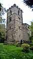 Holy Trinity Church, Lambley - geograph.org.uk - 5170967.jpg 3,024 × 5,376; 2.98 MB
-
 Hungerhill Lane - geograph.org.uk - 1758667.jpg 640 × 480; 86 KB
-
 Hungerhill Lane - geograph.org.uk - 2319771.jpg 1,280 × 959; 1,006 KB
-
 Hungerhill Lane - geograph.org.uk - 2319780.jpg 1,280 × 959; 535 KB
-
 In Lambley village - geograph.org.uk - 6106715.jpg 1,600 × 1,066; 471 KB
-
 Inspection cover in middle of field - geograph.org.uk - 5170977.jpg 5,376 × 3,024; 2.49 MB
-
 Insulated stiles - geograph.org.uk - 1127276.jpg 640 × 479; 221 KB
-
 Jericho Farm, Lambley - geograph.org.uk - 1749618.jpg 640 × 480; 55 KB
-
 Jericho Farm, Lambley - geograph.org.uk - 4242122.jpg 1,024 × 768; 197 KB
-
 Junction to Woodborough - geograph.org.uk - 2568454.jpg 1,280 × 959; 301 KB
-
 Lambley - geograph.org.uk - 896136.jpg 640 × 480; 79 KB
-
 Lambley cemetery - geograph.org.uk - 1538930.jpg 640 × 428; 104 KB
-
 Lambley Dumble NG4, Notts. - geograph.org.uk - 3456988.jpg 2,554 × 3,938; 2.33 MB
-
 Lambley Dumble, Lambley NG4, Notts. - geograph.org.uk - 3457008.jpg 2,632 × 3,426; 1.6 MB
-
 Lambley Dumbles history - geograph.org.uk - 1013780.jpg 480 × 640; 114 KB
-
 Lambley from Wicketwood Hill - geograph.org.uk - 1127239.jpg 640 × 479; 159 KB
-
 Lambley House Farm - geograph.org.uk - 1758665.jpg 640 × 480; 66 KB
-
 Lambley Methodist Chapel - geograph.org.uk - 1014435.jpg 640 × 480; 148 KB
-
 Lambley Nature Reserve - geograph.org.uk - 1142539.jpg 640 × 427; 107 KB
-
 Lambley NG4, Notts. - geograph.org.uk - 3456533.jpg 1,830 × 1,935; 982 KB
-
 Lambley NG4, Notts. - geograph.org.uk - 3456565.jpg 3,710 × 2,056; 1.42 MB
-
 Lambley NG4, Notts. - geograph.org.uk - 3456633.jpg 3,402 × 2,641; 2.06 MB
-
 Lambley NG4, Notts. - geograph.org.uk - 3456652.jpg 2,974 × 2,032; 1.28 MB
-
 Lambley NG4, Notts. - geograph.org.uk - 3456739.jpg 3,562 × 2,519; 1.74 MB
-
 Lambley NG4, Notts. - geograph.org.uk - 3456794.jpg 3,390 × 2,458; 1.96 MB
-
 Lambley NG4, Notts. - geograph.org.uk - 3456853.jpg 3,716 × 2,598; 2.05 MB
-
 Lambley NG4, Notts. - geograph.org.uk - 3456907.jpg 4,028 × 2,882; 2.35 MB
-
 Lambley NG4, Notts. - geograph.org.uk - 3456932.jpg 3,763 × 2,382; 1.83 MB
-
 Lambley old road - geograph.org.uk - 1614861.jpg 640 × 427; 73 KB
-
 Lambley old road - geograph.org.uk - 1614866.jpg 640 × 427; 86 KB
-
 Lambley old road - geograph.org.uk - 1614876.jpg 640 × 427; 144 KB
-
 Lambley Post Office - geograph.org.uk - 1014431.jpg 480 × 640; 95 KB
-
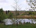
 Lambley Reed Pond - geograph.org.uk - 1013702.jpg 640 × 480; 218 KB
-
 Lambley Reed Pond - geograph.org.uk - 1013704.jpg 640 × 480; 210 KB
-
 Lambley Road - geograph.org.uk - 1758533.jpg 640 × 480; 72 KB
-
 Lambley Spring - geograph.org.uk - 1014460.jpg 480 × 640; 163 KB
-
 Lambley Village - geograph.org.uk - 1013684.jpg 640 × 480; 138 KB
-
 Lambley village sign - geograph.org.uk - 3922115.jpg 960 × 1,280; 268 KB
-
 Lambley Village sign - geograph.org.uk - 4092182.jpg 1,280 × 960; 430 KB
-
 Lambley village sign - geograph.org.uk - 5173399.jpg 800 × 600; 74 KB
-
 Lambley, former Post Office - geograph.org.uk - 1014414.jpg 623 × 454; 112 KB
-
 Landing strip - geograph.org.uk - 1013644.jpg 640 × 480; 109 KB
-
 Landscape near Woodborough - geograph.org.uk - 2320206.jpg 1,280 × 959; 662 KB
-
 Landscape with lowering skies - geograph.org.uk - 1013634.jpg 640 × 386; 75 KB
-
 Lapwing marker - geograph.org.uk - 1013695.jpg 640 × 480; 181 KB
-
 Late flowering bramble - geograph.org.uk - 1013610.jpg 640 × 480; 233 KB
-
 Lingwood Lane - geograph.org.uk - 2319766.jpg 1,280 × 959; 991 KB
-
 Lingwood Lane south of Woodborough - geograph.org.uk - 4242158.jpg 1,024 × 768; 270 KB
-
 Living trees and roots of a stump - geograph.org.uk - 1749629.jpg 640 × 480; 105 KB
-
 Looking up Bottom Dumble - geograph.org.uk - 1013748.jpg 640 × 480; 137 KB
-
 Lost your bottle^ - geograph.org.uk - 2320208.jpg 1,280 × 846; 736 KB
-
 Lowering skies - geograph.org.uk - 1013625.jpg 640 × 480; 102 KB
-
 Main Street, Lambley - geograph.org.uk - 1758550.jpg 640 × 480; 64 KB
-
 Main Street, Lambley - geograph.org.uk - 5170970.jpg 5,376 × 3,024; 2.04 MB
-
 Map of Lambley Dumbles - geograph.org.uk - 1013776.jpg 640 × 443; 95 KB
-
 Mapperley Plains NG3, Notts. - geograph.org.uk - 3457038.jpg 3,798 × 2,052; 1.61 MB
-
 Marl pond - geograph.org.uk - 1167859.jpg 640 × 479; 194 KB
-
 Marl pond - geograph.org.uk - 1167887.jpg 640 × 479; 88 KB
-
 Mill House, Lambley.jpg 1,280 × 960; 440 KB
-
 Minor Road towards Woodborough - geograph.org.uk - 1758662.jpg 640 × 480; 73 KB
-
 Minor Road towards Woodborough - geograph.org.uk - 1758664.jpg 640 × 480; 77 KB
-
 Modern harvesting - geograph.org.uk - 2568530.jpg 1,280 × 959; 309 KB
-
 Modified stile - geograph.org.uk - 1013659.jpg 480 × 640; 190 KB
-
 Muddy progress - geograph.org.uk - 1167891.jpg 640 × 479; 157 KB
-
 Nature reserve, Lambley - geograph.org.uk - 4242114.jpg 1,024 × 768; 165 KB
-
 New Bridge - geograph.org.uk - 452892.jpg 640 × 480; 57 KB
-
 No fly zone - geograph.org.uk - 5170947.jpg 5,376 × 3,024; 2.08 MB
-
 North end of Cromwell Crescent, Lambley - geograph.org.uk - 4240892.jpg 1,024 × 768; 144 KB
-
 Not a lot to see on Green Lane^ - geograph.org.uk - 5170944.jpg 5,376 × 3,024; 2.09 MB
-
 Nottingham bus leaving Lambley - geograph.org.uk - 4240891.jpg 1,024 × 768; 206 KB
-
 Nuff said - geograph.org.uk - 1069408.jpg 640 × 480; 115 KB
-
 On Wicketwood Hill - geograph.org.uk - 1127236.jpg 640 × 479; 120 KB
-
 Orchard Rise - geograph.org.uk - 1013793.jpg 640 × 480; 155 KB
-
 Orchard Rise estate - geograph.org.uk - 1014406.jpg 629 × 460; 101 KB
-
 Orchard Rise, Lambley - geograph.org.uk - 4242103.jpg 1,024 × 768; 191 KB
-
 Park Lane, Lambley - geograph.org.uk - 1758539.jpg 640 × 480; 72 KB
-
 Pasture east of Crimea Farm - geograph.org.uk - 4240882.jpg 1,024 × 768; 127 KB
-
 Path junction east of Lambley House - geograph.org.uk - 4242190.jpg 1,024 × 768; 234 KB
-
 Petrol station on Main Street, Lambley - geograph.org.uk - 4240899.jpg 1,024 × 768; 140 KB
-
 Pillbox near Arnold Lodge - geograph.org.uk - 2568527.jpg 1,280 × 959; 416 KB
-
 Plantation on Hunger Hill - geograph.org.uk - 2319789.jpg 1,280 × 959; 817 KB
-
 Ploughed field on Hunger Hill - geograph.org.uk - 4242169.jpg 1,024 × 768; 156 KB
-
 Ploughman wood and Fields - geograph.org.uk - 1098397.jpg 640 × 480; 64 KB
-
 Ploughman Wood Information Board - geograph.org.uk - 1013589.jpg 640 × 480; 97 KB
-
 Ploughman Wood Nature Reserve - geograph.org.uk - 1069407.jpg 640 × 480; 97 KB
-
 Power lines near Lambley - geograph.org.uk - 1013636.jpg 520 × 640; 75 KB
-
 Public footpath to Lambley from Catfoot Lane - geograph.org.uk - 3974579.jpg 1,024 × 768; 197 KB
-
 Ridge and furrow - geograph.org.uk - 1167881.jpg 640 × 479; 93 KB
-
 Roadworks - geograph.org.uk - 896126.jpg 640 × 480; 94 KB
-
 Rural road name sign - geograph.org.uk - 2319883.jpg 1,280 × 959; 900 KB
-
 Signs at Ploughman wood - geograph.org.uk - 1098410.jpg 640 × 480; 120 KB
-
 Slate gravestone - geograph.org.uk - 1210510.jpg 384 × 599; 101 KB
-
 South end of Catfoot Lane, Lambley - geograph.org.uk - 4240893.jpg 1,024 × 768; 186 KB


.jpg)


_-_geograph.org.uk_-_4240884.jpg)
_-_geograph.org.uk_-_4240886.jpg)
_-_geograph.org.uk_-_4242184.jpg)
_-_geograph.org.uk_-_4242188.jpg)


_-_geograph.org.uk_-_1013822.jpg)


_-_geograph.org.uk_-_4242118.jpg)
_-_geograph.org.uk_-_4242124.jpg)


