Category:Lancaster Canal Tramroad
Jump to navigation
Jump to search
English: The Lancaster Canal Company obtained an Act of Parliament (32 Geo. III c. 101) in 1792 to construct a canal linking the towns of Kendal, Lancaster and Preston to the coalfields around Wigan. Coal was to be the chief traffic northwards and limestone southwards. Most of the canal was completed quickly, including the impressive aqueduct across the River Lune near Lancaster, but the part across the wide valley of the River Ribble remained to be built when the construction capital became exhausted. (→Lancaster Canal Tramroad)
Former horse-drawn railway in Lancashire, England | |||||
| Upload media | |||||
| Instance of | |||||
|---|---|---|---|---|---|
| Location |
| ||||
 | |||||
Media in category "Lancaster Canal Tramroad"
The following 8 files are in this category, out of 8 total.
-
 Fishergate Tramroad Tunnel, Preston - geograph.org.uk - 952735.jpg 640 × 480; 112 KB
-
 Fishergate Tunnel approach ramp, Preston - geograph.org.uk - 954383.jpg 640 × 480; 109 KB
-
 Lancaster Canal Tramroad map.svg 490 × 662; 1.74 MB
-
 Old Tram Bridge, Preston 232-01.jpg 1,641 × 1,109; 464 KB
-
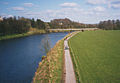
 The Old Tram Bridge, Preston - geograph.org.uk - 1651562.jpg 640 × 480; 176 KB
-
 Tramway bridge, Garden St, Preston 231-17.jpg 1,499 × 1,161; 462 KB
-
 Tramway bridge.jpg 640 × 445; 91 KB
-
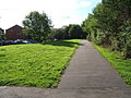 Walton summit remains.jpg 640 × 480; 120 KB


