<nowiki>বিষয়শ্রেণী:নাইজারের ভূমিরূপ; Kategória:Niger domborzata; Kategorija:Reljefni oblici u Nigeru; Categoria:Acidentes geográficos do Níger; رده:زمینچهرهای نیجر; Kategori:Nijer'deki yeryüzü şekilleri; زمرہ:نائجر کے تغیرات ارض; Kategorija:Nigēras reljefa formas; Kategoriya:Sa dagway sa yuta sa Nigyer; Kategorio:Terformoj en Niĝero; Категорія:Рельєф Нігеру; Төркем:Нигер рельефы; വര്ഗ്ഗം: നൈജറിന്റെ ഭൂരൂപങ്ങൾ; Thể loại:Địa mạo Niger; Category:ニジェールの地形; 분류:니제르의 지형; Category:Landforms of Niger; تصنيف:تضاريس النيجر; Kategori:Landformer i Niger; Kategori:Bentang alam Niger; categoría de Wikimedia; وِکیٖمیٖڈیا زٲژ; kategori Wikimedia; Wikimedia category page; د ويکيمېډيا وېشنيزه; Vikimedya kategorisi; ویکیمیڈیا زمرہ; kategória projektov Wikimedia; категорія проєкту Вікімедіа; 维基媒体分类; Wikimedia-Kategorie; ৱিকিমিডিয়াৰ শ্ৰেণী; kategorie na projektech Wikimedia; kategorija na Wikimediji; विकिपीडिया:श्रेणी; page de catégorie d'un projet Wikimedia; kategorija na Wikimediji; विकिपीडिया वर्ग; категорија на Викимедији; Wikimedia-Kategorie; Wikimedia-kategori; kategori Wikimédia; تصنيف ويكيميديا; pajenn rummata eus Wikimedia; Wikimedia:ကဏ္ဍခွဲခြင်း; 維基媒體分類; Wikimedia категориясы; categoría de Wikimedia; Kategorie op Wikimedia; Викимедиа категорияһы; tudalen categori Wikimedia; kategori e Wikimedias; ردهٔ ویکیمدیا; 维基媒体项目分类; Wikimedia-kategori; ვიკიპედია:კატეგორიზაცია; ウィキメディアのカテゴリ; categoria Wikimedia; تصنيف بتاع ويكيميديا; විකිමීඩියා ප්රභේද පිටුව; categoria Vicimediorum; विकिमीडिया वर्गः; Vikipidiya:Shopni; Wikimedia-luokka; Wikimedia category page; gurühi Vikimedia; катэгорыя ў праекце Вікімэдыя; Викимедиа проектындагы төркем; catigurìa di nu pruggettu Wikimedia; หน้าหมวดหมู่วิกิมีเดีย; Wikimedia:Kategorija; Wikimedia-Kategorie; উইকিমিডিয়া থাক; Уикимедия категория; categorie în cadrul unui proiect Wikimedia; 維基媒體分類; Wikimedia-kategori; kawan Wikimèdia; 維基媒體專案分類; 위키미디어 분류; Wikimedia-bólkur; kategorio en Vikimedio; kategori Wikimedia; categoría de Wikimedia; উইকিমিডিয়া বিষয়শ্রেণী; kategori Wikimedia; 维基媒体分类; kategorija w projektach Wikimedije; thể loại Wikimedia; Wikimedia projekta kategorija; Wikimedia-kategorie; categoria de um projeto da Wikimedia; Wikimedia category; категорияд Ангилал; Wikimedia-kategori; kategori Wikimedia; پۆلی ویکیمیدیا; Wikimedia category; Vikimédia ñemohenda; Wikimédia-kategória; વિકિપીડિયા શ્રેણી; Wikimediako kategoria; категория в проекте Викимедиа; Wikimedia-Kategorie; Kategoriya ning Wikimedia; Wikimedia-kategorie; Wîkîmediya:Kategorî; विकिमिडिया श्रेणी; Wikimedia-Kategorie; Wikimedia-categorie; κατηγορία εγχειρημάτων Wikimedia; קטגוריה בוויקיפדיה; Викимедиа проектындагы төркем; categoria de Wikimedia; Wikimedia kategooria; Wikimedia-categorie; Wikimedia-kategoriija; гурӯҳ дар лоиҳаи Викимедиа; विकिमिडिया श्रेणी; Wikimedia:Ronnaghys; விக்கிமீடியப் பகுப்பு; categoria di un progetto Wikimedia; kategoria projektu Wikimedia; kategoria ti Wikimedia; Wikimedia-Kategorie; 維基媒體分類; Wikimedia:Klassys; kategorya ng Wikimedia; categurìa 'e nu pruggette Wikimedia; катэгорыя ў праекце Вікімедыя; ẹ̀ka Wikimedia; гурӯҳи Викимедиа; categoria de um projeto da Wikimedia; Викимедиина категорија; Wikimedia-Kategorie; tumbung Wikimedia; Wikimedia-kategory; kategorija Wikimedie; Wikimedia proyektındağı törkem; 维基媒体分类; kategoriya sa Wikimedia; kategori Wikimedia; jamii ya Wikimedia; വിക്കിമീഡിയ വർഗ്ഗം; 維基媒體分類; kategori Wikimedia; Wikimedia-categorie; زمرو:وڪيپيڊيا زمرا بندي; Viciméid catagóir; categoría de Wikimedia; Վիքիմեդիայի նախագծի կատեգորիա; 维基媒体项目分类; विकिमीडिया श्रेणी</nowiki>
Subcategories
This category has the following 12 subcategories, out of 12 total.


 Colline se trouvant derrière les Bureaux de la Commune Rurale de Koygolo.jpg 4,608 × 3,456; 3.06 MB
 Niger, Niabéré Bella Zarma (5) and Dallol Bosso.jpg 4,000 × 2,250; 3.82 MB
 Niger, Tiloa (2), barren plateau.jpg 3,264 × 2,448; 3.79 MB
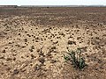 Niger, Tiloa (3), barren plateau.jpg 3,264 × 2,448; 3.57 MB
_and_Dallol_Bosso.jpg)
,_barren_plateau.jpg)
,_barren_plateau.jpg)