Category:Landgoed Oosterhout, Lent
Jump to navigation
Jump to search
| Object location | | View all coordinates using: OpenStreetMap |
|---|
 | |||||
| Upload media | |||||
| Instance of | |||||
|---|---|---|---|---|---|
| Part of | |||||
| Location | Nijmegen, Gelderland, Netherlands | ||||
| Street address |
| ||||
| Heritage designation |
| ||||
 | |||||
Nederlands: Rijksmonument complex:
|
This is a category about rijksmonumentcomplex number 520307
|
Hoofdgebouw:
|
This is a category about rijksmonument number 520308
|
Historische aanleg:
|
This is a category about rijksmonument number 520309
|
Tuinmuur:
|
This is a category about rijksmonument number 520311
|
Prieel:
|
This is a category about rijksmonument number 520312
|
Koetshuis(L):
|
This is a category about rijksmonument number 520313
|
Stalgebouw(L):
|
This is a category about rijksmonument number 520314
|
Schuur(L):
|
This is a category about rijksmonument number 527421
|
Dienstwoning, Oude Groenestraat 1:
|
This is a category about rijksmonument number 529145
|
Boerderij, Boetzelaerstraat 1 :
|
This is a category about rijksmonument number 529146
|
Kleine schuur, Boetzelaerstraat 1:
|
This is a category about rijksmonument number 529147
|
Grote schuur, Boetzelaerstraat 1:
|
This is a category about rijksmonument number 529148
|
| Address |
|
Subcategories
This category has only the following subcategory.
Media in category "Landgoed Oosterhout, Lent"
The following 15 files are in this category, out of 15 total.
-
 Achterzijde - Oosterhout - 20174664 - RCE.jpg 1,200 × 806; 281 KB
-
 Exterieur OVERZICHT RECHTER ZIJGEVEL, VOORGEVEL - Oosterhout - 20339475 - RCE.jpg 1,183 × 1,200; 434 KB
-
 Exterieur VOORGEVEL, RECHTER ZIJGEVEL - Oosterhout - 20339476 - RCE.jpg 1,183 × 1,200; 501 KB
-
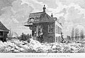
 Huis Oosterhout (vervanger van het verdwenen kasteel Notesteijn).jpg 2,111 × 1,450; 499 KB
-
 Lent Rijksmonument 520308 hoofdgebouw landgoed Oosterhout (west).JPG 3,648 × 2,736; 4.21 MB
-
 Lent Rijksmonument 520308 hoofdgebouw landgoed Oosterhout (zuidwesthoek).JPG 3,648 × 2,736; 4.29 MB
-
 Lent Rijksmonument 520308 hoofdgebouw van landgoed Oosterhout (zuidoost).JPG 3,648 × 2,736; 4.23 MB
-
 Lent Rijksmonument 520309 tuinaanleg landgoed Oosterhout met paneel.JPG 3,648 × 2,736; 4.28 MB
-
 Lent Rijksmonument 520309 tuinaanleg landgoed Oosterhout.JPG 3,648 × 2,736; 4.25 MB
-
 Lent Rijksmonument 520311 tuinmuren landgoed Oosterhout.JPG 3,648 × 2,736; 4.27 MB
-
 Lent Rijksmonument 520312 prieel landgoed Oosterhout.JPG 2,736 × 3,648; 3.61 MB
-
 Theekoepel - Oosterhout - 20174663 - RCE.jpg 1,200 × 809; 374 KB
-
 Voorgevel - Oosterhout - 20174666 - RCE.jpg 1,200 × 806; 215 KB
-
 Voorgevel detail - Oosterhout - 20174665 - RCE.jpg 1,200 × 809; 268 KB
-
 Watersnood 1820 oosterhout.jpg 4,672 × 3,199; 4.29 MB


.jpg)
.JPG)
.JPG)
.JPG)


