Category:Landgoed Schothorst
Jump to navigation
Jump to search
| Object location | | View all coordinates using: OpenStreetMap |
|---|
park in Amersfoort, the Netherlands  | |||||
| Upload media | |||||
| Instance of | |||||
|---|---|---|---|---|---|
| Location | Amersfoort, Utrecht, Netherlands | ||||
| Located on street |
| ||||
| Has part(s) | |||||
| Heritage designation |
| ||||
| Different from | |||||
 | |||||
|
This is a category about rijksmonumentcomplex number 517673
|
Landhuis:
|
This is a category about rijksmonument number 517674
|
Historische aanleg:
|
This is a category about rijksmonument number 517675
|
Koetshuis:
|
This is a category about rijksmonument number 517676
|
Oranjerie:
|
This is a category about rijksmonument number 517677
|
| Address |
|
Subcategories
This category has only the following subcategory.
M
Media in category "Landgoed Schothorst"
The following 32 files are in this category, out of 32 total.
-
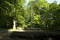
 20100629-061 Amersfoort - Sculptuur in de tuin van Landhuis Schothorst.jpg 3,000 × 4,000; 3.74 MB
-
 Amersfoort Schothorst Kademuren vegetatie.jpg 4,864 × 3,648; 9.47 MB
-
 Amersfoort Schothorst Zonnewijzer.jpg 4,864 × 3,648; 8.86 MB
-
 Amersfoort, Schothorst hist aanleg park RM517675.jpg 2,304 × 1,728; 3.67 MB
-
 Amersfoort, Schothorst RM517674.jpg 2,304 × 1,728; 4.22 MB
-
 Beukenlaan 2.jpg 3,456 × 5,184; 9.54 MB
-
 Beukenlaan herfst.jpg 3,456 × 5,184; 9.47 MB
-
 Beukenlaan.jpg 3,456 × 5,184; 11.36 MB
-
 Boerderij De Schothorst te Hoogland bij Amersfoort, Bestanddeelnr 159-1327.jpg 3,399 × 2,384; 1.55 MB
-
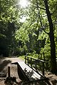 Bruggetje.jpg 3,456 × 5,184; 10.8 MB
-
 Doorkijk landgoed.jpg 3,456 × 5,184; 10.87 MB
-
 Exterieur ACHTERGEVEL - Amersfoort - 20314002 - RCE.jpg 1,200 × 938; 293 KB
-
 Exterieur OVERZICHT VOORGEVEL - Amersfoort - 20314003 - RCE.jpg 1,200 × 956; 285 KB
-
 Luchtfoto Kattenbroek Zielhorst Schothorst 1992.jpg 4,588 × 3,608; 7.25 MB
-
 Luchtfoto van het Stadspark Schothorst te Amersfoort.jpg 4,588 × 3,608; 7.95 MB
-
 Luchtfoto Zielhorst en Kattenbroek 1992.jpg 4,588 × 3,608; 7.72 MB
-
 Maanhof Park Schothorst Amersfoort 2019.jpg 3,364 × 1,548; 521 KB
-
 Open plek.jpg 5,184 × 3,456; 9.69 MB
-
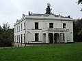 RM517674 Schothorst (achterzijde).JPG 4,320 × 3,240; 1.52 MB
-
 RM517675 Landgoed Schothorst.JPG 3,240 × 4,320; 2.24 MB
-
 RM517676 Koetshuis Schothorst.JPG 4,320 × 3,240; 2.42 MB
-
 RM517677 Orangerie Schothorst.JPG 4,320 × 3,055; 1.13 MB
-
 Runderen.jpg 5,184 × 3,456; 9.14 MB
-
 Schothorst koetshuis.jpg 4,390 × 3,485; 8.38 MB
-
 Schothorst landhuis achterzijde.jpg 4,803 × 3,550; 7.1 MB
-
 Schothorst landhuis.jpg 4,775 × 3,543; 7.52 MB
-
 Schothorst schapenstal.jpg 4,636 × 3,474; 10.2 MB
-
 Schothorsterlaan.jpg 2,111 × 3,197; 4.11 MB
-
 Stallen en schuren, varkensstalboerderij, de schothorst, Bestanddeelnr 162-0605.jpg 3,400 × 2,366; 1.38 MB
-
 Weide landgoed.jpg 5,184 × 3,456; 12.06 MB
-
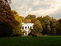
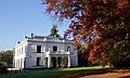 Witte villa 2.jpg 3,617 × 2,180; 2.62 MB
-
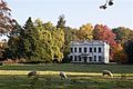 Witte villa.jpg 5,184 × 3,456; 6.05 MB


.JPG)


