Category:Landkreis Deggendorf
Jump to navigation
Jump to search
Urban districts (cities): Amberg · Ansbach · Aschaffenburg · Augsburg · Bamberg · Bayreuth · Coburg · Erlangen · Fürth · Hof · Ingolstadt · Kaufbeuren · Kempten · Landshut · Memmingen · Munich · Nuremberg · Passau · Regensburg · Rosenheim · Schwabach · Schweinfurt · Straubing · Weiden in der Oberpfalz · Würzburg
district in Bavaria, Germany    | |||||
| Upload media | |||||
| Instance of |
| ||||
|---|---|---|---|---|---|
| Location | Lower Bavaria, Bavaria, Germany | ||||
| Capital | |||||
| Head of government |
| ||||
| Inception |
| ||||
| Highest point | |||||
| Population |
| ||||
| Area |
| ||||
| Elevation above sea level |
| ||||
| official website | |||||
 | |||||
Subcategories
This category has the following 19 subcategories, out of 19 total.
*
M
P
V
Pages in category "Landkreis Deggendorf"
This category contains only the following page.
Media in category "Landkreis Deggendorf"
The following 53 files are in this category, out of 53 total.
-
 01 Lage Blick auf DEG aus dem Krankenhaus.jpg 1,192 × 894; 279 KB
-
 01 Lage Isarmuendung red.jpg 3,901 × 2,924; 2.21 MB
-
 Arbeiter Gedenkstein (Metten).jpg 2,992 × 4,000; 7.76 MB
-
 Bavaria deg (1).png 237 × 245; 15 KB
-
 Bavaria deg.png 237 × 245; 15 KB
-
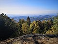 Blick vom Ruselabsatz.jpg 1,192 × 894; 325 KB
-
 DEG in Bayern.svg 1,227 × 1,236; 311 KB
-
 DEG0.jpg 2,848 × 4,272; 1.49 MB
-
 Feng Shui Woidlife.jpg 5,947 × 3,607; 22.87 MB
-
 Gefallenenhain Deggendorf 1.jpg 6,000 × 8,000; 9.74 MB
-
 Gefallenenhain Deggendorf 2.jpg 4,096 × 2,304; 4.74 MB
-
 Gefallenenhain Deggendorf 3.jpg 4,096 × 2,304; 5.3 MB
-
 Grafling Einoedriegel2019.jpg 3,096 × 4,128; 4.7 MB
-
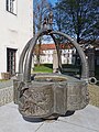 Gunther Brunnen Niederalteich.jpg 5,695 × 7,593; 6.31 MB
-
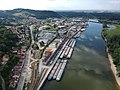 Hafen Deggendorf.JPG 3,968 × 2,976; 5.08 MB
-
 Hirschenstein Turm im Winter.jpg 3,264 × 2,448; 1.27 MB
-
 Historischer Kilometerstein Wegweiser Zwieserbruck.jpg 5,831 × 7,775; 9.17 MB
-
 Hl. Quirin.jpg 2,268 × 2,508; 1.11 MB
-
 Hochwasser Markierung Niederalteich.jpg 2,304 × 4,096; 2.94 MB
-
 Infotafel Gunther Brunnen.jpg 2,094 × 2,800; 604 KB
-
 Isarmuendungsgebiet.jpg 2,004 × 1,475; 991 KB
-
 Kneipp Anlage Geiersberg Deggendorf.jpg 8,000 × 6,000; 8.54 MB
-
 Kreuz am Geiersberg (Deggendorf).jpg 6,000 × 8,000; 18.24 MB
-
 Kreuz Friedhof (Deggendorf).jpg 6,000 × 8,000; 10.41 MB
-
 Kulturlichtung (Deggendorf) 1.jpg 4,000 × 2,992; 2.86 MB
-
 Kulturlichtung (Deggendorf) 2.jpg 4,000 × 2,992; 3.45 MB
-
 Kulturlichtung (Deggendorf) 3.jpg 4,000 × 2,992; 3.11 MB
-
 Lage des Landkreises Deggendorf in Deutschland.png 197 × 235; 2 KB
-
 Lallinger Winkel.jpg 4,048 × 1,966; 5.11 MB
-
 Landratsamt Deggendorf.jpg 2,839 × 1,493; 986 KB
-
 Laufbrunnen Aschenau (Offenberg).jpg 4,096 × 2,304; 2.86 MB
-
 Locator map DEG in Bavaria.svg 867 × 855; 1,000 KB
-
 Locator map DEG in Germany.svg 1,075 × 1,273; 581 KB
-
 Perlbach Schild (Metten).jpg 4,000 × 2,992; 4.11 MB
-
 Perlbach Schild 2 (Metten).jpg 4,000 × 2,992; 5.98 MB
-
 Plattling Isar nach Staustufe.jpg 4,048 × 1,304; 2.74 MB
-
 Raum der Stille (Deggendorf).jpg 7,886 × 5,916; 6.68 MB
-
 Regionalpavillon (Deggendorf).jpg 3,164 × 2,373; 1.13 MB
-
 Regionalpavillon innen (Deggendorf).jpg 8,000 × 6,000; 10.24 MB
-
 Schloss Egg 2019.jpg 4,032 × 3,024; 6.33 MB
-
 Schöpfwerk Fischerdorf am Saubach 1.jpg 8,000 × 6,000; 10.98 MB
-
 Schöpfwerk Fischerdorf am Saubach.jpg 8,000 × 6,000; 6.84 MB
-
 Schöpfwerk Gundlau.jpg 3,963 × 2,229; 1.65 MB
-
 Schöpfwerk Sommersdorf.jpg 8,000 × 6,000; 12.22 MB
-
 Splash pad (Deggendorf).jpg 8,000 × 6,000; 14.71 MB
-
 Stele Brücke der Menschenrechte (Deggendorf).jpg 6,000 × 8,000; 14.91 MB
-
 Strassenverkehr Autobahnkreuz.JPG 1,280 × 960; 255 KB
-
 Tafel mit Inschrift Kreuz Friedhof (Deggendorf).jpg 8,000 × 6,000; 11.71 MB
-
 Thundorf Blick ueber Niederaltaich.jpg 3,694 × 2,594; 6.64 MB
-
 Trinkwasser Brunnen 7 (Deggendorf).jpg 2,992 × 4,000; 4.2 MB
-
 Unterstand mit Infotafeln Lebensader Donau Aicha (an der Donau).jpg 4,096 × 2,304; 2.03 MB
-
 Wanderwege binder.jpg 2,362 × 1,772; 2.72 MB
-
 Ziegel und Kalkmuseum Winzer 4.jpg 4,356 × 3,060; 3.1 MB


.jpg)
.png)


.jpg)
.jpg)
_1.jpg)
_2.jpg)
_3.jpg)


.jpg)


.jpg)
.jpg)
.jpg)
.jpg)
.jpg)


.jpg)
.jpg)

.jpg)

.jpg)
.jpg)

