Category:Landpoortstraat 18, Woudrichem
Jump to navigation
Jump to search
| Object location | | View all coordinates using: OpenStreetMap |
|---|
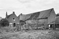
building in Woudrichem, Netherlands  | |||||
| Upload media | |||||
| Instance of | |||||
|---|---|---|---|---|---|
| Location | Woudrichem, Altena, North Brabant, Netherlands | ||||
| Street address |
| ||||
| Located on street | |||||
| Heritage designation |
| ||||
 | |||||
|
This is a category about rijksmonument number 39583
|
| Address |
|
Media in category "Landpoortstraat 18, Woudrichem"
The following 4 files are in this category, out of 4 total.
-
 Achtergevel - Woudrichem - 20218065 - RCE.jpg 1,200 × 804; 238 KB
-
 Voor- en zijgevel - Woudrichem - 20218063 - RCE.jpg 1,200 × 800; 245 KB
-
 Voorgevel - Woudrichem - 20218064 - RCE.jpg 1,200 × 804; 223 KB
-
 Woudrichem - rijksmonument 39583 - Landpoortstraat 18 20120630.jpg 800 × 433; 198 KB


