Category:Landscapes of California
Jump to navigation
Jump to search
States of the United States: Alabama · Alaska · Arizona · Arkansas · California · Colorado · Connecticut · Delaware · Florida · Georgia · Hawaii · Idaho · Illinois · Indiana · Iowa · Kansas · Kentucky · Louisiana · Maine · Maryland · Massachusetts · Michigan · Minnesota · Mississippi · Missouri · Montana · Nebraska · Nevada · New Hampshire · New Jersey · New Mexico · New York · North Carolina · North Dakota · Ohio · Oklahoma · Oregon · Pennsylvania · Rhode Island · South Carolina · South Dakota · Tennessee · Texas · Utah · Vermont · Virginia · Washington · West Virginia · Wisconsin · Wyoming – Washington, D.C.
Puerto Rico
Puerto Rico
English: Landscapes of California
Español: Paisajes de California
Subcategories
This category has the following 9 subcategories, out of 9 total.
B
- Bliss (9 F)
C
- Cornfields in California (10 F)
D
- Desert landscapes of California (85 F)
G
L
M
- Remote views of Mount Shasta (78 F)
S
- Snowy landscapes in California (188 F)
Media in category "Landscapes of California"
The following 200 files are in this category, out of 329 total.
(previous page) (next page)-
 160000-FS-Tahoe-MR-001 (32665645761).jpg 3,000 × 2,000; 4.04 MB
-
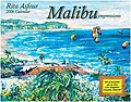 2006 Malibu Calendar.jpg 350 × 275; 57 KB
-
 20111018-FS-DD-0010 - Flickr - USDAgov.jpg 1,536 × 2,048; 720 KB
-
 2nd California Infantry Company "K" (306e7ca9-154a-4fc8-a2a0-08511a72f5e0).tif 14,988 × 3,388, 2 pages; 145.29 MB
-
 4NOV2006 LARGE.jpg 1,201 × 901; 604 KB
-
 88 SAM 3257 (4841843605).jpg 3,056 × 3,056; 579 KB
-
 AbovetheNapaValley.jpg 386 × 261; 80 KB
-
 Alabama Hills 01.jpg 5,184 × 3,456; 2.12 MB
-
 Alabama Hills 02.jpg 5,184 × 3,456; 3.3 MB
-
 Alabama Hills 03.jpg 5,184 × 3,456; 2.71 MB
-
 Alabama Hills 04.jpg 3,456 × 5,184; 2.44 MB
-
 Alabama Hills at Sierra Nevada in CA 1.jpg 2,048 × 1,536; 2.87 MB
-
 Alabama Hills at Sierra Nevada in CA 2.jpg 2,048 × 1,536; 2.99 MB
-
 Alabama Hills at Sierra Nevada in CA 3.jpg 2,048 × 1,536; 3.27 MB
-
 Alabama Hills at Sierra Nevada in CA 4.jpg 2,048 × 1,536; 3.51 MB
-
 Alabama Hills at Sierra Nevada in CA 5.jpg 2,048 × 1,536; 3.19 MB
-
 Alabama Hills at Sierra Nevada in CA 6.jpg 2,048 × 1,536; 3.18 MB
-
 Alabama Hills at Sierra Nevada in CA 7.jpg 2,048 × 1,536; 2.81 MB
-
 Alabama Hills at Sierra Nevada in CA 8.jpg 2,048 × 1,536; 3.15 MB
-
 Alexandervalleyscenery.jpg 240 × 160; 49 KB
-
 Aliso Creek with Saddleback in distance.JPG 2,048 × 1,536; 1.51 MB
-
 Ancient Bristlecone Pine Forest 04 30 2022 10.jpg 8,064 × 6,048; 32.27 MB
-
 Ancient Bristlecone Pine Forest 04 30 2022 11.jpg 8,064 × 6,048; 33.88 MB
-
 Ancient Bristlecone Pine Forest 04 30 2022 17.jpg 6,048 × 8,064; 36.72 MB
-
 Ancient Bristlecone Pine Forest 04 30 2022 5.jpg 8,064 × 6,048; 35.92 MB
-
 Ancient Bristlecone Pine Forest 04 30 2022 6.jpg 8,064 × 6,048; 32.91 MB
-
 Ancient Bristlecone Pine Forest 04 30 2022 8.jpg 8,064 × 6,048; 32.78 MB
-
 Ancient Bristlecone Pine Forest 04 30 2022 9.jpg 8,064 × 6,048; 29.99 MB
-
 Ano Nuevo - panoramio.jpg 3,648 × 2,736; 2.88 MB
-
 Anza-Borrego Desert State Park - 51871027923.jpg 3,000 × 2,000; 4.92 MB
-
 AnzaBorregoClouds.jpg 2,528 × 1,322; 947 KB
-
 Armida Winery vineyards 0001.jpg 640 × 480; 70 KB
-
 Artist Drive at Death Valley National Park in California.jpg 2,048 × 1,536; 2.33 MB
-
 Artist Palette at Death Valley National Park in California.jpg 2,048 × 1,536; 2.53 MB
-
 Atlas Peak vineyards Napa Valley.jpg 3,648 × 2,736; 3.68 MB
-
 ATSF at Bealville, CA on April 11, 1967 (22666811776).jpg 2,000 × 1,355; 4.56 MB
-
 Badwater Basin at Death Valley National Park in California.jpg 2,048 × 1,536; 2.35 MB
-
 Badwater DeathValley California.jpg 1,200 × 800; 376 KB
-
 BallonaDusk.jpg 8,404 × 3,842; 6.15 MB
-
 Beautiful scene at charlotte lake on a rainy day..JPG 3,744 × 2,104; 2.28 MB
-
 Bella wine caves 2006.jpg 1,024 × 768; 489 KB
-
 BennettValleylookingsecmhogan.jpg 1,000 × 605; 162 KB
-
 Beringerredhillslakecounty.png 1,885 × 1,412; 4.11 MB
-
 Berkeley Grizzly Peak Sunset.jpg 3,264 × 2,448; 1.17 MB
-
 Big Basin Redwood State Park, Rancho Del Oso, CA, jjron 24.03.2012.jpg 1,728 × 1,152; 931 KB
-
 Big Sur portrait.jpg 686 × 1,024; 370 KB
-
 Billy-Goat-Hill.jpg 800 × 531; 103 KB
-
 Bloody Canyon from U.S. 395.jpg 1,000 × 430; 49 KB
-
 Blowing-alkali-dust-Owens-Lake.jpg 4,000 × 3,000; 2.19 MB
-
 Bodie, California.jpg 1,080 × 1,080; 174 KB
-
 Buberel Moon Mountain vineyards.jpg 597 × 399; 74 KB
-
 Selby Campground, Selby Rocks from Caliente Range.jpg 2,272 × 1,704; 2.84 MB
-
 California - Dark Hole; Big Dalton Dam through Davis - NARA - 23934231.jpg 4,397 × 3,408; 7.72 MB
-
 California - Dark Hole; Big Dalton Dam through Davis - NARA - 23934233.jpg 4,397 × 3,400; 7.66 MB
-
 California - Mare Island Navy through Mission Creek - NARA - 23934541.jpg 3,456 × 2,672; 1.87 MB
-
 California Lake Isabella1.jpg 1,188 × 678; 245 KB
-
 California State Route 1 01.jpg 2,272 × 1,704; 1.03 MB
-
 California Vineyards in Jericho Canyon, Napa Valley.jpg 601 × 400; 132 KB
-
 California, Death Valley National Park, Artist's Palette.jpg 3,456 × 2,304; 3.55 MB
-
 California, Death Valley National Park, Badwater Basin, sign.jpg 2,304 × 3,456; 4.95 MB
-
 California, Death Valley National Park, Badwater Basin.jpg 3,456 × 2,304; 4.52 MB
-
 California, Death Valley National Park, Devil's Golf Course (detail).jpg 3,456 × 2,304; 3.9 MB
-
 California, Death Valley National Park, Devil's Golf Course (Matthieu).jpg 3,271 × 2,181; 3.73 MB
-
 California, Death Valley National Park, Devil's Golf Course.jpg 3,350 × 2,233; 5.82 MB
-
 California, Death Valley National Park, Zabriskie Point.jpg 6,538 × 1,967; 8.3 MB
-
 Camp Pendleton Sunset.jpg 3,456 × 2,304; 1.06 MB
-
 Capt Dana Tree Nipomo.JPG 1,600 × 1,200; 444 KB
-
 Carrizo plain pano.jpg 6,826 × 2,157; 2.66 MB
-
 Caruthers Canyon 6.jpg 1,800 × 2,198; 1.16 MB
-
 Castle Peaks from Nipton Road 1.jpg 1,800 × 1,200; 295 KB
-
 CattleCañada Larga.jpg 1,544 × 1,024; 853 KB
-
 Ceanothusoliganthus.jpg 667 × 500; 128 KB
-
 Change of Scenery, Lone Pine, CA 5-15 (20035930064).jpg 2,800 × 2,242; 1.37 MB
-
 Chateau Montelena vines.jpg 480 × 332; 182 KB
-
 Chino Canyon.jpg 3,072 × 1,588; 1.53 MB
-
 Cima Dome landscape 4.jpg 2,560 × 1,707; 1,004 KB
-
 Cliffs at devils slide california.jpg 2,832 × 4,256; 9 MB
-
 CloudysVineyard.jpg 1,306 × 979; 675 KB
-
 Contra Costa County - Mount Diablo State Park - 20230416105619.jpg 4,096 × 3,072; 1.62 MB
-
 Contra Costa County - Mount Diablo State Park - 20230416124619.jpg 4,096 × 3,072; 2.46 MB
-
 Contra Costa County - Mount Diablo State Park - 20230416134432.jpg 4,096 × 3,072; 2.68 MB
-
 Coyote hills park 2.jpg 4,032 × 3,024; 2.44 MB
-
 Crater Mountain Panarama.jpg 4,235 × 1,829; 4.15 MB
-
 CSU Channel Islands, Landscape.jpg 3,256 × 868; 450 KB
-
 Death Valley 01.jpg 3,456 × 5,184; 2.58 MB
-
 Death Valley 02.jpg 5,184 × 3,456; 2.76 MB
-
 Death Valley 03.jpg 5,184 × 3,456; 2.94 MB
-
 Death Valley 04.jpg 5,184 × 3,456; 3.96 MB
-
 Death valley dead trees.jpg 4,272 × 2,848; 8.73 MB
-
 Death Valley National Park, California, Jubilee Pass Road (3375976203).jpg 2,816 × 2,112; 2.44 MB
-
 Death valley rock.JPG 2,896 × 1,944; 1.54 MB
-
 Deep Creek Hot Springs (upper pool).jpg 2,112 × 2,816; 1.41 MB
-
 Del Puerto Canyon, California.jpg 3,071 × 1,680; 2.5 MB
-
 Demon Valley, California.jpg 4,288 × 2,848; 8.19 MB
-
 Desert Cactus Plants at Mojave National Preserve in California 1.jpg 2,048 × 1,536; 3.76 MB
-
 Desert Cactus Plants at Mojave National Preserve in California 4.jpg 2,048 × 1,536; 2.63 MB
-
 Desert View Indian Wells.jpg 1,632 × 918; 1.6 MB
-
 DGP ToneMap (10316545706).jpg 4,296 × 2,844; 13.8 MB
-
 Don-Pedro-Lake-Panorama-2005-11-24.jpg 1,600 × 412; 265 KB
-
 Drone view of Great Mausoleum.jpg 3,968 × 2,976; 5.17 MB
-
 DSC 0009 (50785236652).jpg 6,000 × 4,000; 10.96 MB
-
 Dutcher Crossing Vineyards in Dry Creek Valley.jpg 2,048 × 1,536; 519 KB
-
 Eagle lake (004179cb0b164b65826aaa0f3fb4efb8).jpg 990 × 661; 342 KB
-
 EmeraldBay LakeTahoe.jpg 1,280 × 853; 415 KB
-
 Emerson Parcel Tidal Marsh California.jpg 1,173 × 880; 338 KB
-
 Emertius Vineyards - August 2023 - Sarah Stierch 02.jpg 4,032 × 3,024; 9.03 MB
-
 Father Crowley Overlook U.S. Route 190 3.jpg 8,064 × 6,048; 77.28 MB
-
 Father Crowley Overlook U.S. Route 190 7.jpg 8,064 × 6,048; 60.95 MB
-
 Field of Flowers and Five Fingers (33603756283).jpg 4,927 × 3,285; 16.87 MB
-
 Fisherman's Warf HDR.jpg 4,007 × 2,990; 1.04 MB
-
 Flower fields on Los Osos Valley road.jpg 4,099 × 2,388; 4.74 MB
-
 Flowers at Desert Center, CA, 2019..jpg 3,024 × 4,032; 2.71 MB
-
 Foggy Tree View.jpg 4,032 × 2,268; 4 MB
-
 Folie a Deux vinyard.jpg 1,280 × 960; 555 KB
-
 Fort Ord NM (9299754251).jpg 1,200 × 800; 440 KB
-
 Fort Ord NM (9302539654).jpg 1,200 × 800; 396 KB
-
 Freeman junction, California.jpg 640 × 422; 81 KB
-
 Geology of Southern California (3600186011).jpg 3,264 × 2,448; 2.74 MB
-
 Geology of Southern California (3600186753).jpg 3,264 × 2,448; 2.66 MB
-
 Geology of Southern California (3600188255).jpg 3,264 × 2,448; 2.91 MB
-
 Geology of Southern California (3600188679).jpg 3,264 × 2,448; 2.53 MB
-
 Geology of Southern California (3600189855).jpg 3,264 × 2,448; 2.82 MB
-
 Geology of Southern California (3600191191).jpg 3,264 × 2,448; 2.77 MB
-
 Geology of Southern California (3600996382).jpg 3,264 × 2,448; 2.85 MB
-
 Geology of Southern California (3600997126).jpg 3,264 × 2,448; 2.63 MB
-
 Geology of Southern California (3600997888).jpg 3,264 × 2,448; 3.08 MB
-
 Geology of Southern California (3600998642).jpg 3,264 × 2,448; 2.85 MB
-
 Geology of Southern California (3600999888).jpg 3,264 × 2,448; 2.6 MB
-
 Geology of Southern California (3601000244).jpg 3,264 × 2,448; 2.71 MB
-
 Geology of Southern California (3601001122).jpg 3,264 × 2,448; 2.82 MB
-
 Geology of Southern California (3601001598).jpg 3,264 × 2,448; 2.95 MB
-
 Gigantic Alluvial Fan Being Uplift by New Fault.jpg 2,048 × 1,360; 1.7 MB
-
 Going Skyward - Caldera Rim of Cinder Cone at Lassen Volcanic National Park.jpg 2,048 × 1,360; 1.98 MB
-
 Golden Hill (145211747).jpeg 2,048 × 1,365; 1.34 MB
-
 Grass Valley Wilderness.jpg 8,257 × 4,764; 31.93 MB
-
 Graylodgewildlifearea.jpg 1,485 × 1,024; 487 KB
-
 Ground in the Diablo Range.jpg 1,276 × 392; 214 KB
-
 Guyot spur trained vines in Temecula.jpg 3,111 × 2,333; 2.97 MB
-
 H20130601-8522—Scene at Walker Ridge (9230823539).jpg 1,024 × 768; 965 KB
-
 Harper Valley Dry Lake Bed.jpg 9,006 × 6,004; 44.33 MB
-
 Heitz vineyards Mark Brady.jpg 922 × 579; 147 KB
-
 Hexagonal Shaped Salt Crust at Badwater.jpg 2,048 × 1,360; 2.29 MB
-
 Hiking Views at Griffith Park .jpg 4,032 × 3,024; 2.13 MB
-
 Holiday Inn Express Fort Bragg - August 2023 - Sarah Stierch 06.jpg 4,032 × 3,024; 8.49 MB
-
 Holiday Inn Express Fort Bragg - August 2023 - Sarah Stierch 07.jpg 4,032 × 3,024; 8.31 MB
-
 HollysHillsViewNew.jpg 350 × 233; 60 KB
-
 Humboldt County Wildfires, Panorama of Top of the World, 9-9-2020.jpg 6,688 × 2,864; 6.27 MB
-
 Humboldt County Wildfires, Top of the World, 9-9-2020.jpg 3,024 × 4,032; 3.02 MB
-
 Indio, CA from scenic outlook.jpg 16,502 × 5,995; 57.26 MB
-
 Inyo, California 1989 01.jpg 1,005 × 676; 1.01 MB
-
 Inyo, California 1989 02.jpg 988 × 636; 928 KB
-
 Joe Mania 2016-08-01 (Unsplash PFLchrsv9jY).jpg 5,760 × 3,840; 11.62 MB
-
 Johnson Valley-1.jpg 4,288 × 2,848; 10.03 MB
-
 Joshua Tree 02.jpg 5,184 × 3,456; 3.26 MB
-
 Joshua Tree 03.jpg 3,456 × 5,184; 3.14 MB
-
 Joshua Tree 04.jpg 5,184 × 3,456; 3.55 MB
-
 Joshua Tree 05.jpg 5,184 × 3,456; 4.2 MB
-
 Joshua Tree National Park (California, USA) -- 2012 -- 5663 (crop).jpg 3,865 × 3,273; 10.64 MB
-
 Joshua Tree National Park (California, USA) -- 2012 -- 5663.jpg 5,184 × 3,456; 15.02 MB
-
 Joshua Tree NP, CA USA.JPG 3,648 × 2,736; 3.31 MB
-
 Jtree1.jpg 1,000 × 667; 241 KB
-
 Jurupa Valley as seen from Mt. Rubidoux, 2013 .jpg 5,184 × 3,456; 6.59 MB
-
 Jurupa valley as seen from the Jurupa Hills .jpg 12,857 × 3,225; 17.45 MB
-
 California Ranch by William Keith, 1908.jpg 2,627 × 1,479; 1.45 MB
-
 Kenwood, California - Stierch.jpg 2,000 × 1,500; 412 KB
-
 Kirby Cove - Mano Seca Bench.jpg 1,260 × 843; 677 KB
-
 Kirby Cove campsite 4 with outhouse.jpg 3,872 × 2,592; 2.88 MB
-
 Lafayette, CA.jpg 2,048 × 1,536; 1.08 MB
-
 Laika ac Calico (9138960740).jpg 5,184 × 3,456; 6.06 MB
-
 Lake Elizabeth in Fremont Central Park.JPG 2,816 × 1,880; 2.37 MB
-
 Landscape, Joshua Tree.jpg 2,592 × 1,944; 1.08 MB
-
 Lassen National Park (32083814803).jpg 3,264 × 2,448; 5.15 MB
-
 Le Mans, France (0d9778c2-1949-49fa-9ed4-1187c6125812).tif 15,296 × 3,244, 2 pages; 141.97 MB
-
 Lightkeepers Cabbage.jpg 3,504 × 2,336; 3.8 MB
-
 LIvermoreSceney.jpg 300 × 200; 55 KB
-
-
 Mammoth Lakes Sunset (Jul, 2024).jpg 1,877 × 1,407; 694 KB
-
 Mano Seca bench at Selby Campground, Carrizo Plain National Monument.jpg 2,272 × 1,704; 2.93 MB
-
 Mauricebraunsdhills.jpg 613 × 400; 52 KB
-
 MeadowInBigBear.JPG 1,600 × 1,200; 673 KB
-
 Cima Dome landscape 3.jpg 2,400 × 1,800; 1.13 MB
-
 Mojave vista.jpg 3,072 × 2,048; 3.76 MB
-
 Monday Night Birding (14177890134).jpg 2,688 × 1,520; 2.99 MB
-
 Mono Lake Serenity.jpg 3,456 × 2,304; 5.79 MB
-
 Mono-lake-tufa-1981-003.jpg 1,024 × 563; 86 KB
-
 Monterey cypress.jpg 3,264 × 2,448; 1.82 MB
-
 Mount Konocti Volcano - panoramio.jpg 2,154 × 1,539; 583 KB
-
 Mount Shasta as seen from Bunny Flat.jpg 6,272 × 4,480; 27.34 MB
-
 Mountain Bridge.jpg 4,616 × 3,464; 15.22 MB
-
 Mountain River Bend.jpg 2,580 × 3,439; 9.46 MB
-
 Mountains 1-967831241.jpg 2,816 × 1,880; 1.42 MB
-
 Mt san gorgonio.jpg 1,216 × 912; 272 KB
-
 Mt. Banner.jpg 3,040 × 2,280; 3.52 MB
-
 Napa Valley April06.jpg 1,024 × 768; 523 KB
-
 Napa Valley east from Niebaum-Coppola.jpg 1,800 × 1,200; 384 KB
-
 Napa Valley Fog and mountains - Stierch.jpg 683 × 1,024; 111 KB
-
 Napa Valley from Auberge du Soleil 1.jpg 2,400 × 1,600; 669 KB
-
 Napa Valley from Auberge du Soleil 2.jpg 2,400 × 1,600; 524 KB
-
 Napa Valley from Oakville Grade 1.jpg 1,800 × 1,200; 471 KB
-
 Napa Valley from Oakville Grade 2.jpg 2,400 × 1,600; 620 KB
.jpg)


.jpg)


.jpg)


.jpg)
.jpg)


.jpg)


.jpg)

.jpg)


.jpg)

.jpg)

.jpg)


.jpg)


.jpg)
.jpg)

.jpg)
.jpg)
.jpg)
.jpg)
.jpg)
.jpg)
.jpg)
.jpg)
.jpg)
.jpg)
.jpg)
.jpg)
.jpg)
.jpg)


.jpeg)


.jpg)


.jpg)


_--_2012_--_5663_(crop).jpg)
_--_2012_--_5663.jpg)


.jpg)


.jpg)


.jpg)


.jpg)


