Category:Landzigt, Numansdorp
Jump to navigation
Jump to search
| Object location | | View all coordinates using: OpenStreetMap |
|---|
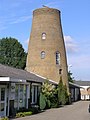
former windmill in Numansdorp, Netherlands  | |||||
| Upload media | |||||
| Instance of | |||||
|---|---|---|---|---|---|
| Location | Numansdorp, Hoeksche Waard, South Holland, Netherlands | ||||
| Street address |
| ||||
| Located on street |
| ||||
| Heritage designation |
| ||||
| Source of energy | |||||
 | |||||
|
This is a category about rijksmonument number 527680
|
| Address |
|
Media in category "Landzigt, Numansdorp"
This category contains only the following file.
-
 Numansdorp Landzigt 4840.jpg 1,712 × 2,288; 2.41 MB