Category:Langton Long Blandford
Jump to navigation
Jump to search
village in the United Kingdom  | |||||
| Upload media | |||||
| Instance of | |||||
|---|---|---|---|---|---|
| Location | North Dorset, Dorset, South West England, England | ||||
 | |||||
Subcategories
This category has only the following subcategory.
L
Media in category "Langton Long Blandford"
The following 41 files are in this category, out of 41 total.
-
 A354 bypassing Blandford Forum - geograph.org.uk - 5724955.jpg 640 × 428; 122 KB
-
 Between the woods near Langton Lodge - geograph.org.uk - 1948270.jpg 640 × 480; 141 KB
-
 Black Lane - geograph.org.uk - 1947840.jpg 640 × 458; 80 KB
-
 Eleven miles to Wimborne - geograph.org.uk - 1273065.jpg 640 × 453; 169 KB
-
 Entrance to Ashley Wood Golf Club - geograph.org.uk - 3389083.jpg 640 × 480; 82 KB
-
 Entrance to Langton House - geograph.org.uk - 295123.jpg 600 × 450; 87 KB
-
 Entrance to Langton House - geograph.org.uk - 3470179.jpg 640 × 480; 90 KB
-
 Entrance to Langton House, Langton Long - geograph.org.uk - 452318.jpg 640 × 480; 126 KB
-
 Field of barley near Snows Down - geograph.org.uk - 1947871.jpg 640 × 480; 91 KB
-
 Field of barley, Langton Lodge - geograph.org.uk - 1948121.jpg 640 × 439; 88 KB
-
 Horse riding for one mile - geograph.org.uk - 5964077.jpg 1,024 × 684; 332 KB
-
 Langton Long Blandford, B3082 - geograph.org.uk - 3293893.jpg 1,024 × 768; 239 KB
-
 Langton Long Blandford, cattle grazing - geograph.org.uk - 4764428.jpg 1,024 × 768; 159 KB
-

-
 Langton Long Blandford, stubble field - geograph.org.uk - 3293897.jpg 1,024 × 768; 163 KB
-
 Langton Long, farm road - geograph.org.uk - 4766214.jpg 1,024 × 768; 180 KB
-
 Langton Long, former rectory - geograph.org.uk - 4766218.jpg 1,024 × 768; 301 KB
-
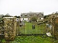
 Langton Long, gateway - geograph.org.uk - 4766193.jpg 1,024 × 762; 214 KB
-
 Langton Long, house - geograph.org.uk - 4766212.jpg 1,024 × 765; 170 KB
-
 Langton Long, Langton Farm - geograph.org.uk - 4766220.jpg 1,024 × 769; 131 KB
-
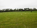 Langton Long, sheep grazing - geograph.org.uk - 4766197.jpg 1,024 × 769; 129 KB
-
 Langton Long, signpost - geograph.org.uk - 4766203.jpg 1,024 × 768; 194 KB
-
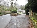 Langton Long, South Lodge - geograph.org.uk - 4766223.jpg 1,024 × 769; 231 KB
-
 Langton Nursery - geograph.org.uk - 1273139.jpg 640 × 469; 112 KB
-

-
 Poor chalk soil on Hungry Down - geograph.org.uk - 4698031.jpg 4,347 × 3,276; 3.27 MB
-
 Poppies near Snows Down - geograph.org.uk - 1947898.jpg 479 × 640; 123 KB
-
 Rectory garden - geograph.org.uk - 1319911.jpg 640 × 480; 55 KB
-
 Road towards Blandford Forum - geograph.org.uk - 5964109.jpg 1,024 × 684; 331 KB
-
 Tarrant Keyneston, cattle grazing - geograph.org.uk - 4764397.jpg 1,024 × 768; 116 KB
-
 Tarrant Keyneston, farmyard - geograph.org.uk - 4764169.jpg 1,024 × 768; 161 KB
-
 Tarrant Keyneston, power lines - geograph.org.uk - 4764402.jpg 1,024 × 749; 90 KB
-
 Tarrant Keyneston, stiles - geograph.org.uk - 4764404.jpg 1,024 × 768; 262 KB
-
 The B3082 - geograph.org.uk - 3389057.jpg 640 × 480; 34 KB
-
 The Old Rectory - geograph.org.uk - 1317432.jpg 640 × 480; 73 KB
-
 The Old Rectory, Langton Long - geograph.org.uk - 1317414.jpg 640 × 480; 50 KB
-
 The Old Rectory, Langton Long - geograph.org.uk - 1317425.jpg 640 × 480; 87 KB
-

-
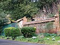 Wall at Clerkenwell House - geograph.org.uk - 1174267.jpg 640 × 480; 175 KB
-
 Walled garden, Old Rectory - geograph.org.uk - 1317435.jpg 480 × 640; 97 KB
-
 West Barn Business Park - geograph.org.uk - 3389071.jpg 640 × 480; 98 KB


