Category:Lantmäteriets topografiska webbkarta
Jump to navigation
Jump to search
English: The maps in this category are taken from a service provided by the Swedish National Land Survey called Download map images, which were until recently licensed as CC-BY, but the maps taken from the service now are licensed CC-0. Here is a link to the download service: Open data. And here is a link to the licensing terms: Terms of Use. The maps are published under a CC0 license when in resolution with a scale number of 200 m or higher.
Svenska: Kartorna härifrån är tagna från Lantmäteriets tjänst Nedladdning av kartbilder och var tidigare licensierad med CC-BY, men är numera licensierad med CC-0. Länk till tjänsten: Min karta (sedan 29 mars 2021 ersättare för "Kartsök och ortnamn". Länk till licensvillkoren: Användning, villkor och avgifter.
Media in category "Lantmäteriets topografiska webbkarta"
The following 56 files are in this category, out of 56 total.
-
Aapua småort 2015.png 1,658 × 848; 843 KB
-
Akkavare.png 713 × 576; 229 KB
-
Alsån Småort 2010.png 1,658 × 848; 947 KB
-
Bergby mfl tätort 2015 och 2010, småorter 2015 och 2010.png 1,658 × 848; 999 KB
-
Bergby mfl tätorter 2015 och 2010.png 1,658 × 848; 982 KB
-
Bergby tätort 2015, småorter 2010.png 1,658 × 848; 972 KB
-
Bergby tätort 2015, småorter 2015 och 2010.png 1,658 × 848; 981 KB
-
Bergby tätort 2015, småorter 2015.png 1,658 × 848; 977 KB
-
Bergby tätort 2015.png 1,658 × 848; 964 KB
-
Bergby, Hamrångefjärden och Totra tätorter 2010, småorter 2010.png 1,658 × 848; 958 KB
-
Bergby, Hamrångefjärden och Totra tätorter 2010.png 1,658 × 848; 950 KB
-
Björkö, Kalvsund (180819).jpg 662 × 1,538; 382 KB
-
Björkö, Kalvsund.jpg 331 × 769; 177 KB
-
Blidö och Yxlans öar småorter 2010.png 1,840 × 1,613; 1.65 MB
-
Blidö och Yxlans öar småorter 2015.png 1,840 × 1,613; 1.69 MB
-
Blidö och Yxlans öar tätort 2015, småorter 2015 och 2010.png 1,840 × 1,613; 1.72 MB
-
Blidö och Yxlans öar tätort 2015, småorter 2015.png 1,840 × 1,613; 1.72 MB
-
Blixbo småorter 2010.png 1,658 × 848; 1.21 MB
-
Blixbo småorter 2015 och 2010.png 1,658 × 848; 1.21 MB
-
Blixbo tätort 2015 och 2010, småorter 2015 och 2010.png 1,658 × 848; 1.25 MB
-
Blixbo tätort 2015, småort 2010.png 1,658 × 848; 1.24 MB
-
Ekskogen och Långsjötorp tätort 2015 och småort 2010.png 1,658 × 848; 1.12 MB
-
Ekskogen och Älgeby småort 2010.png 1,658 × 848; 1.1 MB
-
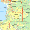
Frillesås, Sjöaremossen (karta).png 695 × 691; 392 KB
-
Galterö (Tk).png 523 × 293; 87 KB
-
Gäddede tätort och småort 2015.png 1,658 × 848; 981 KB
-
Gåsö (topografisk karta).png 511 × 378; 120 KB
-
Haapakylä småort 2015 och Övertorneå tätort 2015.png 1,658 × 848; 938 KB
-
Helsingborg-Ramlösa (stationsmarkering).jpg 898 × 497; 468 KB
-
Helsingborg-Ramlösa.jpg 898 × 497; 450 KB
-
Högsbohöjd Frölunda topogr webbkarta (190423).png 634 × 874; 747 KB
-
Isokylä småort 2015.png 1,658 × 848; 850 KB
-
Jokkmokk tätort 2015 och Mattisuddens småort 2015.png 2,559 × 1,284; 2.3 MB
-
Karlsborg småorter 2015 och tätorter 2015 och 2010.png 1,658 × 848; 979 KB
-
Karlsborg småorter 2015 och tätorter 2015.png 1,658 × 848; 960 KB
-
Karlsborg tätort 2010.png 1,658 × 848; 951 KB
-
Karta över Mora.png 1,366 × 662; 1,005 KB
-
Kiruna kommun, väster (Lantmäteriet-webbkarta).jpg 917 × 377; 285 KB
-
Korsträsk Tätort 2015, Småort 2015.png 1,658 × 848; 1.21 MB
-
Kviberg Lantm topogr webbkarta (181028).jpg 490 × 504; 168 KB
-
Kållandsö karta.png 772 × 478; 161 KB
-
Laisvall småort 2015.png 1,658 × 848; 1,000 KB
-
Lansjärv Småort 2010.png 1,658 × 848; 940 KB
-
Lauker småort 2015.png 1,658 × 848; 940 KB
-
Lurö karta.png 802 × 654; 118 KB
-
Murjek småort 2010.png 1,658 × 848; 925 KB
-
Niemis (norra delen) småort 2015.png 1,658 × 848; 732 KB
-
Persbo fyra småorter 2015.png 1,658 × 848; 1.2 MB
-
Pitholmen (Lantm, CC-webbkarta).jpg 525 × 522; 94 KB
-
Saxtorp småort 2005 och tätorter 2005.png 1,658 × 848; 896 KB
-
Skärgårdssafari Göteborg 2016-08-21.png 699 × 1,426; 465 KB
-
Tyna och Heden småort 2010 och 2000.png 1,658 × 848; 1.14 MB
-
Vetlanda tätort 2015 småorter 2015.png 1,658 × 848; 1.35 MB
-
Vitsaniemi småort 2015.png 1,658 × 848; 699 KB
-
Ängesbyn tätorter 2015 och småorter 2015.png 1,658 × 848; 915 KB
-
Öckero, Hönö (180616).jpg 1,228 × 1,004; 620 KB


