Category:Largo Bay
Jump to navigation
Jump to search
bay in Fife, Scotland, UK, on the north shore of the Firth of Forth  | |||||
| Upload media | |||||
| Instance of | |||||
|---|---|---|---|---|---|
| Part of | |||||
| Location | Fife, Scotland | ||||
| Located in or next to body of water | |||||
 | |||||
Subcategories
This category has the following 2 subcategories, out of 2 total.
E
- East Vows beacon (3 F)
R
- Ruddons Point (4 F)
Media in category "Largo Bay"
The following 43 files are in this category, out of 43 total.
-
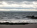 Across the Firth - geograph.org.uk - 625401.jpg 640 × 480; 66 KB
-
 At the edge of the rocks - geograph.org.uk - 3565563.jpg 1,142 × 857; 681 KB
-
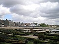 Beach and houses at Lower Largo - geograph.org.uk - 945569.jpg 640 × 480; 65 KB
-

-
 Beach front, Largo - geograph.org.uk - 497019.jpg 640 × 450; 75 KB
-
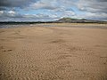
 Beach, east end of Largo Bay - geograph.org.uk - 1537929.jpg 640 × 480; 81 KB
-
 Beach, Largo Bay - geograph.org.uk - 1537934.jpg 640 × 480; 73 KB
-
 Beach, Lower Largo. - geograph.org.uk - 15033.jpg 640 × 418; 58 KB
-
 Blockhouse on the coast - geograph.org.uk - 945572.jpg 640 × 480; 65 KB
-
 Cocklemill Burn - geograph.org.uk - 1537938.jpg 640 × 480; 107 KB
-
 Cooling off in Largo Bay - geograph.org.uk - 1386862.jpg 640 × 488; 101 KB
-
 Eastern end of Largo Bay.jpg 1,600 × 1,200; 394 KB
-
 FCP and Leven Bay - geograph.org.uk - 626773.jpg 640 × 399; 81 KB
-
 Fife Coast Path - geograph.org.uk - 1537664.jpg 640 × 480; 114 KB
-
 Fife Coastal Path at Cocklemill Burn - geograph.org.uk - 936846.jpg 640 × 480; 79 KB
-
 Kelp and sea bed - geograph.org.uk - 3643070.jpg 640 × 360; 252 KB
-

-
 Largo Bay from Dumbarnie Links - geograph.org.uk - 1386822.jpg 640 × 488; 103 KB
-
 Largo Bay, centre section - geograph.org.uk - 98587.jpg 640 × 473; 239 KB
-
 Largo Bay, East section - geograph.org.uk - 89560.jpg 640 × 480; 138 KB
-
 Largo Bay, West section - geograph.org.uk - 98596.jpg 640 × 446; 249 KB
-
 Largo Beach - geograph.org.uk - 524953.jpg 640 × 424; 51 KB
-
 Largo, across Largo Bay - geograph.org.uk - 350855.jpg 640 × 480; 98 KB
-
 Lith-print In The Mood.jpg 1,262 × 1,888; 1.19 MB
-
 Lith-print Largo Beach.jpg 1,803 × 1,212; 1.04 MB
-
 Looking back to Leven - geograph.org.uk - 1386850.jpg 640 × 488; 102 KB
-
 Looking east on Lower Largo beach - geograph.org.uk - 104991.jpg 640 × 480; 136 KB
-
 Lower Largo Beach - geograph.org.uk - 34078.jpg 640 × 446; 112 KB
-
 Lower Largo Beach Front - geograph.org.uk - 34086.jpg 640 × 480; 121 KB
-
 Lower Largo beach.jpg 6,000 × 4,000; 15.06 MB
-

-
 On the beach - geograph.org.uk - 1710753.jpg 640 × 480; 68 KB
-

-
 Rocks on the shore near Carrick Villa - geograph.org.uk - 1897928.jpg 947 × 710; 155 KB
-
 Round Largo Bay to Ruddon's Point - geograph.org.uk - 350860.jpg 640 × 480; 75 KB
-
 Sandy Beaches, Lower Largo - geograph.org.uk - 1583741.jpg 640 × 480; 75 KB
-
 Sandy shores. - geograph.org.uk - 625405.jpg 640 × 480; 60 KB
-
 Six-spot burnet moth on knapweed - geograph.org.uk - 1386416.jpg 640 × 488; 100 KB
-
 Spring low water - geograph.org.uk - 3647469.jpg 640 × 360; 276 KB
-
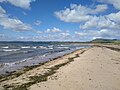
 Spring low water off Dumbarnie Links - geograph.org.uk - 3643081.jpg 640 × 360; 250 KB
-
 Sunset - geograph.org.uk - 103846.jpg 640 × 480; 58 KB
-

-
 The Dunes and Beach, Largo Bay - geograph.org.uk - 400579.jpg 640 × 480; 96 KB


