Category:Latchford Viaduct
Jump to navigation
Jump to search
| Object location | | View all coordinates using: OpenStreetMap |
|---|
abandoned bridge in Latchford, Warrington, Cheshire, England, United Kingdom  | |||||
| Upload media | |||||
| Instance of | |||||
|---|---|---|---|---|---|
| Named after | |||||
| Location |
| ||||
| Crosses | |||||
| Carries | |||||
| Inception |
| ||||
| Date of official closure |
| ||||
| Next crossing upstream |
| ||||
| Next crossing downstream |
| ||||
 | |||||
Media in category "Latchford Viaduct"
The following 14 files are in this category, out of 14 total.
-
 Communications - geograph.org.uk - 3445182.jpg 4,473 × 2,688; 7.45 MB
-

-
 Knutsford Road swingbridge nearly closed - geograph.org.uk - 3425111.jpg 1,024 × 768; 118 KB
-
 Latchford Lock, Manchester Ship Canal - geograph.org.uk - 3023.jpg 512 × 350; 37 KB
-
 Latchford Locks Warrington - geograph.org.uk - 292209.jpg 425 × 640; 66 KB
-
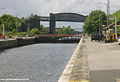
 Latchford Viaduct - geograph.org.uk - 2614154.jpg 1,024 × 747; 136 KB
-
 Leaving Latchford Lock - geograph.org.uk - 2535350.jpg 640 × 426; 71 KB
-
 Manchester Ship Canal - geograph.org.uk - 2073303.jpg 640 × 426; 66 KB
-
 Manchester Ship Canal - geograph.org.uk - 3060785.jpg 640 × 480; 491 KB
-
 Manchester Ship Canal - panoramio.jpg 1,408 × 1,056; 700 KB
-
 Manchester Ship Canal at Latchford - geograph.org.uk - 998791.jpg 451 × 640; 85 KB
-

-
 Railway bridge and Latchford locks - geograph.org.uk - 1917203.jpg 640 × 480; 51 KB
-


