Category:Launceston, Cornwall
Jump to navigation
Jump to search
town, ancient borough, and civil parish in Cornwall, United Kingdom  | |||||
| Upload media | |||||
| Instance of | |||||
|---|---|---|---|---|---|
| Location | Cornwall, South West England, England | ||||
| Population |
| ||||
 | |||||
Subcategories
This category has the following 9 subcategories, out of 9 total.
B
K
L
- Launceston (LSR) railway station (12 F)
N
- Newport Roundhouse (2 F)
S
- Streets in Launceston, Cornwall (24 F)
Media in category "Launceston, Cornwall"
The following 176 files are in this category, out of 176 total.
-
 A footbridge over the A30 - geograph.org.uk - 3521040.jpg 1,024 × 768; 227 KB
-
 A30 crossed by A388 - geograph.org.uk - 3223769.jpg 3,648 × 2,048; 1.43 MB
-
 A30 crossed by unnamed road south of Middle Bamham - geograph.org.uk - 3223780.jpg 3,648 × 2,048; 1.43 MB
-
 A30 eastbound exit for Launceston - geograph.org.uk - 3831831.jpg 1,536 × 1,152; 1,008 KB
-
 A30 footbridge between Launceston Hospital and College - geograph.org.uk - 3223768.jpg 3,100 × 1,931; 1.08 MB
-
 A30 near Launceston.jpg 4,288 × 2,848; 5.32 MB
-
 A30 north of Pennygillam Industrial Estate - geograph.org.uk - 3223762.jpg 3,010 × 2,047; 1.07 MB
-
 A30 north of Stourscoumbe Farm - geograph.org.uk - 3223775.jpg 3,648 × 2,048; 1.39 MB
-

-
-
 A388 bridge over A30 - geograph.org.uk - 2841825.jpg 800 × 599; 284 KB
-
 Advert for Folley and Sons, the high-class grocers Wellcome L0040421.jpg 3,348 × 2,672; 2.98 MB
-
 Animal feeder near Stourscombe - geograph.org.uk - 2834405.jpg 640 × 427; 60 KB
-
 BP filling station in Newport, Launceston - geograph.org.uk - 4924274.jpg 4,377 × 3,275; 1.36 MB
-
 Bridge across A30, Launceston - geograph.org.uk - 1729515.jpg 640 × 480; 124 KB
-
 Bungalows in Woburn Road, Launceston - geograph.org.uk - 4924040.jpg 1,600 × 1,200; 230 KB
-
 Castle view - geograph.org.uk - 2235167.jpg 640 × 426; 123 KB
-

-
 Christopher Lethbridge of Launceston.jpg 600 × 804; 62 KB
-
 Co-op - geograph.org.uk - 5611463.jpg 1,000 × 662; 613 KB
-
 Cross Lanes, St Stephens - geograph.org.uk - 4923368.jpg 1,600 × 1,205; 488 KB
-
 Devon and Cornwall notes and queries (1911) (14594008599) (cropped).jpg 1,069 × 1,635; 917 KB
-
 Devon and Cornwall notes and queries (1911) (14594008599).jpg 3,824 × 2,244; 1.01 MB
-
 Dunheved Cross - geograph.org.uk - 429070.jpg 458 × 640; 119 KB
-
-

-

-
 Footbridge over Launceston by pass - geograph.org.uk - 4036842.jpg 640 × 423; 47 KB
-
 Footbridge over the A30 - geograph.org.uk - 4427035.jpg 3,463 × 1,828; 3.4 MB
-
-
 Gate near South Lodge - geograph.org.uk - 2836548.jpg 480 × 640; 108 KB
-
 Gateway and tower of St Stephen's church - geograph.org.uk - 4923360.jpg 1,200 × 1,600; 447 KB
-
 Higher Truscott - geograph.org.uk - 322871.jpg 640 × 426; 103 KB
-
 Housing estate at Newport - geograph.org.uk - 5085332.jpg 640 × 480; 120 KB
-
 Jericho's Brasserie, 4 Northgate St. Launceston - geograph.org.uk - 3857793.jpg 3,023 × 2,267; 3.9 MB
-
 Junction of Wooda Road and St Thomas Road, Launceston - geograph.org.uk - 4924012.jpg 1,600 × 1,199; 267 KB
-
 Launceston (8980640662).jpg 3,648 × 2,736; 1.1 MB
-
 Launceston - geograph.org.uk - 2235161.jpg 640 × 426; 106 KB
-
 Launceston - The South Gate - geograph.org.uk - 5692089.jpg 1,013 × 1,000; 873 KB
-
-
 Launceston Castle (3) - geograph.org.uk - 3560982.jpg 640 × 427; 379 KB
-
 Launceston Castle - geograph.org.uk - 1910220.jpg 3,872 × 2,592; 4.11 MB
-

-
 Launceston Christmas Lights - geograph.org.uk - 4036761.jpg 2,592 × 1,552; 1.02 MB
-
 Launceston Dancers - geograph.org.uk - 4036747.jpg 250 × 250; 103 KB
-
 Launceston Family Fun Day - geograph.org.uk - 4036751.jpg 480 × 326; 40 KB
-
 Launceston from Castle Keep - geograph.org.uk - 2744659.jpg 1,500 × 2,242; 270 KB
-
 Launceston from S.W. Cornwall England.jpg 1,081 × 843; 192 KB
-
 Launceston from S.W., Cornwall, England-LCCN2002696593.jpg 3,722 × 2,770; 3.32 MB
-
 Launceston from St. Stephens Cornwall England.jpg 1,075 × 848; 173 KB
-
 Launceston from St. Stephens, Cornwall, England-LCCN2002696592.jpg 3,700 × 2,791; 3.31 MB
-
 Launceston Industrial Estate - geograph.org.uk - 1882312.jpg 640 × 403; 56 KB
-
 Launceston Memorial Christmas Lights - geograph.org.uk - 4036768.jpg 1,552 × 2,592; 1,024 KB
-
 Launceston SR station - geograph.org.uk - 3390163.jpg 640 × 480; 72 KB
-
 Launceston Station - geograph.org.uk - 1911648.jpg 640 × 480; 75 KB
-

-

-
 Launceston Town Square - geograph.org.uk - 4036727.jpg 180 × 250; 68 KB
-
 Launceston Town Square Official Opening - geograph.org.uk - 4036834.jpg 3,072 × 2,304; 2.72 MB
-
 Launceston, Empty shop in Market Street - geograph.org.uk - 5746570.jpg 7,360 × 4,912; 5.63 MB
-
 Launceston, Flower Scene florists 1 - geograph.org.uk - 5746417.jpg 6,200 × 4,138; 4.31 MB
-
 Launceston, Flower Scene florists 2 - geograph.org.uk - 5746424.jpg 6,089 × 4,064; 3.93 MB
-
 Launceston, Market Square - geograph.org.uk - 5746577.jpg 7,360 × 4,912; 5.42 MB
-

-
 Launceston, St. Mary Magdalene's Church - geograph.org.uk - 5746430.jpg 7,360 × 4,912; 5.48 MB
-
 Launceston, St. Mary Magdalene's Church - geograph.org.uk - 5746513.jpg 4,775 × 3,187; 2.76 MB
-
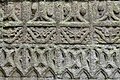
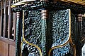
 Launceston, St. Mary Magdalene's Church, Bench end 1 - geograph.org.uk - 5746462.jpg 5,854 × 3,908; 3.85 MB
-
 Launceston, St. Mary Magdalene's Church, Bench end 2 - geograph.org.uk - 5746468.jpg 5,609 × 3,744; 3.54 MB
-
 Launceston, St. Mary Magdalene's Church, Bench end 4 - geograph.org.uk - 5746477.jpg 7,174 × 4,787; 4.95 MB
-
 Launceston, St. Mary Magdalene's Church, Bench end 5 - geograph.org.uk - 5746479.jpg 7,360 × 4,912; 6.74 MB
-
 Launceston, St. Mary Magdalene's Church, Bench end 6 - geograph.org.uk - 5746481.jpg 4,495 × 6,737; 5.32 MB
-
 Launceston, St. Mary Magdalene's Church, Bench end(s) 3 - geograph.org.uk - 5746474.jpg 6,367 × 4,249; 5.05 MB
-
-

-

-
 Launceston, St. Mary Magdalene's Church, Eastern aspect - geograph.org.uk - 5746437.jpg 4,683 × 3,126; 2.97 MB
-

-

-

-

-

-

-

-

-

-

-
 Launceston, St. Mary Magdalene's Church, Royal Coat of Arms - geograph.org.uk - 5746541.jpg 5,751 × 3,838; 4.97 MB
-

-
-

-
-

-

-
-

-

-

-
 Launceston, St. Mary Magdalene's Church, The nave - geograph.org.uk - 5746517.jpg 7,094 × 4,735; 5.32 MB
-

-

-

-

-
 Launceston, St. Mary Magdalene's Church, The Piper effigies - geograph.org.uk - 5746496.jpg 4,187 × 2,795; 1.85 MB
-

-

-
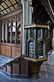
 Launceston, St. Mary Magdalene's Church, The south porch - geograph.org.uk - 5757287.jpg 5,258 × 3,509; 6.66 MB
-
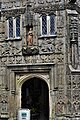 Launceston, St. Mary Magdalene's Church, The south porch - geograph.org.uk - 5757292.jpg 3,560 × 5,336; 7.6 MB
-

-

-
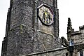 Launceston, St. Mary Magdalene's Church, The tower (detail) - geograph.org.uk - 5757296.jpg 6,516 × 4,348; 7.16 MB
-
-
 Launceston, The White Hart Arcade - geograph.org.uk - 3832947.jpg 640 × 480; 72 KB
-
 Launceston, Westgate Street Car Park - geograph.org.uk - 5746406.jpg 7,360 × 4,912; 5.59 MB
-
 Launceston, Westgate Street Car Park - geograph.org.uk - 5746411.jpg 7,360 × 4,912; 7.14 MB
-
-
 Lilian at Launceston railway station - geograph.org.uk - 5512005.jpg 1,600 × 1,200; 686 KB
-
 Lower Bamham Ford - geograph.org.uk - 5927303.jpg 4,032 × 3,024; 4.76 MB
-
 LSWR North Cornwall railway - geograph.org.uk - 1882299.jpg 640 × 413; 73 KB
-
 Modern housing at Stourscombe - geograph.org.uk - 2834454.jpg 640 × 480; 68 KB
-
 No railway now - geograph.org.uk - 1882307.jpg 640 × 420; 56 KB
-
 North Cornwall , The A30 - geograph.org.uk - 3381888.jpg 4,288 × 2,848; 4.63 MB
-
 North Cornwall , The A30 - geograph.org.uk - 3862278.jpg 4,288 × 2,848; 5.09 MB
-
 North Cornwall , The A30 - geograph.org.uk - 3862281.jpg 4,288 × 2,848; 4.49 MB
-
 North Cornwall , The A30 - geograph.org.uk - 3862283.jpg 4,288 × 2,848; 5.09 MB
-
 North Cornwall , The A30 - geograph.org.uk - 3862285.jpg 4,288 × 2,848; 4.73 MB
-

-

-
 Ordnance Survey One-Inch Sheet 186 Bodmin & Launceston, Published 1961.jpg 8,356 × 9,950; 10.71 MB
-
 Ordnance Survey One-Inch Sheet 186 Bodmin & Launceston, Published 1967.jpg 8,284 × 9,881; 11.29 MB
-
 Ordnance Survey One-Inch Sheet 186 Bodmin and Launceston, Published 1946.jpg 8,242 × 9,593; 10.18 MB
-
 Race Hill, Launceston - geograph.org.uk - 2423038.jpg 640 × 480; 63 KB
-
 Ridgegrove Lane, looking south-east - geograph.org.uk - 5512008.jpg 640 × 480; 69 KB
-
 Riverside, Launceston - geograph.org.uk - 1596363.jpg 640 × 450; 90 KB
-
 Road past Launceston Golf Course - geograph.org.uk - 2836551.jpg 640 × 480; 86 KB
-
 Sale notice Eagle House 1830.jpg 1,000 × 895; 269 KB
-
 Shops in 'The Square' Launceston - geograph.org.uk - 4748886.jpg 1,024 × 677; 153 KB
-
 Slip road at Pennygillam junction - geograph.org.uk - 4036854.jpg 640 × 422; 50 KB
-
-
 Southgate Arch, Launceston - geograph.org.uk - 5120592.jpg 1,600 × 1,200; 474 KB
-
 Spar shop, Dutson Road - geograph.org.uk - 4923372.jpg 1,600 × 1,066; 266 KB
-
 St Thomas Hill and St Thomas Road, Launceston - geograph.org.uk - 4924004.jpg 1,600 × 1,198; 227 KB
-
 St. Mary Magdalene, Church Street, Launceston - geograph.org.uk - 6210261.jpg 5,160 × 4,146; 7.18 MB
-
 Steep climb up to Launceston castle keep - geograph.org.uk - 5150163.jpg 800 × 533; 619 KB
-
 Steps in Launceston - geograph.org.uk - 3853311.jpg 4,000 × 6,000; 4.24 MB
-
 Stone building, Western Road, Launceston - geograph.org.uk - 4924029.jpg 1,600 × 1,199; 269 KB
-
 Sun and rain, Launceston - geograph.org.uk - 1596733.jpg 640 × 444; 92 KB
-
 Tamar Otter & Wildlife Centre, Launceston (280162) (9453606141).jpg 4,004 × 2,402; 3.04 MB
-

-
 The A30 again - geograph.org.uk - 429104.jpg 640 × 427; 92 KB
-
 The A30 westbound - geograph.org.uk - 3521164.jpg 1,024 × 768; 244 KB
-
 The A30 westbound at Launceston - geograph.org.uk - 3521115.jpg 1,024 × 768; 214 KB
-
 The A30 westbound at the A388 - geograph.org.uk - 3521008.jpg 1,024 × 768; 201 KB
-
 The A30 westbound near Bulsworthy Farm - geograph.org.uk - 3520963.jpg 1,024 × 686; 222 KB
-
 The A30 westbound near Launceston - geograph.org.uk - 3520996.jpg 1,024 × 768; 236 KB
-
 The A30 westbound near Launceston - geograph.org.uk - 3521119.jpg 1,024 × 768; 215 KB
-
 The A30 westbound near Pennygillam - geograph.org.uk - 3521028.jpg 1,024 × 768; 220 KB
-
 The closed GWR station at Launceston - geograph.org.uk - 3410678.jpg 640 × 480; 72 KB
-
 The Red Post, Launcells - geograph.org.uk - 1368912.jpg 640 × 480; 106 KB
-
 The small car park in Southgate Street Launceston - geograph.org.uk - 2771143.jpg 3,040 × 2,288; 3.01 MB
-
 The White Horse Inn and its advertising - geograph.org.uk - 4923378.jpg 1,600 × 1,200; 233 KB
-

-

-
 Town Square, Launceston - geograph.org.uk - 4940929.jpg 1,600 × 1,200; 533 KB
-
 Train from Plymouth at Launceston - geograph.org.uk - 3438334.jpg 640 × 480; 115 KB
-
 Trevallyn Bridge, Launceston (c1900) (14182411134).jpg 8,858 × 6,531; 16.69 MB
-

-
 View from Launceston Castle - geograph.org.uk - 3637761.jpg 1,024 × 654; 725 KB
-
 Will of John Dingley 1930.jpg 800 × 835; 196 KB
-
 Bridge over the Cutting - geograph.org.uk - 329666.jpg 640 × 427; 97 KB
-
 Farm Buildings at Goodmansleigh - geograph.org.uk - 328608.jpg 640 × 427; 84 KB
-
 Launceston Golf Course - geograph.org.uk - 323337.jpg 640 × 427; 155 KB
-
 Launceston Sewage Works - geograph.org.uk - 329424.jpg 640 × 427; 104 KB
-
 Launceston, Ridgegrove Mills - geograph.org.uk - 62189.jpg 640 × 440; 133 KB
-
 Modern Housing at Stourscombe - geograph.org.uk - 330705.jpg 640 × 427; 100 KB
-
 New housing on the edge of Launceston - geograph.org.uk - 330720.jpg 640 × 427; 92 KB
-
 The A30 at Launceston - geograph.org.uk - 330768.jpg 640 × 427; 100 KB


_(14594008599)_(cropped).jpg)
_(14594008599).jpg)


_-_geograph.org.uk_-_3831838.jpg)


.jpg)


_-_geograph.org.uk_-_3560982.jpg)


_3_-_geograph.org.uk_-_5746474.jpg)


_-_geograph.org.uk_-_5757319.jpg)


_1_-_geograph.org.uk_-_5746500.jpg)
_2_-_geograph.org.uk_-_5746503.jpg)

_-_geograph.org.uk_-_5746559.jpg)


_-_geograph.org.uk_-_5757296.jpg)


_(9453606141).jpg)


.jpg)


_(14182411134).jpg)


