Category:Layham
Jump to navigation
Jump to search
English: Layham is a small village in southern Suffolk, England. It is part of the Babergh district.
village in Suffolk, England, UK  | |||||
| Upload media | |||||
| Instance of | |||||
|---|---|---|---|---|---|
| Location | Babergh, Suffolk, East of England, England | ||||
 | |||||
Subcategories
This category has the following 3 subcategories, out of 3 total.
Media in category "Layham"
The following 75 files are in this category, out of 75 total.
-
 'Hadleigh 10' at Layham church - geograph.org.uk - 5606618.jpg 640 × 428; 137 KB
-
 'Sugar beet' temporary road sign - geograph.org.uk - 5607223.jpg 640 × 480; 141 KB
-
 Approaching Water House Farm - geograph.org.uk - 3495592.jpg 1,024 × 768; 207 KB
-
 Arable field boundary, Layham - geograph.org.uk - 4463040.jpg 3,648 × 2,736; 2.73 MB
-
 B1070 towards Raydon - geograph.org.uk - 2942053.jpg 640 × 480; 91 KB
-
 Barns, Pope's Green Farm - geograph.org.uk - 5607445.jpg 640 × 480; 112 KB
-
 Clear Footpath - geograph.org.uk - 2116490.jpg 1,600 × 1,200; 598 KB
-
 Country Road - geograph.org.uk - 2116496.jpg 1,600 × 1,200; 376 KB
-
 Dead End - geograph.org.uk - 3495568.jpg 1,024 × 768; 185 KB
-
 Distant View - geograph.org.uk - 3495526.jpg 1,024 × 768; 189 KB
-
 Ditch - geograph.org.uk - 2116509.jpg 1,600 × 1,200; 703 KB
-
 Ditch With Bend - geograph.org.uk - 2116502.jpg 1,600 × 1,200; 518 KB
-
 Essex and Suffolk Hunt kennels - geograph.org.uk - 5605010.jpg 640 × 428; 95 KB
-
 Farm track, Lower Layham - geograph.org.uk - 5607240.jpg 640 × 480; 138 KB
-
 Farmland north of Layham Park - geograph.org.uk - 5606638.jpg 640 × 480; 128 KB
-
 Field and hedges near Ashbrook House - geograph.org.uk - 5606631.jpg 640 × 480; 149 KB
-
 Field path near Pott's Farm, Hadleigh Heath - geograph.org.uk - 2735639.jpg 1,024 × 768; 280 KB
-

-
 Footbridge - geograph.org.uk - 2116499.jpg 1,600 × 1,200; 484 KB
-
 Footpath - geograph.org.uk - 2116474.jpg 1,600 × 1,200; 517 KB
-
 Footpath And Country Lane - geograph.org.uk - 2116464.jpg 1,600 × 1,200; 572 KB
-
 Footpath Footbridge And Road - geograph.org.uk - 2116492.jpg 1,200 × 1,600; 665 KB
-
 Footpath Sign - geograph.org.uk - 2116472.jpg 1,600 × 1,200; 607 KB
-
 Footpath signpost, Layham - geograph.org.uk - 4463033.jpg 3,648 × 2,736; 3.43 MB
-
 Footpath Signs - geograph.org.uk - 2116504.jpg 1,200 × 1,600; 492 KB
-
 Hadleigh from the air - geograph.org.uk - 3312007.jpg 640 × 480; 121 KB
-
 Hadleigh Heath from the air - geograph.org.uk - 3367296.jpg 640 × 480; 120 KB
-
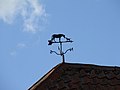 Horse and dog weather vane - geograph.org.uk - 588351.jpg 640 × 480; 38 KB
-

-
 Lane by Overbury Hall - geograph.org.uk - 5607258.jpg 640 × 480; 193 KB
-
 Lane corner near Portman's Farm - geograph.org.uk - 1265592.jpg 640 × 504; 121 KB
-
 Lane towards Hadleigh - geograph.org.uk - 5606829.jpg 640 × 480; 171 KB
-
 Lane towards Pott's Farm - geograph.org.uk - 1474369.jpg 640 × 480; 107 KB
-
 Layham Ford - geograph.org.uk - 3217133.jpg 3,872 × 2,592; 2.45 MB
-
 Layham House Cottage, Lower Layham (geograph 7177838).jpg 1,024 × 768; 194 KB
-
 Layham House, Lower Layham (geograph 7177841).jpg 1,024 × 790; 178 KB
-
 Layham Post Office, Suffolk 1978 - Flickr - sludgegulper.jpg 4,426 × 2,901; 803 KB
-
 Layham War Memorial - geograph.org.uk - 4622502.jpg 2,592 × 3,456; 3.17 MB
-
 Looking to Stoke Road Cottage (listed building), Layham - geograph.org.uk - 4463054.jpg 1,600 × 1,067; 796 KB
-
 Minor Road - geograph.org.uk - 2116440.jpg 1,200 × 1,600; 565 KB
-
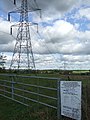
 Overhead line project notice - geograph.org.uk - 588361.jpg 480 × 640; 106 KB
-
-
 Rands Road - geograph.org.uk - 3495764.jpg 1,024 × 768; 193 KB
-
 Rands Road - geograph.org.uk - 3495768.jpg 1,024 × 768; 178 KB
-
 Sharp Bend - geograph.org.uk - 2116441.jpg 1,600 × 1,200; 722 KB
-
 Sheep And A Goat - geograph.org.uk - 3495597.jpg 1,024 × 768; 219 KB
-
 Shelley Road, Lower Layham - geograph.org.uk - 4621420.jpg 1,240 × 930; 545 KB
-
 Springtime by Stoke Road - geograph.org.uk - 1265604.jpg 640 × 494; 119 KB
-
 Stoke Road - geograph.org.uk - 5607391.jpg 640 × 480; 218 KB
-
 Stoke Road - geograph.org.uk - 5607396.jpg 640 × 480; 197 KB
-
 Stoke Road enters Lower Layham - geograph.org.uk - 5607248.jpg 640 × 480; 182 KB
-
 Stream at Masons Bridge - geograph.org.uk - 2942050.jpg 640 × 480; 90 KB
-
 The Leaning Pole Of Hadleigh - geograph.org.uk - 2116444.jpg 1,200 × 1,600; 430 KB
-
 The road to Lower Layham - geograph.org.uk - 4621411.jpg 1,240 × 930; 430 KB
-
 The Terrace, Stoke Road - geograph.org.uk - 4792351.jpg 640 × 480; 174 KB
-
 Towards Portman's Farm - geograph.org.uk - 1265596.jpg 640 × 498; 88 KB
-
 Track by hedge - geograph.org.uk - 1265615.jpg 640 × 480; 110 KB
-
 Track to east of Coram Street Wood - geograph.org.uk - 3442799.jpg 1,600 × 1,000; 564 KB
-

-
 Two mile point, Hadleigh 10 - geograph.org.uk - 5605004.jpg 640 × 428; 82 KB
-
 Two Trees - geograph.org.uk - 2116497.jpg 1,200 × 1,600; 481 KB
-
 Valley - geograph.org.uk - 2116478.jpg 1,600 × 1,200; 432 KB
-
 View east over valley of River Brett - geograph.org.uk - 5606814.jpg 640 × 480; 115 KB
-

-
 View over valley of River Brett - geograph.org.uk - 4792387.jpg 640 × 480; 138 KB
-
 Walking towards Rand's Farm, near Hadleigh - geograph.org.uk - 2735648.jpg 1,024 × 768; 322 KB
-
 Water Filled Ditch - geograph.org.uk - 2116507.jpg 1,600 × 1,200; 656 KB
-

-
 Flat Farmland - geograph.org.uk - 628158.jpg 640 × 480; 91 KB
-
 Footbridge over the River Brett - geograph.org.uk - 628151.jpg 640 × 480; 97 KB
-
 Footpath from Benton Street - geograph.org.uk - 628147.jpg 480 × 640; 90 KB
-
 Part of Rands Road near Lower Layham - geograph.org.uk - 374200.jpg 640 × 441; 63 KB
-
 Raydon Water Source - geograph.org.uk - 40594.jpg 640 × 482; 69 KB
-
 River Brett - geograph.org.uk - 628155.jpg 640 × 480; 74 KB
-
 Start of Hook Lane - geograph.org.uk - 622801.jpg 640 × 480; 95 KB


.jpg)
.jpg)


,_Layham_-_geograph.org.uk_-_4463054.jpg)


