Category:Le Moléson
Jump to navigation
Jump to search
| Object location | | View all coordinates using: OpenStreetMap |
|---|
mountain of the Swiss Prealps  | |||||
| Upload media | |||||
| Instance of | |||||
|---|---|---|---|---|---|
| Made from material | |||||
| Location |
| ||||
| Mountain range | |||||
| Topographic prominence |
| ||||
| Topographic isolation |
| ||||
| Elevation above sea level |
| ||||
| Parent peak | |||||
 | |||||
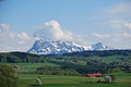
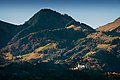
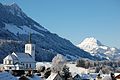
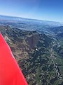
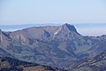
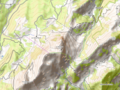
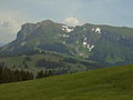
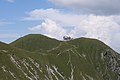
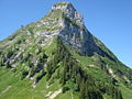
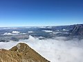
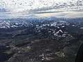
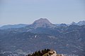
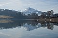
The Moleson (2,002 m) is a mountain of the Fribourg Prealps, overlooking the region of Gruyères in the canton of Fribourg. It lies at the northern end of the chain between Lake Geneva and the valley of the Sarine.
Subcategories
This category has the following 6 subcategories, out of 6 total.
A
- Aerial photographs of Le Moléson (13 F)
M
- Moleson (ship, 2010) (1 F)
N
R
- Remote views of Moléson (3 F)
T
Media in category "Le Moléson"
The following 111 files are in this category, out of 111 total.
-
 06moleson.jpg 1,600 × 1,200; 346 KB
-
 2013-05-07 Friburgo (Foto Dietrich Michael Weidmann) 029.JPG 3,872 × 2,592; 3.01 MB
-
 2013-05-07 Friburgo (Foto Dietrich Michael Weidmann) 250.JPG 3,872 × 2,592; 2.98 MB
-
 2013-05-07 Friburgo (Foto Dietrich Michael Weidmann) 268.JPG 3,872 × 2,592; 3.89 MB
-
 2013-05-07 Friburgo (Foto Dietrich Michael Weidmann) 281.JPG 3,872 × 2,592; 4.04 MB
-
 2013-05-07 Friburgo (Foto Dietrich Michael Weidmann) 282.JPG 3,872 × 2,592; 3.42 MB
-
 2013-05-07 Friburgo (Foto Dietrich Michael Weidmann) 283.JPG 3,872 × 2,592; 3.19 MB
-
 2013-05-07 Friburgo (Foto Dietrich Michael Weidmann) 284.JPG 3,872 × 2,592; 3.21 MB
-
 3 des 5 fondateurs en Suisse.jpg 4,214 × 1,715; 864 KB
-
 A travers les nuages.jpg 4,480 × 6,720; 9.29 MB
-
 Belfaux20200111161052.jpg 4,032 × 3,024; 5.72 MB
-
 Belfaux20200111161106.jpg 4,032 × 3,024; 3.38 MB
-
 Belfaux20200301113835.jpg 3,024 × 3,024; 3.73 MB
-
 Belfaux20200301114013.jpg 4,032 × 3,024; 4.47 MB
-
 Belfaux20200301115030.jpg 9,750 × 3,628; 22.14 MB
-
 Belfaux29299391113813.jpg 3,024 × 4,032; 4.45 MB
-
 ButterflyMoléson.jpg 1,396 × 1,005; 1.17 MB
-
 Charmey 07 2008 - panoramio.jpg 1,200 × 797; 809 KB
-
 Chateau de Gruyères après le lever du soleil.jpg 1,000 × 666; 701 KB
-
 Chateau de Gruyères au lever du soleil.jpg 1,000 × 666; 609 KB
-
 Church in Charmey.jpg 3,008 × 2,000; 1.55 MB
-
 Château de Gruyère et Moléson, Suisse.jpg 3,360 × 1,711; 2.51 MB
-
 Col soladier.jpg 9,974 × 3,806; 35.43 MB
-
 Dent de Lys, Le Moléson and Dent de Corjon (42951098990).jpg 5,184 × 3,456; 4.37 MB
-
 Gruyère DSC 4352 (6478390647).jpg 4,849 × 3,211; 9.31 MB
-
 Gruyères Altstadt1.jpg 591 × 400; 71 KB
-
 Gruyères Moléson 2010.jpg 2,560 × 1,920; 2.1 MB
-
 Gustave Roux 05 L'Alpage des Colombettes et le Moléson.jpg 7,876 × 4,245; 11.93 MB
-
 Intyamon20220702103926.jpg 3,024 × 4,032; 5.51 MB
-
 Le Moleson au dessus des nuages.jpg 4,857 × 3,238; 1.44 MB
-
 Le Moléson (15521610209).jpg 5,184 × 3,456; 5.1 MB
-
 Le Moléson (15693111116).jpg 5,184 × 3,456; 5.2 MB
-
 Le Moléson barn.jpg 4,608 × 3,456; 3.56 MB
-
 Le Moléson OSM.png 860 × 644; 615 KB
-
 Le Moléson seen from Le Molard (13934450646).jpg 5,184 × 3,456; 5.98 MB
-
 Le Moléson vu depuis Plan-Francey.JPG 3,264 × 2,448; 3.63 MB
-
 Le Moléson, de ses 2002m, trône sur la Gruyère.JPG 3,648 × 2,736; 3.94 MB
-
 Le Moléson.JPG 3,264 × 2,448; 677 KB
-
 Lever de soleil sur les Préalpes.jpg 1,600 × 900; 935 KB
-
 L’amour au dessus de tout.jpg 3,193 × 4,667; 5.06 MB
-
 Moleson from north-east.jpg 6,240 × 4,160; 13.21 MB
-
 Moleson from south-west.jpg 6,240 × 4,160; 13.34 MB
-
 Moleson juin 2008.jpg 1,014 × 760; 167 KB
-
 Moleson über Gruyere.jpg 916 × 461; 84 KB
-
 Moleson.JPG 3,888 × 2,592; 3.44 MB
-
 Moleson.jpg 968 × 704; 110 KB
-
 Moleson20160807.jpg 2,592 × 1,936; 1.88 MB
-
 Moleson20180311151334.jpg 3,024 × 4,032; 1.89 MB
-
 Moleson20180908.jpg 4,032 × 3,024; 1.38 MB
-
 Moleson20181103151408.jpg 4,032 × 3,024; 2.01 MB
-
 Moleson20181103151413.jpg 3,024 × 4,032; 1.95 MB
-
 Moleson20181103151447.jpg 4,032 × 3,024; 1.81 MB
-
 Moleson20200125160954.jpg 4,032 × 3,024; 5.01 MB
-
 Moleson20200125160958.jpg 3,024 × 4,032; 4.81 MB
-
 Moleson20211023113317.jpg 4,032 × 3,024; 5.25 MB
-
 Moleson20211023133353.jpg 4,032 × 3,024; 5.49 MB
-
 Moleson20211023134438.jpg 4,032 × 3,024; 3.35 MB
-
 Moleson20211023134835.jpg 4,032 × 3,024; 4.66 MB
-
 Moleson20211023134842.jpg 4,032 × 3,024; 3.61 MB
-
 Moleson20211218154222.jpg 4,032 × 3,024; 5.37 MB
-
 Moleson20211218154252.jpg 4,032 × 3,024; 5.32 MB
-
 Moleson20211218154257.jpg 3,024 × 4,032; 5.11 MB
-
 Moleson20220218130951.jpg 4,032 × 3,024; 6.47 MB
-
 Moleson20220218130956.jpg 3,024 × 4,032; 6.24 MB
-
 Moleson20221126153210.jpg 4,032 × 3,024; 5.03 MB
-
 Moleson20221126153324.jpg 4,032 × 3,024; 5.85 MB
-
 MolesonAnsichtVonPetitPlane.jpg 3,024 × 3,024; 3.79 MB
-
 MolesonView.jpg 1,589 × 1,062; 1.03 MB
-
 Moléson (12952108103).jpg 5,184 × 3,456; 5.28 MB
-
 Moléson depuis le lac de la Gruyère-b.jpg 3,888 × 2,592; 1.3 MB
-
 Moléson depuis le lac de la Gruyère-c.jpg 3,888 × 2,592; 1.32 MB
-
 Moléson depuis le lac de la Gruyère-d.jpg 3,888 × 2,592; 1.28 MB
-
 Moléson depuis le lac de la Gruyère-i.jpg 3,888 × 2,592; 4.05 MB
-
 Moléson depuis le lac de la Gruyère.jpg 3,888 × 2,592; 4.31 MB
-
 Moléson enneigé.jpg 1,600 × 900; 1.35 MB
-
 Moléson from Gruyère (22282537559).jpg 5,472 × 3,648; 3.72 MB
-
 Moléson vue aérienne.JPG 3,009 × 2,006; 3.24 MB
-
 Moléson.jpg 2,048 × 1,536; 722 KB
-
 Moléson1.JPG 3,328 × 1,968; 2.89 MB
-
 MolésonButterfly1.jpg 1,620 × 1,080; 1.3 MB
-
 MolésonButterfly2.jpg 1,620 × 1,080; 816 KB
-
 MolésonInsect.jpg 1,620 × 1,080; 843 KB
-
 MolésonInsect1.jpg 1,620 × 1,080; 758 KB
-
 MolésonSpider.jpg 1,620 × 1,080; 543 KB
-
 MolésonView.jpg 1,620 × 1,080; 957 KB
-
 OrchidMoléson.jpg 1,620 × 1,080; 815 KB
-
 Panomoleson.jpg 8,651 × 380; 510 KB
-
 Panoramic view from L'Aiguille - panoramio (1).jpg 20,131 × 2,350; 20.9 MB
-
 Panoramic view from L'Aiguille - panoramio.jpg 18,570 × 2,324; 21.9 MB
-
 Panoramic view from Le Moléson (13934179066).jpg 20,643 × 2,426; 47.35 MB
-
 Panoramic view from Le Moléson (13957645504).jpg 14,583 × 2,670; 39.86 MB
-
 Panoramic view from Le Moléson - panoramio.jpg 20,422 × 2,400; 23.38 MB
-
 Panoramic view from the Col de Lys (14697486640).jpg 14,498 × 2,623; 42.88 MB
-
 Panoramic view near La Brâ (14033435678).jpg 10,028 × 2,612; 28.87 MB
-
 Panoramic view near La Brâ - panoramio.jpg 10,028 × 2,612; 22.17 MB
-
 Pays de la Gruyère.jpg 4,608 × 2,592; 4.21 MB
-
 Philippe Blatter. Photo Serge Kurschat.jpg 5,283 × 3,153; 1.76 MB
-
 Préalpes fribourgeoises.jpg 1,600 × 900; 1.78 MB
-
 Randonnée accompagnée.jpg 1,600 × 1,067; 1.37 MB
-
 Scenic view onto the Lake of Geneva from Le Molard - panoramio (21).jpg 5,184 × 3,456; 7.14 MB
-
 Scenic view onto the Lake of Geneva from Le Molard - panoramio (22).jpg 5,184 × 3,456; 6.99 MB
-
 Station (421897983).jpg 3,264 × 2,448; 6.12 MB
-
 Swiss paragliding at Moléson peak.jpg 2,200 × 1,404; 663 KB
-
 Switzerland 2018-01-20 (39930917681).jpg 5,664 × 4,000; 1.24 MB
-
 Switzerland Moleson.jpg 2,048 × 1,260; 213 KB
-
 Teysachaux and Moleson (14708200310).jpg 5,184 × 3,456; 6 MB
-
 Teysachaux and Moleson (14894528982).jpg 5,184 × 3,456; 6.33 MB
-
 Teysachaux and Moleson seen from the Dent de Lys (14708198540).jpg 5,184 × 3,456; 6.77 MB
-
 Teysachaux.jpg 4,288 × 2,848; 4.42 MB
-
 The paraglider pilot over Sharmey - panoramio.jpg 1,024 × 799; 473 KB
-
 Via Ferrata Le Pilier, Moléson, Gruyère.jpg 3,690 × 2,764; 3.64 MB

_029.JPG)
_250.JPG)
_268.JPG)
_281.JPG)
_282.JPG)
_283.JPG)
_284.JPG)


.jpg)
.jpg)


.jpg)
.jpg)


.jpg)


.jpg)


.jpg)


.jpg)
.jpg)
.jpg)

.jpg)

.jpg)
.jpg)
.jpg)


.jpg)
.jpg)
.jpg)
.jpg)
.jpg)