Category:Lea, Herefordshire
Jump to navigation
Jump to search
village and civil parish in Herefordshire, England  | |||||
| Upload media | |||||
| Instance of | |||||
|---|---|---|---|---|---|
| Location | Herefordshire, West Midlands, England | ||||
 | |||||
English: Lea is a village and civil parish in the South East of Herefordshire, just south-east of Ross-on-Wye and adjoining Gloucestershire. Amenities include a school, church, village hall, shop, public house, garage and Post Office, all of which lie on the A40 road which passes through the village. (→Lea, Herefordshire)
Polski: Lea – wieś i civil parish w Anglii, w hrabstwie Herefordshire. W 2011 civil parish liczyła 673 mieszkańców. Lea jest wspomniana w Domesday Book (1086) jako Lecce. (→Lea (Herefordshire))

Subcategories
This category has the following 4 subcategories, out of 4 total.
Media in category "Lea, Herefordshire"
The following 200 files are in this category, out of 290 total.
(previous page) (next page)-
 12 miles from Lea to Gloucester - geograph.org.uk - 3423028.jpg 800 × 799; 188 KB
-
 A spring in his step - geograph.org.uk - 2903524.jpg 1,024 × 769; 489 KB
-

-
 A wintry scene at Rock Farm - geograph.org.uk - 1652398.jpg 640 × 480; 127 KB
-
 A40 at Lea - geograph.org.uk - 3171146.jpg 1,200 × 676; 495 KB
-
 A40 at Lea - geograph.org.uk - 6238323.jpg 1,600 × 900; 473 KB
-
 A40 at Lea Line - geograph.org.uk - 1692005.jpg 640 × 480; 223 KB
-
 A40 at Lea Line - geograph.org.uk - 3019302.jpg 1,024 × 768; 353 KB
-
 A40 at Lea, Herefordshire, 1 - geograph.org.uk - 6187549.jpg 1,600 × 901; 642 KB
-
 A40 at Lea, Herefordshire, 2 - geograph.org.uk - 6187550.jpg 1,600 × 899; 524 KB
-
 A40 in Lea - geograph.org.uk - 4624878.jpg 640 × 482; 45 KB
-
 A40, Lea - geograph.org.uk - 6276854.jpg 1,600 × 900; 445 KB
-
 Alan Keef Ltd, Lea Line - geograph.org.uk - 1691978.jpg 640 × 480; 251 KB
-
 Allotments at Lea - geograph.org.uk - 6109434.jpg 1,600 × 900; 815 KB
-
 Approach embankment, Mitcheldean Road - geograph.org.uk - 3949126.jpg 3,872 × 2,592; 3.26 MB
-
 Approaching Lea - geograph.org.uk - 2869553.jpg 1,024 × 577; 352 KB
-
 Approaching Lea - geograph.org.uk - 2947324.jpg 800 × 451; 184 KB
-
 Approaching Lea from the Northwest - geograph.org.uk - 1231840.jpg 640 × 456; 145 KB
-
 Autumnal oak - geograph.org.uk - 2160464.jpg 800 × 606; 364 KB
-
 Barley crop by the B4224 - geograph.org.uk - 896313.jpg 640 × 480; 105 KB
-
 Barley crop is ready - geograph.org.uk - 896314.jpg 640 × 338; 125 KB
-
 Barn on Hoovers Lane - geograph.org.uk - 3949734.jpg 3,872 × 2,592; 4.29 MB
-
 Beef by the crossroads at Lea - geograph.org.uk - 2945872.jpg 1,024 × 577; 308 KB
-
 Bench, litter bin and the A40, Lea - geograph.org.uk - 3423142.jpg 640 × 545; 120 KB
-
 Brick house at Lea - geograph.org.uk - 3071704.jpg 1,024 × 577; 320 KB
-
 Brook height gauge, Lea - geograph.org.uk - 3423283.jpg 537 × 640; 135 KB
-
 Brown field and church spire, Lea - geograph.org.uk - 3422433.jpg 640 × 473; 82 KB
-
 Building site by The A40, Lea - geograph.org.uk - 5543066.jpg 2,048 × 1,536; 969 KB
-
 Bus shelter on A40 opposite Lea church - geograph.org.uk - 5886463.jpg 1,600 × 1,203; 639 KB
-
 Bus stop on the A40, Lea - geograph.org.uk - 5546092.jpg 2,304 × 1,728; 1.01 MB
-
 Churn stand at Moors Farm, Lea - geograph.org.uk - 539708.jpg 640 × 480; 91 KB
-
 Clearing skies - geograph.org.uk - 1712928.jpg 456 × 640; 322 KB
-
 Cooper's Cottage - geograph.org.uk - 3570057.jpg 800 × 800; 368 KB
-
 Cottage by the Rudhall Brook - geograph.org.uk - 860893.jpg 640 × 480; 95 KB
-
 Cottage for sale - geograph.org.uk - 4250490.jpg 800 × 600; 191 KB
-
 Cottages and village shop, Lea - geograph.org.uk - 1231845.jpg 484 × 640; 123 KB
-
 Cottages in the snow, Rock Lane, Lea - geograph.org.uk - 1652416.jpg 640 × 480; 133 KB
-
 Crews Hill - geograph.org.uk - 1268966.jpg 640 × 480; 218 KB
-
 Crews Hill from the A40 - geograph.org.uk - 6071387.jpg 1,600 × 900; 845 KB
-
 Crossroads in Lea - geograph.org.uk - 6246852.jpg 1,600 × 900; 749 KB
-
 Crossroads on A40 at Lea - geograph.org.uk - 1543648.jpg 640 × 480; 49 KB
-
 Cue the music - geograph.org.uk - 1471670.jpg 640 × 438; 124 KB
-
 Cultivated field near Lea - geograph.org.uk - 2921594.jpg 1,024 × 577; 302 KB
-
 Curvaceous - geograph.org.uk - 1231871.jpg 640 × 415; 115 KB
-
 Cut hay - geograph.org.uk - 2534521.jpg 800 × 600; 360 KB
-
 Dean Common Farm - geograph.org.uk - 4412837.jpg 3,788 × 2,772; 2.23 MB
-
 Dismantled railway bridge - geograph.org.uk - 883588.jpg 640 × 480; 129 KB
-
 Down the hill to Lea - geograph.org.uk - 1652408.jpg 640 × 480; 123 KB
-
 Duelling irrigation guns - geograph.org.uk - 3558206.jpg 800 × 451; 202 KB
-
 East Dean - geograph.org.uk - 124769.jpg 640 × 479; 86 KB
-

-
 Entrance to Warren Farm near Lea - geograph.org.uk - 796762.jpg 640 × 426; 103 KB
-
 Evening grazing - geograph.org.uk - 2367553.jpg 1,024 × 683; 639 KB
-
 Farm track after harvest - geograph.org.uk - 2570336.jpg 800 × 450; 256 KB
-
 Field edge near Lea - geograph.org.uk - 3041066.jpg 1,200 × 676; 420 KB
-
 Field of gold 1 - geograph.org.uk - 2540716.jpg 800 × 600; 363 KB
-
 Field, farm and wooded hill - geograph.org.uk - 4294099.jpg 800 × 451; 183 KB
-
 Flytip by the B4224 - geograph.org.uk - 3642808.jpg 800 × 598; 224 KB
-
 Footpath across a barley crop - geograph.org.uk - 3567694.jpg 600 × 800; 280 KB
-
 Footpath across a rape crop^ - geograph.org.uk - 4251622.jpg 800 × 600; 341 KB
-
 Footpath from Lining Wood towards Lea - geograph.org.uk - 3905715.jpg 800 × 563; 156 KB
-
 Footpath realignment - geograph.org.uk - 883565.jpg 640 × 480; 104 KB
-
 Footpath through rape^ - geograph.org.uk - 2950323.jpg 1,024 × 768; 417 KB
-
 Fordson Super Major at the Lea Show - geograph.org.uk - 1472947.jpg 640 × 480; 134 KB
-
 Former school at Lea - geograph.org.uk - 724489.jpg 640 × 480; 144 KB
-
 From Gloucestershire into Herefordshire - geograph.org.uk - 3567341.jpg 800 × 451; 177 KB
-
 From Herefordshire into Gloucestershire - geograph.org.uk - 3567331.jpg 800 × 451; 168 KB
-
 Fuel prices creeping up again - geograph.org.uk - 1652413.jpg 480 × 640; 103 KB
-
 Get off of my cloud^ - geograph.org.uk - 1691931.jpg 640 × 481; 212 KB
-
 Grade II listed Brook House, Lea - geograph.org.uk - 3423163.jpg 569 × 640; 79 KB
-
 Green doors - geograph.org.uk - 3071683.jpg 1,024 × 577; 264 KB
-
 Green Lane - geograph.org.uk - 1651544.jpg 480 × 640; 126 KB
-
 Green Lane in winter - geograph.org.uk - 1638943.jpg 640 × 640; 337 KB
-
 Green Lane oak - geograph.org.uk - 3668198.jpg 800 × 600; 271 KB
-
 Green lane to Lea - geograph.org.uk - 6122267.jpg 1,600 × 900; 441 KB
-
 Grille of a Fordson Super Major - geograph.org.uk - 1472952.jpg 482 × 640; 134 KB
-
 Hairy, brown caterpillar - geograph.org.uk - 2121401.jpg 640 × 571; 304 KB
-
 Harlequin ladybird - invader - geograph.org.uk - 1971215.jpg 1,024 × 1,024; 356 KB
-
 Harvesting barley - geograph.org.uk - 896308.jpg 640 × 302; 48 KB
-
 Heading Southeast into Lea - geograph.org.uk - 1231837.jpg 480 × 640; 134 KB
-
-
 Hillside pasture - geograph.org.uk - 1971311.jpg 800 × 600; 208 KB
-
 Horses and hounds - geograph.org.uk - 1472507.jpg 640 × 446; 117 KB
-
 House on the A40, Lea - geograph.org.uk - 5543245.jpg 1,960 × 1,412; 843 KB
-
 Housing development in Lea, by A40 - geograph.org.uk - 5886996.jpg 1,600 × 963; 566 KB
-
 Housing in Lea, 1 - geograph.org.uk - 6294077.jpg 1,600 × 900; 584 KB
-
 Housing in Lea, 2 - geograph.org.uk - 6294078.jpg 1,600 × 900; 357 KB
-
 Impassable - geograph.org.uk - 883563.jpg 640 × 480; 124 KB
-
 Infilled railway line at Lea Line - geograph.org.uk - 1691999.jpg 640 × 480; 234 KB
-
 Junction at Lea on A40 - geograph.org.uk - 4656219.jpg 800 × 450; 80 KB
-
 Junction of A40 and the B4224 - geograph.org.uk - 1651589.jpg 640 × 480; 75 KB
-
 Just discernible footpath - geograph.org.uk - 1971335.jpg 800 × 600; 394 KB
-
 Lane at Lea Line, north of the A40 - geograph.org.uk - 4624877.jpg 640 × 480; 89 KB
-

-
 Late afternoon, late December - geograph.org.uk - 1638970.jpg 640 × 481; 208 KB
-
 Lea allotments 1 - geograph.org.uk - 2802538.jpg 1,024 × 577; 329 KB
-
 Lea allotments 2 - geograph.org.uk - 2802541.jpg 1,024 × 577; 317 KB
-
 Lea church with potato fields - geograph.org.uk - 3527783.jpg 800 × 451; 195 KB
-
 Lea crossroads and stone cottages - geograph.org.uk - 2921610.jpg 1,024 × 771; 447 KB
-
 Lea Garage - geograph.org.uk - 1168286.jpg 640 × 481; 178 KB
-
 Lea Garage - geograph.org.uk - 6276849.jpg 1,600 × 900; 450 KB
-
 Lea garage filling station - geograph.org.uk - 6238320.jpg 1,600 × 900; 480 KB
-
 Lea Garage, Lea - geograph.org.uk - 3423429.jpg 640 × 396; 48 KB
-
 Lea Hall and Lea Hall Cottage, Lea - geograph.org.uk - 3423116.jpg 640 × 480; 103 KB
-
 Lea House BandB - geograph.org.uk - 666431.jpg 640 × 480; 95 KB
-
 Lea House Bed ^ Breakfast, Lea - geograph.org.uk - 3423206.jpg 800 × 601; 96 KB
-
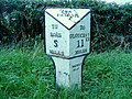 Lea milepost - geograph.org.uk - 2641686.jpg 800 × 600; 501 KB
-
 Lea Sewage Pumping Station - geograph.org.uk - 808711.jpg 640 × 426; 83 KB
-
 Lea Telephone Exchange - geograph.org.uk - 5637019.jpg 2,592 × 1,944; 1.35 MB
-
 Lea Villa Residential Park bus stop, Lea - geograph.org.uk - 3423066.jpg 800 × 566; 117 KB
-
 Lea village centre - geograph.org.uk - 2954913.jpg 1,024 × 577; 335 KB
-
 Lea Village Hall - geograph.org.uk - 3422330.jpg 800 × 543; 99 KB
-
 Lea village hall - geograph.org.uk - 3615730.jpg 800 × 451; 186 KB
-
 Lea Village Hall - geograph.org.uk - 6109437.jpg 1,600 × 899; 531 KB
-
 Lea, Herefordshire - geograph.org.uk - 4023973.jpg 800 × 451; 178 KB
-
 Lea, Herefordshire 1 - geograph.org.uk - 1268991.jpg 640 × 480; 231 KB
-
 Lea, Herefordshire 2 - geograph.org.uk - 1268994.jpg 640 × 480; 215 KB
-
 Lea, milepost - geograph.org.uk - 1245267.jpg 480 × 640; 84 KB
-
 Lea, power lines - geograph.org.uk - 1811233.jpg 1,600 × 1,200; 214 KB
-
 Lea, speed camera - geograph.org.uk - 1245282.jpg 640 × 480; 59 KB
-
 Leaning on a stile - geograph.org.uk - 1231866.jpg 640 × 439; 102 KB
-
 Limewashed cottages, Lea - geograph.org.uk - 3423353.jpg 773 × 800; 144 KB
-
 Local walking group - geograph.org.uk - 1712939.jpg 640 × 618; 478 KB
-
 Maize crop - geograph.org.uk - 883594.jpg 640 × 326; 52 KB
-
 Maize crop north of Warren Lane - geograph.org.uk - 860900.jpg 640 × 480; 106 KB
-
 Milepost at The Lea - geograph.org.uk - 1691962.jpg 480 × 640; 244 KB
-
 Minor crossroads - geograph.org.uk - 1135323.jpg 640 × 480; 102 KB
-
 More housing development, Lea, 1 - geograph.org.uk - 6276846.jpg 1,600 × 900; 507 KB
-
 Noden Drive, Lea - geograph.org.uk - 3071688.jpg 1,024 × 577; 287 KB
-
 Obstructed footpath - geograph.org.uk - 4656223.jpg 800 × 450; 121 KB
-
 Old Hill Cottages - geograph.org.uk - 3071691.jpg 1,024 × 577; 306 KB
-
 Old Milepost by the A40, Castle End Farm, Lea parish (geograph 6048563).jpg 1,251 × 1,704; 439 KB
-
 Old Milepost by the A40, Lea Line, Lea parish - geograph.org.uk - 6050511.jpg 1,143 × 1,704; 414 KB
-
 Old railway bridge abutments - geograph.org.uk - 3949705.jpg 3,872 × 2,592; 4.64 MB
-
 Old railway bridge abutments at Hoovers Lane - geograph.org.uk - 3949720.jpg 3,872 × 2,592; 4.83 MB
-
 Old railway bridge and cutting - geograph.org.uk - 3949672.jpg 3,872 × 2,592; 4.85 MB
-
 Old railway cutting and bridge - geograph.org.uk - 3949664.jpg 3,872 × 2,592; 4.8 MB
-
 Old railway fencing at Lea - geograph.org.uk - 4034658.jpg 3,872 × 2,592; 4.85 MB
-
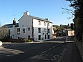
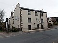
 Old stone building, Lea - geograph.org.uk - 6187551.jpg 1,600 × 900; 896 KB
-
 On the border - geograph.org.uk - 2534508.jpg 800 × 500; 325 KB
-
 On your marks, get set - geograph.org.uk - 1471608.jpg 640 × 431; 166 KB
-
 Orchard View, Lea - geograph.org.uk - 2954907.jpg 1,024 × 577; 296 KB
-
 Parallel power lines - geograph.org.uk - 1651535.jpg 640 × 480; 104 KB
-
 Park Homes off the A40 near Lea - geograph.org.uk - 640192.jpg 640 × 457; 98 KB
-
 Partly-harvested barley crop - geograph.org.uk - 4127242.jpg 800 × 450; 101 KB
-
 Pastoral scene near Lea - geograph.org.uk - 2394710.jpg 800 × 600; 402 KB
-
 Path, mud and railway cutting edge - geograph.org.uk - 4656227.jpg 800 × 450; 153 KB
-
 Penyard View - geograph.org.uk - 1651520.jpg 480 × 640; 111 KB
-
 Petrol station by The A40, Lea - geograph.org.uk - 5543071.jpg 2,014 × 1,490; 782 KB
-
 Phone box near Lea - geograph.org.uk - 4102591.jpg 2,592 × 3,872; 4.07 MB
-

-
 Pink sheep - geograph.org.uk - 2246307.jpg 800 × 600; 426 KB
-
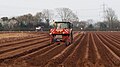 Planting potatoes, 2019 - geograph.org.uk - 6109435.jpg 1,600 × 900; 403 KB
-

-
 Potato crates or bins at Rock Farm - geograph.org.uk - 3046550.jpg 1,200 × 766; 654 KB
-
 Potato crop West of Warren Farm - geograph.org.uk - 860906.jpg 640 × 319; 55 KB
-
 Potato field, Lea - geograph.org.uk - 6257016.jpg 1,600 × 900; 496 KB
-
 Potato land - geograph.org.uk - 3479165.jpg 800 × 501; 190 KB
-
 Potato ridge curves - geograph.org.uk - 2869615.jpg 1,024 × 577; 349 KB
-
 Potato tramlines - geograph.org.uk - 2354723.jpg 1,024 × 768; 700 KB
-
 Potato tramlines, 2019 - geograph.org.uk - 6122292.jpg 1,600 × 1,203; 491 KB
-
 Potato tramlines, Lea - geograph.org.uk - 3455184.jpg 800 × 451; 196 KB
-
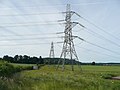
 Power lines - geograph.org.uk - 847900.jpg 640 × 480; 69 KB
-
 Power lines and road bend - geograph.org.uk - 4656228.jpg 800 × 450; 89 KB
-
 Power lines crossing a field north of Lea - geograph.org.uk - 5886457.jpg 1,600 × 941; 536 KB
-
 Power lines near Lea, Herefordshire - geograph.org.uk - 971405.jpg 640 × 426; 74 KB
-
 Power lines passing through - geograph.org.uk - 1135328.jpg 640 × 442; 105 KB
-
 Powerlines near Crews Hill - geograph.org.uk - 808733.jpg 640 × 426; 91 KB
-
 Pumping station, Lea - geograph.org.uk - 444865.jpg 640 × 480; 356 KB
-
 Pylons by the B4224 - geograph.org.uk - 847894.jpg 640 × 480; 64 KB
-
 Rape and polytunnels - geograph.org.uk - 3504017.jpg 800 × 451; 198 KB
-
 Red soil of South Herefordshire - geograph.org.uk - 1712938.jpg 640 × 440; 288 KB
-

-
 Ridge and furrow - geograph.org.uk - 2880662.jpg 1,024 × 576; 333 KB
-
 Road junction for A40 in Lea - geograph.org.uk - 5886461.jpg 1,600 × 1,230; 794 KB
-
 Road junction off A40 between Lea church and Lea - geograph.org.uk - 5886984.jpg 1,600 × 1,200; 715 KB
-
 Road to Aston Crews - geograph.org.uk - 1268986.jpg 640 × 480; 229 KB
-
 Road to Mitcheldean from Lea - geograph.org.uk - 3423251.jpg 800 × 549; 118 KB
-
 Road towards Pontshill - geograph.org.uk - 4656224.jpg 800 × 450; 116 KB
-
 Rock Farm, January 2010 - geograph.org.uk - 1652402.jpg 640 × 485; 121 KB
-
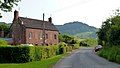
 Rock Farm, Lea - geograph.org.uk - 3046553.jpg 1,200 × 676; 349 KB
-
 Rock Farm, Lea - geograph.org.uk - 4046323.jpg 800 × 451; 208 KB
-
 Rock Farm, Lea - geograph.org.uk - 666423.jpg 640 × 480; 188 KB
-
 Rock Lane, Lea - geograph.org.uk - 1651635.jpg 640 × 479; 90 KB
-
 Rock Lane, Lea - geograph.org.uk - 3423448.jpg 800 × 510; 87 KB
-
 Rock outcrop on the edge of Cornage Wood - geograph.org.uk - 1971315.jpg 800 × 600; 463 KB
-

-
 Row of red sandstone cottages - geograph.org.uk - 666487.jpg 640 × 443; 94 KB
-
 Rudhall valley, late summer - geograph.org.uk - 3642877.jpg 800 × 451; 199 KB
-
 Rudhall View 1 - geograph.org.uk - 1168274.jpg 640 × 480; 212 KB
-
 Rudhall View 2 - geograph.org.uk - 1168279.jpg 640 × 480; 204 KB
-
 Rural Herefordshire in Maytime - geograph.org.uk - 808724.jpg 640 × 426; 66 KB
-
 Saunders Close, Lea - geograph.org.uk - 4659511.jpg 800 × 451; 193 KB
-
 Sheep in the Mud - geograph.org.uk - 4409139.jpg 4,000 × 3,000; 1.72 MB
-
 Sheep in winter - geograph.org.uk - 1691947.jpg 640 × 480; 216 KB
-
 Short footpath to the B4224 - geograph.org.uk - 1135317.jpg 640 × 425; 92 KB
-
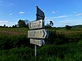 Signpost in need of some TLC - geograph.org.uk - 2954897.jpg 1,024 × 768; 454 KB
-

-

-
 Snow, sheep and hillside, 1 - geograph.org.uk - 6046327.jpg 800 × 450; 157 KB


_Primary_School,_Lea_-_geograph.org.uk_-_3422297.jpg)


.jpg)


