Category:Leamside Line
Jump to navigation
Jump to search
railway line in the UK  | |||||
| Upload media | |||||
| Instance of |
| ||||
|---|---|---|---|---|---|
| Location | England | ||||
| Operator |
| ||||
| Length |
| ||||
| Terminus |
| ||||
 | |||||
English: The Leamside Line (originally part of the Durham Junction Railway) is a railway line in the North East of England, branching off from the main East Coast Main Line (ECML) at Tursdale Junction in County Durham, and continuing north through Washington and Wardley, finally joining the Newcastle to Sunderland line at Pelaw Junction.
It is currently out of use, having been mothballed by British Rail in 1991 after the closure of the Freightliner freight terminal at Follingsby, near Washington, which was the recipient of most of the line's traffic in its last years. A very short section of the line from Pelaw Junction remained in operation for a number of years, serving the open-cast coal mine at Wardley, but this too has now closed.
Subcategories
This category has the following 11 subcategories, out of 11 total.
D
F
L
- Leamside railway station (2 F)
P
- Penshaw railway station (3 F)
S
T
- Tursdale Junction (4 F)
U
- Usworth railway station (2 F)
V
- Victoria Viaduct (13 F)
Media in category "Leamside Line"
The following 26 files are in this category, out of 26 total.
-
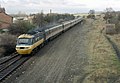 Intercity 125 train Leamside 1990.jpg 3,198 × 2,220; 5.65 MB
-
-
 Coxgreen Road Bridge, Penshaw.jpg 4,272 × 2,848; 2.41 MB
-
 Disused railway line at Whitwell Grange - geograph.org.uk - 239769.jpg 640 × 480; 109 KB
-
 Disused Railway Line near Follingsby - geograph.org.uk - 1717974.jpg 600 × 450; 192 KB
-
 Disused railway line, Follingsby - geograph.org.uk - 133252.jpg 640 × 480; 61 KB
-

-
 Disused Railway Track, North of Sherburn - geograph.org.uk - 78707.jpg 640 × 480; 148 KB
-

-
 Leamside Line at Penshaw.jpg 4,272 × 2,848; 2.89 MB
-
 Leamside Line Bullhead Rails at former Usworth Station site.jpg 4,272 × 2,848; 2.73 MB
-
 Leamside Line Southbound View to Washington Station.jpg 2,848 × 4,272; 1.64 MB
-
 Leamside Line track at Wardley.jpg 4,272 × 2,848; 2.37 MB
-
 Leamside Line track at Washington (A1231).jpg 4,272 × 2,848; 2.37 MB
-
 Leamside Line track under the A1231.jpg 4,272 × 2,848; 1.54 MB
-
 Leamside Line Trackbed.jpg 2,848 × 4,272; 2.62 MB
-
 Leamside Line, Washington Tyne and Wear.jpeg 4,272 × 2,848; 1.7 MB
-
 Leamside Line, Washington, Tyne and Wear.jpeg 4,272 × 2,848; 2.07 MB
-
 Leamside Line- Wardley, Northbound View to Pelaw Junction.jpg 4,272 × 2,848; 2.01 MB
-
 Lines near Usworth Hall - geograph.org.uk - 223501.jpg 640 × 480; 104 KB
-
 Low Newton Junction Nature Reserve - geograph.org.uk - 351788.jpg 640 × 480; 84 KB
-
 Penshaw – Leamside Line.jpg 2,848 × 4,272; 2.6 MB
-
 The Leamside Line - geograph.org.uk - 352174.jpg 640 × 480; 77 KB
-
 Tursdale Junction geograph-2141659.jpg 1,024 × 552; 252 KB
-
 Wardley Northbound View to Pelaw Junction.jpg 4,272 × 2,848; 2.32 MB
-
 Wardley Southbound View.jpg 4,272 × 2,848; 1.71 MB


.jpg)


