Category:Ledige Stede 1-3, Elburg
Jump to navigation
Jump to search
| Object location | | View all coordinates using: OpenStreetMap |
|---|
 | |||||
| Upload media | |||||
| Instance of | |||||
|---|---|---|---|---|---|
| Location | Elburg, Gelderland, Netherlands | ||||
| Street address |
| ||||
| Located on street |
| ||||
| Heritage designation |
| ||||
 | |||||
|
This is a category about rijksmonument number 14788
|
|
This is a category about rijksmonument number 14788
|
| Address |
|
Media in category "Ledige Stede 1-3, Elburg"
The following 23 files are in this category, out of 23 total.
-
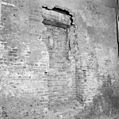
 Achtergevel - Elburg - 20069090 - RCE.jpg 1,191 × 1,200; 421 KB
-
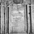
 Achtergevel - Elburg - 20069091 - RCE.jpg 1,190 × 1,200; 445 KB
-

-

-

-
-

-

-

-
-

-
 Elburg - Jufferenstraat - View on Ledige Stede.jpg 3,915 × 2,592; 11.18 MB
-
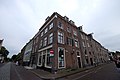
 Elburg - Ledige Stede - View SW.jpg 1,600 × 1,071; 314 KB
-
 Elburg, Netherlands - panoramio (103).jpg 2,048 × 1,155; 501 KB
-
 Elburg, Netherlands - panoramio (72).jpg 4,896 × 3,264; 2.3 MB
-
 Elburg, Netherlands - panoramio (78).jpg 2,048 × 1,155; 537 KB
-
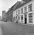
 Elburg- Ledige Stede 3.JPG 3,840 × 2,160; 3.52 MB
-
 Overzicht - Elburg - 20069085 - RCE.jpg 1,190 × 1,200; 337 KB
-
 Overzicht - Elburg - 20069086 - RCE.jpg 1,193 × 1,200; 324 KB
-
 RM14788 Ledige Stede 1.JPG 2,580 × 4,101; 3.01 MB
-
 Topgevel - Elburg - 20069089 - RCE.jpg 1,188 × 1,200; 303 KB
-
 Voorgevels - Elburg - 20069087 - RCE.jpg 1,197 × 1,200; 372 KB
-
 Voorgevels - Elburg - 20069088 - RCE.jpg 1,193 × 1,200; 377 KB


_in_2e_balkvak_(geteld_vanaf_de_Jufferstraat)_-_Elburg_-_20069092_-_RCE.jpg)


.jpg)
.jpg)
.jpg)


