This is a main category requiring frequent diffusion and maybe maintenance. As many pictures and media files as possible should be moved into appropriate subcategories.
<nowiki>Leeds; Leeds; Leeds; Leeds; Лидс; Leeds; لیڈز; لیڈز; Leeds; Лідс; 利兹; Leeds; Lids; Лидс; Leeds; Leeds; Leeds; Leeds; लीड्स; Лидс; Leeds; Leeds; Lids; ليدز; Leeds; 列斯; Лидс; Leeds; Leeds; Leeds; Leeds; Leeds; Leeds; لیدز; 利兹; Leeds; ლიდზი; リーズ; Leeds; Leeds; ليدز; ලීඩ්ස්; Ledesia; लीड्स; 利兹; Leeds; Leeds; இலீட்சு; Лідс; Lids; Leeds; ลีดส์; Leeds; Lids; Leeds; Leeds; لیدز; Лийдс; Leeds; 列斯; Leeds; 里茲; Leeds; 리즈; Leeds; Leeds; Leeds; লিডস; 利兹; לידז; Leeds; Leeds; Līdsa; Leeds; Leeds; 利兹; Leeds; Leeds; ಲೀಡ್ಸ್; لیدز; Leeds; Leeds; લીડ્ઝ; Leeds; Loidis; لیدز; Leeds; Leeds; Лидс; Лідс; Λιντς; Leeds; Leeds; लीड्स; Leeds; Leeds; Leeds; Leeds; Leeds; לידס; Лидс; Leeds; Leeds; లీడ్స్; ܠܝܕܣ; Leeds; ꯂꯤꯗ꯭ꯁ (ꯃꯐꯝ); ലീഡ്സ്; Leeds; Leeds; Leeds; Լիդս; Leeds; 列斯; Лидс; Leeds; Leeds; Leeds; Leeds; ሊድስ; Leeds; Leeds; Leeds; Leeds; Lidsas; Leeds; Lungsod ng Leeds; Лидс; Лидс; Leeds; Leeds; Leeds; 里茲; Leeds; Ritis; Leeds; ਲੀਡਸ; Leeds; Leeds; 利兹; Leeds; ciudad de Yorkshire del Oeste, Inglaterra, Reino Unido; ইংল্যান্ডের শহর; ville d'Angleterre, Royaume-Uni; grad u Engleskoj; ciutat d'Anglaterra; sídlo v hrabství West Yorkshire ve Velké Británii; Angliai város; город в Англии, административный центр одноимённого городского региона; city in West Yorkshire, England, United Kingdom; Stadt in West Yorkshire, England, Vereinigtes Königreich; Cidade inglesa; city in West Yorkshire, England, United Kingdom; zità te la Nghiltiera; 英国英格兰城市; Dinas yn Lloegr; Ingiltere'de bir şehir; イングランドの都市; citate in West Yorkshire, Anglaterra; stad i West Yorkshire, England, Storbritannien; Kota dan Distrik Metropolitan Inggris; 英国英格兰西约克郡城市; by i England; stad in Verenigd Koninkrijk; עיר בממלכה המאוחדת; città del Regno Unito in Inghilterra; kapital sa kondado; kaupunki Englannissa, Yhdistyneessä kuningaskunnassa; cidade do norte de Inglaterra; مدينة في انجلترا; Πόλη της Αγγλίας; இங்கிலாந்தில் மேற்கு யோக்ஷயரில் உள்ள ஒரு நகரம்; Ciudad de Leeds; Cross Gates; City of Leeds; लीड्झ; Leeds; Leeds; 列斯; 里茲; Leeds; Лидз; ლიდსი; Leeds, West Yorkshire; לידז; Leeds; Leedesium; Loidae; Loidis; Leodis; 列斯; Leeds; Lydsas; Leeds, West Yorkshire; رىتىس; ܠܝܕܙ; لييدز; ليدس; Leeds; லீட்சு; லீட்ஸ்</nowiki>


.svg)


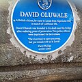 Blue Plaque for David Oluwale (replacement).jpg 1,993 × 1,993; 1.31 MB
 Leeds (122767106).jpg 640 × 480; 64 KB
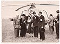 Leeds 1950.jpg 4,388 × 3,261; 1.65 MB
 Leeds Collage 3.jpg 7,080 × 6,768; 10.86 MB
 Leeds New Collage.jpg 3,264 × 3,264; 10.39 MB
 Leeds Wikivoyage Banner.png 2,100 × 302; 1.29 MB
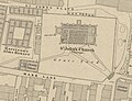 OS map of St John's, Leeds, surveyed 1847.jpg 772 × 591; 112 KB
 South Bank, Leeds.jpg 2,850 × 1,750; 4.04 MB
.jpg)
.jpg)


