Category:Leidseplein 12, Amsterdam
Jump to navigation
Jump to search
| Object location | | View all coordinates using: OpenStreetMap |
|---|
 | |||||
| Upload media | |||||
| Instance of |
| ||||
|---|---|---|---|---|---|
| Location | Amsterdam, North Holland, Netherlands | ||||
| Street address |
| ||||
| Has part(s) | |||||
| Heritage designation |
| ||||
 | |||||
|
This is a category about rijksmonument number 3314
|
| Address |
|
Subcategories
This category has only the following subcategory.
L
- Leidseplein Theater (Amsterdam) (19 F)
Media in category "Leidseplein 12, Amsterdam"
The following 7 files are in this category, out of 7 total.
-
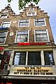 Leidseplein 12 - RM 3314 - DSC04138.jpg 4,000 × 6,000; 3.46 MB
-
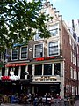 Leidseplein 12.JPG 2,304 × 3,072; 1.72 MB
-
 Leidseplein 14.JPG 2,304 × 3,072; 1.72 MB
-
 Leidseplein 16.JPG 2,304 × 3,072; 1.72 MB
-
 Leidseplein nr. 14.JPG 2,304 × 3,072; 1.72 MB
-
 Ludwig Willem Reymert Wenckebach, Afb 010194001543.jpg 1,845 × 1,963; 947 KB
-
 Stadsarchief Amsterdam, Afb OSIM00001004732.jpg 2,878 × 3,706; 1.16 MB


