Category:Leliegracht 54, Amsterdam
Jump to navigation
Jump to search
| Object location | | View all coordinates using: OpenStreetMap |
|---|
 | |||||
| Upload media | |||||
| Instance of |
| ||||
|---|---|---|---|---|---|
| Location | Amsterdam, North Holland, Netherlands | ||||
| Street address |
| ||||
| Located on street | |||||
| Heritage designation |
| ||||
 | |||||
|
This is a category about rijksmonument number 3478
|
| Address |
|
Media in category "Leliegracht 54, Amsterdam"
The following 6 files are in this category, out of 6 total.
-
 Gebroeders Douwes, Afb B00000031409.jpg 6,822 × 5,010; 2.72 MB
-
 Leliegracht 36-52 (v.r.n.l.).jpg 6,822 × 5,010; 2.72 MB
-
 Leliegracht 52.JPG 2,240 × 3,016; 1.38 MB
-
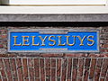 Leliegracht 54, gevelsteen LELYSLUYS .JPG 4,026 × 3,024; 2.47 MB
-
 Leliegracht 54.JPG 896 × 2,528; 577 KB
-
 Leliegracht tussen Keizersgracht en Prinsengracht.jpg 2,040 × 1,332; 454 KB

.jpg)


