Category:Lenzie
Jump to navigation
Jump to search
town in East Dunbartonshire, Scotland, UK .jpg) | |||||
| Upload media | |||||
| Instance of | |||||
|---|---|---|---|---|---|
| Location |
| ||||
| Population |
| ||||
 | |||||
Lenzie is a village in East Dunbartonshire, Scotland. It lies to the south of Kirkintilloch.
Subcategories
This category has the following 11 subcategories, out of 11 total.
D
- Andy Dunlop (3 F)
G
- Gadloch Farm (9 F)
L
- Lenzie Golf Course (14 F)
- Lenzie Moss (26 F)
- Lenzie Old Parish Church (2 F)
- Lenzie railway station (10 F)
- Loch Farm, Lenzie (5 F)
M
S
- St Cyprian's Church, Lenzie (2 F)
W
- Woodilee Hospital (5 F)
Media in category "Lenzie"
The following 50 files are in this category, out of 50 total.
-
 "Puddle" by the railway line - geograph.org.uk - 1476124.jpg 640 × 480; 125 KB
-
 Abandoned bale - geograph.org.uk - 1518228.jpg 640 × 480; 72 KB
-
-
 Auchinloch and Gadloch from the air (geograph 5681704).jpg 640 × 480; 168 KB
-
 Bearhill Farm - geograph.org.uk - 1476092.jpg 640 × 480; 114 KB
-
 Bearhill Farm - geograph.org.uk - 57738.jpg 640 × 480; 101 KB
-
 Beech Road (geograph 4968501).jpg 1,024 × 683; 572 KB
-
 Beech Road, Lenzie - geograph.org.uk - 4968502.jpg 1,024 × 683; 424 KB
-
 Beech Road, Lenzie, 1902.jpg 816 × 522; 165 KB
-
 Boghead Road - geograph.org.uk - 1476117.jpg 640 × 480; 136 KB
-
 Boghead Road, entering Lenzie - geograph.org.uk - 1476103.jpg 640 × 480; 138 KB
-
 Byars Road - geograph.org.uk - 124691.jpg 640 × 480; 178 KB
-
 Campsie View School, Lenzie - geograph.org.uk - 1476111.jpg 640 × 480; 132 KB
-
 Closed off road, Woodlee - geograph.org.uk - 3623653.jpg 640 × 480; 352 KB
-

-
 Crosshill Road, Boghead - geograph.org.uk - 1473856.jpg 640 × 480; 127 KB
-
 Cycle path down to Woodside Avenue - geograph.org.uk - 1476211.jpg 480 × 640; 159 KB
-
 Downtown Lenzie (5998972614).jpg 3,648 × 2,736; 3.21 MB
-
 Field of cattle near Boghead - geograph.org.uk - 1473854.jpg 640 × 480; 117 KB
-
 Garngaber Avenue - geograph.org.uk - 1473972.jpg 640 × 480; 144 KB
-
-
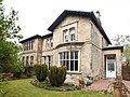
 Glenhead, Lenzie, Entrance Doorway.png 471 × 710; 642 KB
-
 Glenhead, Lenzie, Entrance Hall.png 540 × 718; 716 KB
-
 Glenhead, Lenzie.png 993 × 702; 1.25 MB
-
 Heather Road, Lenzie - geograph.org.uk - 1473858.jpg 640 × 480; 126 KB
-
 High Gallowhill - geograph.org.uk - 4684539.jpg 1,024 × 683; 123 KB
-
 House at Boghead - geograph.org.uk - 57742.jpg 640 × 480; 136 KB
-
 House in Boghead - geograph.org.uk - 1476099.jpg 640 × 480; 136 KB
-
 Junction, A806 - geograph.org.uk - 3623656.jpg 640 × 480; 324 KB
-
 Kirkintilloch Road, Lenzie (geograph 5293328).jpg 1,600 × 1,200; 406 KB
-
 Lenzie and Kirkintilloch from the air (geograph 2965815).jpg 640 × 433; 221 KB
-
 Lenzie church spire (geograph 4968527).jpg 600 × 800; 176 KB
-
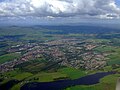 Lenzie from the air (Geograph 2518981 by Thomas Nugent).jpg 640 × 480; 88 KB
-
 Lenzie Moss Primary School - geograph.org.uk - 3036307.jpg 640 × 480; 71 KB
-
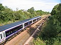
 Lenzie railway station - looking towards Bishopbriggs.JPG 4,608 × 3,456; 3.61 MB
-
 Lenzie railway station looking towards Croy.JPG 4,608 × 3,456; 3.63 MB
-
 Lenzie Union Parish Church (geograph 3036289).jpg 640 × 480; 70 KB
-
 Lenzie, Garngaber Avenue - geograph.org.uk - 4684546.jpg 1,024 × 683; 208 KB
-
 Mini-roundabout at Auchinloch Road - geograph.org.uk - 1476168.jpg 640 × 480; 135 KB
-
 Netherhouses near Lenzie - geograph.org.uk - 128751.jpg 640 × 448; 56 KB
-
 Railway Line east of Lenzie - geograph.org.uk - 3800375.jpg 640 × 480; 82 KB
-
 Sharp bend approaching on Crosshill Road - geograph.org.uk - 1473851.jpg 640 × 480; 114 KB
-
 The Greens - geograph.org.uk - 3232642.jpg 640 × 360; 192 KB
-
 The Tower Nursery, Lenzie (geograph 6186567).jpg 1,600 × 1,192; 317 KB
-
 Trees (4019564352).jpg 375 × 500; 110 KB
-
 Victoria Road, Lenzie - geograph.org.uk - 1473863.jpg 640 × 480; 126 KB
-
 View to Lenzie from Crosshill Road - geograph.org.uk - 1476087.jpg 640 × 480; 117 KB
-
 Warwick Croft.jpg 640 × 480; 63 KB
-
 Wester Boghead Holdings - geograph.org.uk - 57744.jpg 640 × 480; 107 KB
-
 Woodland near Lenzie - geograph.org.uk - 5346523.jpg 640 × 379; 52 KB


.jpg)


.jpg)


.jpg)


.jpg)
.jpg)
.jpg)


.jpg)


.jpg)
.jpg)


