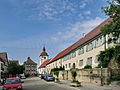
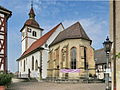
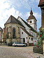
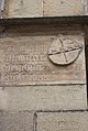
Category:Leonhardskirche (Knittlingen)
Jump to navigation
Jump to search
| Object location | | View all coordinates using: OpenStreetMap |
|---|
church  | |||||
| Upload media | |||||
| Instance of | |||||
|---|---|---|---|---|---|
| Named after | |||||
| Location | Knittlingen, Enz, Karlsruhe Government Region, Baden-Württemberg, Germany | ||||
| Architectural style | |||||
| Heritage designation | |||||
 | |||||
Subcategories
This category has only the following subcategory.
Media in category "Leonhardskirche (Knittlingen)"
The following 33 files are in this category, out of 33 total.
-
 20140908 Leonhardskirche - Knittlingen 001.JPG 1,600 × 1,200; 718 KB
-
 20140908 Leonhardskirche - Knittlingen 002.JPG 1,600 × 1,200; 747 KB
-
 20140908 Leonhardskirche - Knittlingen 003.JPG 1,200 × 1,600; 642 KB
-
 20140908 Leonhardskirche - Knittlingen 004.JPG 1,600 × 1,200; 764 KB
-
 20140908 Leonhardskirche - Knittlingen 005.JPG 1,200 × 1,600; 651 KB
-
 20140908 Leonhardskirche - Knittlingen 006.JPG 1,200 × 1,600; 667 KB
-
 20140908 Leonhardskirche - Knittlingen 007.JPG 1,600 × 1,200; 743 KB
-
 20140908 Leonhardskirche - Knittlingen 008.JPG 1,200 × 1,600; 746 KB
-
 20140908 Leonhardskirche - Knittlingen 009.JPG 1,600 × 1,243; 895 KB
-
 20140908 Leonhardskirche - Knittlingen 010.JPG 1,200 × 1,600; 701 KB
-
 20140908 Leonhardskirche - Knittlingen 011.JPG 1,200 × 1,600; 582 KB
-
 20140908 Leonhardskirche - Knittlingen 012.JPG 1,600 × 1,200; 613 KB
-
 20140908 Leonhardskirche - Knittlingen 013.JPG 1,600 × 1,200; 830 KB
-
 20140908 Leonhardskirche - Knittlingen 014.JPG 1,600 × 1,096; 430 KB
-
 20140908 Leonhardskirche - Knittlingen 015.JPG 1,600 × 1,200; 618 KB
-
 20140908 Leonhardskirche - Knittlingen 016.JPG 1,064 × 1,600; 427 KB
-
 20140908 Leonhardskirche - Knittlingen 017.JPG 1,600 × 1,200; 451 KB
-
 20140908 Leonhardskirche - Knittlingen 018.JPG 1,200 × 1,600; 664 KB
-
 20140908 Leonhardskirche - Knittlingen 019.JPG 1,200 × 1,600; 666 KB
-
 20140908 Leonhardskirche - Knittlingen 020.JPG 1,600 × 1,067; 663 KB
-
 20140908 Leonhardskirche - Knittlingen 021.JPG 1,067 × 1,600; 610 KB
-
 20140908 Leonhardskirche - Knittlingen 022.JPG 1,067 × 1,600; 629 KB
-
 20140908 Leonhardskirche - Knittlingen 023.JPG 1,600 × 1,067; 673 KB
-
 20140908 Leonhardskirche - Knittlingen 024.JPG 1,066 × 1,600; 538 KB
-
 20140908 Leonhardskirche - Knittlingen 025.JPG 1,067 × 1,600; 573 KB
-
 20140908 Leonhardskirche - Knittlingen 026.JPG 1,067 × 1,600; 535 KB
-
 20140908 Leonhardskirche - Knittlingen 027.JPG 1,067 × 1,600; 600 KB
-
 Church Of Knittlingen - panoramio.jpg 4,320 × 3,240; 4.27 MB
-
 Knittlingen St. Leonhardskirche 151.JPG 2,916 × 2,432; 5.12 MB
-
 Knittlingen St. Leonhardskirche 152.JPG 2,265 × 3,376; 6.19 MB
-
 Knittlingen St. Leonhardskirche 153.JPG 2,496 × 3,718; 5.58 MB
-
 Knittlingen St. Leonhardskirche147.JPG 2,108 × 3,844; 4.99 MB
-
 Knittlingen St. Leonhardskirche150.JPG 2,592 × 3,888; 7.86 MB


