Category:Lepton, West Yorkshire
Jump to navigation
Jump to search
suburb of Huddersfield, West Yorkshire, United Kingdom .JPG) | |||||
| Upload media | |||||
| Instance of | |||||
|---|---|---|---|---|---|
| Location | Huddersfield, Kirklees, West Yorkshire, Yorkshire and the Humber, England | ||||
| Different from | |||||
 | |||||
Subcategories
This category has the following 7 subcategories, out of 7 total.
L
- Lepton Lane, Kirkburton (6 F)
M
- Lepton Methodist Church (2 F)
S
- St John's Church, Lepton (8 F)
- The Star, Lepton (3 F)
- The Sun, Lepton (2 F)
T
- The Tandem, Kirkburton (2 F)
- Thurgory Lane (6 F)
Media in category "Lepton, West Yorkshire"
The following 50 files are in this category, out of 50 total.
-
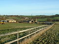
 Across farmland neat High Green - geograph.org.uk - 92047.jpg 640 × 480; 108 KB
-
-
-
 Botany Lane, Lepton - geograph.org.uk - 558970.jpg 640 × 456; 75 KB
-
 Botany, Lepton - geograph.org.uk - 558961.jpg 640 × 474; 79 KB
-
 Castle hill (2153542854).jpg 3,452 × 1,524; 2.82 MB
-
-
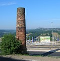 Chimney at Lepton, near Huddersfield - geograph.org.uk - 25155.jpg 637 × 640; 373 KB
-
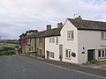
 Cottage, Rowley Lane, Lepton - geograph.org.uk - 558818.jpg 640 × 464; 73 KB
-
 Field off Gawthorpe Green Lane, Lepton - geograph.org.uk - 558898.jpg 640 × 480; 119 KB
-
 Footpath off Gawthorpe Green Lane, Lepton - geograph.org.uk - 558892.jpg 480 × 640; 100 KB
-
 Footpath off Wakefield Road, Lepton - geograph.org.uk - 765228.jpg 468 × 640; 149 KB
-
 Footpath to Lepton - geograph.org.uk - 729084.jpg 640 × 427; 70 KB
-

-
 Former barn, Gawthorpe Green Lane, Lepton - geograph.org.uk - 558882.jpg 640 × 476; 152 KB
-

-

-
 From the edge of Low Wood towards the A642 - geograph.org.uk - 92050.jpg 640 × 480; 131 KB
-
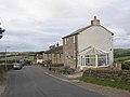
 Gawthorpe Green Farm, Lepton - geograph.org.uk - 558888.jpg 640 × 470; 88 KB
-
 Green Balk Lane, Lepton - geograph.org.uk - 558849.jpg 640 × 480; 103 KB
-

-
 Hillside above Wakefield Road, Lepton - geograph.org.uk - 762377.jpg 640 × 484; 90 KB
-
 Houses at Gawthorpe Green, Lepton - geograph.org.uk - 558871.jpg 640 × 480; 144 KB
-

-
 Lepton, Huddersfield, P6030003 (RLH).JPG 2,277 × 951; 421 KB
-

-
 Lower House, Lepton - geograph.org.uk - 727858.jpg 640 × 427; 81 KB
-
 Milepost, Wakefield Road, Lepton.jpg 480 × 640; 268 KB
-
 Milestone.Penistone Road, Lepton - geograph.org.uk - 396722.jpg 640 × 480; 131 KB
-

-
 Old Milestone, A642, Wakefield Road, Lepton (geograph 6068797).jpg 718 × 960; 135 KB
-
 Old Toll House (geograph 6115115).jpg 1,234 × 947; 261 KB
-
 Paul Lane, Lepton - geograph.org.uk - 759692.jpg 640 × 480; 93 KB
-
 Pinfold and Town End Lanes - geograph.org.uk - 122090.jpg 640 × 480; 78 KB
-

-

-
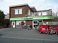
 Post office, Highgate Lane, Lepton - geograph.org.uk - 764427.jpg 640 × 480; 67 KB
-
-
 Roundabout, Wakefield Road, Lepton - geograph.org.uk - 762346.jpg 640 × 458; 66 KB
-
 Rowley Lane, Lepton - geograph.org.uk - 558794.jpg 640 × 476; 119 KB
-
 Rowley Lane, Lepton - geograph.org.uk - 558804.jpg 640 × 480; 88 KB
-
 Rowley Lane, Lepton - geograph.org.uk - 558835.jpg 640 × 480; 92 KB
-
 Rowley Lane, Lepton - geograph.org.uk - 558841.jpg 640 × 451; 68 KB
-
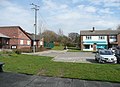
 Scout hut, Highgate Lane, Lepton - geograph.org.uk - 764403.jpg 640 × 490; 67 KB
-
 Stepping Stones below Lower House - geograph.org.uk - 727870.jpg 427 × 640; 152 KB
-
-

-
 View along path from Town End Lane - geograph.org.uk - 122089.jpg 640 × 480; 104 KB
-
 View Northeast from Botany Lane - geograph.org.uk - 92045.jpg 640 × 480; 115 KB
-
 Windswept copse from Wakefield Road - geograph.org.uk - 779374.jpg 640 × 594; 71 KB

,_Botany_lane,_Lepton_-_geograph.org.uk_-_558950.jpg)
,_Botany_Lane,_Lepton_-_geograph.org.uk_-_558946.jpg)


.jpg)


.jpg)
.jpg)


