Category:Lerwick
Jump to navigation
Jump to search

town and port on Shetland, and capital of the Shetland Islands, Scotland, UK  | |||||
| Upload media | |||||
| Instance of |
| ||||
|---|---|---|---|---|---|
| Location |
| ||||
| Population |
| ||||
| Area |
| ||||
| Elevation above sea level |
| ||||
| official website | |||||
 | |||||
Subcategories
This category has the following 22 subcategories, out of 22 total.
A
B
- Bain's Beach, Lerwick (9 F)
C
- Clickimin Broch (102 F)
- Clickimin Leisure Centre (20 F)
- Clickimin Loch (21 F)
- Cruester (4 F)
G
- Gilbert Bain Hospital (3 F)
- Gulberwick (28 F)
H
- Helendale, Lerwick (1 F)
I
- Ian Bairnson (2 F)
L
- Lerwick New Cemetery (31 F)
- Lerwick Up Helly Aa (35 F)
P
- Post boxes in Lerwick (23 F)
R
S
T
- Torchlit parade in Lerwick (16 F)
W
Media in category "Lerwick"
The following 200 files are in this category, out of 483 total.
(previous page) (next page)-
 "Loyal" at Lerwick - geograph.org.uk - 2055586.jpg 2,560 × 1,920; 2.02 MB
-
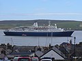 "Marco Polo" - geograph.org.uk - 2055696.jpg 2,560 × 1,920; 1.74 MB
-
 05930 UK Shetland Lerwick welcome sign V-P.jpg 4,530 × 6,792; 10.27 MB
-
 150727 Lerwick 2 (32426192407).jpg 4,896 × 3,672; 4.7 MB
-
 Advertising signs at Tod's Steps - geograph.org.uk - 960310.jpg 480 × 640; 81 KB
-
-
 Albert Buildings, Lerwick - geograph.org.uk - 908536.jpg 640 × 426; 54 KB
-
 Albert Dock, Lerwick - geograph.org.uk - 3551139.jpg 1,024 × 681; 117 KB
-
 Albert Wharf and Fuel Terminal, Lerwick - geograph.org.uk - 5134004.jpg 640 × 427; 332 KB
-

-
 Alexandra Wharf, Lerwick - geograph.org.uk - 2821821.jpg 800 × 532; 159 KB
-
 Alliance and Leicester - geograph.org.uk - 1802362.jpg 640 × 480; 74 KB
-
 Anderson and Co, Lerwick.jpg 1,492 × 1,656; 574 KB
-
 Approaching Bressay Pier - geograph.org.uk - 5733382.jpg 1,024 × 751; 147 KB
-
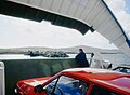
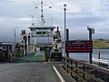
 Approaching Lerwick by Ferry - geograph.org.uk - 646972.jpg 640 × 425; 80 KB
-

-
 Area around Bressay School - geograph.org.uk - 2648618.jpg 800 × 534; 167 KB
-
 Asperity at North Ness - geograph.org.uk - 3787843.jpg 640 × 426; 249 KB
-
 Bank of Scotland, Lerwick (32564027637).jpg 5,379 × 3,586; 11.19 MB
-
 Barge, Lerwick Harbour - geograph.org.uk - 3787605.jpg 640 × 426; 249 KB
-
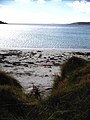
 Beach at the Sletts - geograph.org.uk - 573056.jpg 426 × 640; 47 KB
-

-
 Bienvenue aux Shetland!.jpg 3,456 × 4,608; 6.11 MB
-

-
 Boats at Garthspool, Lerwick - geograph.org.uk - 5886229.jpg 1,600 × 1,065; 642 KB
-
 Brei Wick (bay) from Breiwick Road, Lerwick - geograph.org.uk - 5451487.jpg 1,200 × 799; 328 KB
-
 Brei Wick - geograph.org.uk - 2020850.jpg 2,560 × 1,920; 1.67 MB
-
 Brei Wick - geograph.org.uk - 878322.jpg 600 × 391; 66 KB
-
 Brei Wick Shoreline - geograph.org.uk - 2020866.jpg 1,920 × 2,560; 1.71 MB
-
 Brei Wick, Lerwick - geograph.org.uk - 3155164.jpg 1,024 × 681; 246 KB
-
 Brei Wick, Rocky Shoreline - geograph.org.uk - 5158494.jpg 640 × 481; 386 KB
-
 Breiwick shoreline, Lerwick - geograph.org.uk - 5161297.jpg 1,024 × 576; 102 KB
-
 Bressay Ferry crossing the wake of MV Hrossey - geograph.org.uk - 5143132.jpg 1,600 × 900; 434 KB
-
 Bressay from Bressay Sound - geograph.org.uk - 6252316.jpg 640 × 467; 49 KB
-
 Bressay harbour - geograph.org.uk - 6252314.jpg 640 × 416; 44 KB
-
 Brettaboor shore - geograph.org.uk - 1303191.jpg 640 × 427; 61 KB
-
 Bruce Crescent, Lerwick - geograph.org.uk - 1762478.jpg 800 × 533; 197 KB
-
 Buoy, Lerwick harbour - geograph.org.uk - 3787848.jpg 640 × 426; 271 KB
-
 Buoys in Lerwick harbour - geograph.org.uk - 5335331.jpg 1,024 × 682; 122 KB
-
 Buoys off North Ness, Lerwick - geograph.org.uk - 3351354.jpg 1,024 × 681; 120 KB
-
 Burn of Fitch, near Lerwick - geograph.org.uk - 1064674.jpg 640 × 426; 85 KB
-
 Cable telegraph out to Voe of Sound - geograph.org.uk - 354536.jpg 480 × 640; 93 KB
-
 Campsite at Clickimin, Lerwick - geograph.org.uk - 85046.jpg 640 × 480; 89 KB
-
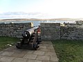 Cannon, Fort Charlotte - geograph.org.uk - 1060994.jpg 640 × 481; 67 KB
-
 Car park at the South Ness, Lerwick - geograph.org.uk - 1569743.jpg 640 × 426; 32 KB
-
 Christian Monument, Lerwick - geograph.org.uk - 1192059.jpg 404 × 640; 72 KB
-
 Christian monument, Lerwick - geograph.org.uk - 960382.jpg 480 × 640; 94 KB
-
 Church Road becomes the Esplanade, Lerwick - geograph.org.uk - 2770555.jpg 1,333 × 1,000; 1.51 MB
-
 Coastal Farm, Bressay - geograph.org.uk - 5164907.jpg 640 × 427; 408 KB
-
 Coastguard Station - geograph.org.uk - 1288730.jpg 640 × 427; 27 KB
-
 Colourful Cars - geograph.org.uk - 4631046.jpg 3,680 × 2,664; 1.6 MB
-
 Common Guillemot (Uria aalge), Lerwick - geograph.org.uk - 3017515.jpg 800 × 534; 135 KB
-
 Common Ivy (Hedera helix), Lerwick - geograph.org.uk - 1762426.jpg 640 × 426; 131 KB
-
 Common Tern (Sterna hirundo), Lerwick - geograph.org.uk - 1922976.jpg 800 × 534; 127 KB
-

-
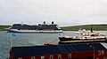
 Costa Mediterranea visiting Lerwick - geograph.org.uk - 5834482.jpg 5,400 × 3,375; 3.37 MB
-
 Crocuses, North Road, Lerwick - geograph.org.uk - 1762449.jpg 800 × 533; 234 KB
-
 Crooked Still.jpg 2,816 × 2,112; 1.42 MB
-
 Crowded pier at Lerwick - geograph.org.uk - 357314.jpg 640 × 443; 68 KB
-
 Crown Princess outside Lerwick - geograph.org.uk - 2712751.jpg 1,523 × 1,000; 1.06 MB
-
 Cruise ship Crystal Symphony in Lerwick harbour - geograph.org.uk - 5036260.jpg 1,024 × 682; 153 KB
-
 Cruise ship in Lerwick - geograph.org.uk - 1955669.jpg 800 × 533; 89 KB
-
 Cruise ship leaving Lerwick - geograph.org.uk - 4011995.jpg 2,048 × 1,536; 462 KB
-
 Da Knowe, Lerwick - geograph.org.uk - 5335377.jpg 1,024 × 682; 271 KB
-
 Da Lodberrie, Lerwick (33629549318).jpg 3,493 × 5,239; 12.06 MB
-
 Da Lodberrie, Lerwick (47453469372).jpg 3,454 × 5,181; 11.8 MB
-
 Da Vadill, North Road, Lerwick - geograph.org.uk - 1762467.jpg 800 × 533; 199 KB
-
 Diana Memorial Fountain, Lerwick - geograph.org.uk - 1804852.jpg 480 × 640; 99 KB
-
 Dim Riv - geograph.org.uk - 2009461.jpg 2,560 × 1,920; 1.82 MB
-
 Distant lighthouse - geograph.org.uk - 2711504.jpg 4,316 × 2,877; 2 MB
-
 Dock buildings, Lerwick - geograph.org.uk - 960288.jpg 640 × 480; 53 KB
-
 Docks at Garthspool, Lerwick - geograph.org.uk - 2705190.jpg 4,928 × 2,660; 710 KB
-
 Douglas Arms - geograph.org.uk - 1805168.jpg 640 × 480; 87 KB
-
 Earlier the same day (5393842156).jpg 4,320 × 3,240; 3.87 MB
-
 Easter Rova Head lighthouse, Lerwick - geograph.org.uk - 2112981.jpg 800 × 533; 121 KB
-
 Ebenezer Hall - geograph.org.uk - 1804990.jpg 640 × 480; 91 KB
-
 Eider (Somateria mollissima), Lerwick - geograph.org.uk - 1922959.jpg 534 × 800; 153 KB
-
 Faerdie-maet - geograph.org.uk - 1802891.jpg 640 × 480; 110 KB
-
 Faerdie-maet, Lerwick - geograph.org.uk - 1590672.jpg 640 × 426; 83 KB
-

-
 Ferry Exciting - geograph.org.uk - 1986015.jpg 2,560 × 1,920; 1.84 MB
-
 Ferry Pier at Lerwick - geograph.org.uk - 5925045.jpg 800 × 600; 593 KB
-
 Ferry Terminal at Bressay - geograph.org.uk - 5160532.jpg 640 × 481; 474 KB
-

-
 Fish processing in Lerwick - geograph.org.uk - 4309212.jpg 1,024 × 751; 174 KB
-
 Fish remains, Skipidock, Lerwick - geograph.org.uk - 1762322.jpg 800 × 534; 264 KB
-
 Fishing boat in Albert Dock, Lerwick, at night - geograph.org.uk - 3240831.jpg 1,024 × 679; 170 KB
-
 Fishing boats in Lerwick - geograph.org.uk - 3211433.jpg 1,024 × 681; 123 KB
-

-
 Floatel in Albert Dock, Lerwick - geograph.org.uk - 3536366.jpg 1,024 × 681; 178 KB
-
 Floatel in Albert Dock, Lerwick - geograph.org.uk - 3536372.jpg 1,024 × 681; 158 KB
-
 Flotel in Lerwick's Albert Dock - geograph.org.uk - 3586756.jpg 640 × 480; 215 KB
-
 Flotel in Morrison Dock, Lerwick - geograph.org.uk - 1922955.jpg 800 × 534; 168 KB
-
 Fort Charlotte Guest House - geograph.org.uk - 1804786.jpg 480 × 640; 122 KB
-
 FPV Jura at Victoria Pier, Lerwick - geograph.org.uk - 3158999.jpg 1,024 × 682; 119 KB
-
 FPV Jura in Lerwick - geograph.org.uk - 2112966.jpg 800 × 534; 191 KB
-
 Frank Williamson, Lerwick - geograph.org.uk - 1132266.jpg 640 × 426; 62 KB
-
 Gardie House from Bressay ferry terminal - geograph.org.uk - 2713051.jpg 1,333 × 1,000; 963 KB
-
 Gardie House, Bressay - geograph.org.uk - 4992149.jpg 1,024 × 682; 157 KB
-
 Garthspool, Lerwick - geograph.org.uk - 5335350.jpg 1,024 × 682; 138 KB
-
 GB-lerwick-01.jpg 4,928 × 3,264; 4.53 MB
-
 Geosund and Geco Scorpio in Albert Dock - geograph.org.uk - 2692496.jpg 1,856 × 1,000; 1.14 MB
-
 Gilbertson Park, Lerwick - geograph.org.uk - 1600997.jpg 640 × 426; 45 KB
-
-
 Glebe and Grindiscol, Bressay - geograph.org.uk - 2499468.jpg 800 × 534; 187 KB
-
 Glebe Park, Glebe, Bressay - geograph.org.uk - 5444715.jpg 1,200 × 799; 341 KB
-
 Glebe, Bressay - geograph.org.uk - 2648627.jpg 800 × 534; 148 KB
-
 Glen Orchy House - geograph.org.uk - 1804982.jpg 640 × 480; 74 KB
-
 GP records in envelopes.jpg 2,592 × 1,728; 945 KB
-
 Grantfield Garage, Lerwick - geograph.org.uk - 1762485.jpg 800 × 534; 128 KB
-
 Gravestone of David Ernest Hornell.jpg 1,600 × 1,200; 709 KB
-

-

-
 Grey Seal (Halichoerus grypus), Lerwick - geograph.org.uk - 1705328.jpg 800 × 534; 204 KB
-
-
 Grey Seal (Halichoreus grypeus), Lerwick - geograph.org.uk - 5873900.jpg 1,600 × 1,067; 269 KB
-
 Gulls fighting for food, Lerwick - geograph.org.uk - 1066249.jpg 640 × 376; 101 KB
-

-
-
 Gurkha Kitchen, Commercial Road, Lerwick - geograph.org.uk - 2359889.jpg 800 × 534; 166 KB
-
 H180 Atlantic Lady at Holmsgarth, Lerwick - geograph.org.uk - 4709153.jpg 1,024 × 681; 179 KB
-
 Ham - geograph.org.uk - 3787588.jpg 640 × 426; 251 KB
-
 Ham - geograph.org.uk - 5166527.jpg 640 × 427; 305 KB
-
 Harbour boat, Kebister - geograph.org.uk - 1804801.jpg 640 × 480; 87 KB
-
 Harbour House - geograph.org.uk - 1804837.jpg 640 × 480; 81 KB
-
 Harbour houses - geograph.org.uk - 4012034.jpg 2,048 × 1,536; 440 KB
-
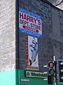
 Harry's Department Store - geograph.org.uk - 1804770.jpg 640 × 480; 84 KB
-
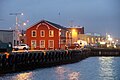
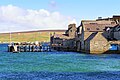
 Hay's Dock, Lerwick - geograph.org.uk - 5923709.jpg 800 × 600; 528 KB
-
 Head of Brei Wick, Lerwick - geograph.org.uk - 3158913.jpg 1,024 × 682; 167 KB
-
 Head of Brei Wick, Lerwick - geograph.org.uk - 3158914.jpg 1,024 × 681; 206 KB
-
 Head of Dales Voe, Lerwick - geograph.org.uk - 1018727.jpg 640 × 426; 80 KB
-
 Head of Dales Voe, Lerwick - geograph.org.uk - 1744789.jpg 800 × 534; 226 KB
-
 Helendale, Lerwick - geograph.org.uk - 736610.jpg 640 × 426; 67 KB
-
 Heogan Fish Factory, Bressay - geograph.org.uk - 2648604.jpg 800 × 534; 136 KB
-
 Herring Gull (Larus argentatus), Lerwick - geograph.org.uk - 1705310.jpg 800 × 533; 129 KB
-

-
 Herring Gulls (Larus argentatus) - geograph.org.uk - 559738.jpg 640 × 426; 33 KB
-

-
 Hillside at Dale, near Lerwick - geograph.org.uk - 811971.jpg 640 × 426; 91 KB
-
 Hjaltland RIB on Exercise - geograph.org.uk - 1986008.jpg 2,560 × 1,920; 1.91 MB
-
 HMS Middleton (M34) at Victoria Pier, Lerwick - geograph.org.uk - 4487343.jpg 1,024 × 681; 124 KB
-
 HMS Middleton (M34) at Victoria Pier, Lerwick - geograph.org.uk - 4487354.jpg 1,024 × 681; 183 KB
-
 Holm of Cruester - geograph.org.uk - 4511579.jpg 640 × 480; 195 KB
-
 Holm of Cruester - geograph.org.uk - 5503312.jpg 4,000 × 3,000; 3.35 MB
-
 Holm of Cruester, Bressay Sound - geograph.org.uk - 5160246.jpg 640 × 427; 397 KB
-
 Holm Sound - geograph.org.uk - 5164893.jpg 640 × 427; 406 KB
-
 Holmsgarth Ferry Terminal, Shetland - geograph.org.uk - 5148792.jpg 640 × 481; 364 KB
-
 Holmsgarth, Lerwick - geograph.org.uk - 2821833.jpg 800 × 533; 174 KB
-

-
 House on Lerwick seafront - geograph.org.uk - 3586627.jpg 640 × 480; 255 KB
-
 House on the Hill above Bressay Shore - geograph.org.uk - 5160516.jpg 640 × 427; 352 KB
-

-
 Junction of Tod's Steps - geograph.org.uk - 960323.jpg 640 × 480; 77 KB
-
 June Rose, LK 779, Skipidock, Lerwick - geograph.org.uk - 1922986.jpg 800 × 533; 173 KB
-
 Jura at Lerwick Harbour - geograph.org.uk - 2070023.jpg 2,560 × 1,920; 1.83 MB
-
 King George's Field - geograph.org.uk - 1805722.jpg 640 × 480; 101 KB
-
 Kittiwake (Rissa tridactyla), Lerwick - geograph.org.uk - 3158948.jpg 1,024 × 684; 130 KB
-
 Klimadiagramm-deutsch-Lerwick (Shetland-Inseln)-GB.png 1,024 × 713; 111 KB
-
 Kristina Cruises - geograph.org.uk - 2009504.jpg 2,560 × 1,920; 1.66 MB
-
 Ladder on the quayside, Lerwick - geograph.org.uk - 2051690.jpg 533 × 800; 164 KB
-
-
 Leira Ness - geograph.org.uk - 4511606.jpg 640 × 480; 178 KB
-
 Leira Ness - geograph.org.uk - 6180689.jpg 1,600 × 1,067; 173 KB
-
 Leirna at Bressay - geograph.org.uk - 2060883.jpg 2,560 × 1,920; 1.9 MB
-
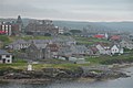 Leirvick.shetland.4.jpg 640 × 426; 45 KB
-
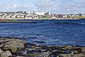
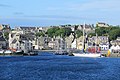
 Lerwick - geograph.org.uk - 5923478.jpg 800 × 533; 620 KB
-
 Lerwick at night from the sea - geograph.org.uk - 4211820.jpg 1,024 × 681; 148 KB
-
 Lerwick banner Harbour.jpg 13,937 × 1,991; 5.65 MB
-
 Lerwick Boating Club - geograph.org.uk - 3120156.jpg 1,024 × 681; 189 KB
-
 Lerwick Boating Club Pier - geograph.org.uk - 1803322.jpg 1,600 × 1,200; 394 KB
-
 Lerwick Bus Station - geograph.org.uk - 2359979.jpg 800 × 534; 165 KB
-
 Lerwick Cemetery - geograph.org.uk - 6180686.jpg 1,600 × 896; 215 KB
-
-
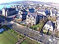
 Lerwick drone photograph 1.jpg 4,096 × 3,072; 1.19 MB
-
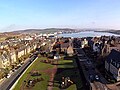
 Lerwick drone photograph 2.jpg 4,096 × 3,072; 1.7 MB
-
 Lerwick drone photograph 3.jpg 4,096 × 3,072; 1.78 MB
-
 Lerwick drone photograph 4.jpg 4,096 × 3,072; 1.13 MB
-
 Lerwick from North Taing - geograph.org.uk - 1310722.jpg 640 × 481; 119 KB
-
 Lerwick from Staney Hill - geograph.org.uk - 281021.jpg 640 × 427; 157 KB
-
 Lerwick from Staney Hill. - Remy Osman.jpg 3,648 × 2,736; 3.38 MB
-
 Lerwick Fuel Depot - geograph.org.uk - 5134007.jpg 640 × 427; 329 KB
-
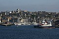
 Lerwick Harbour - geograph.org.uk - 2020960.jpg 2,560 × 1,920; 1.75 MB
-
 Lerwick harbour - geograph.org.uk - 2499440.jpg 800 × 534; 188 KB
-
 Lerwick Harbour - geograph.org.uk - 3787596.jpg 640 × 426; 266 KB
-
 Lerwick Harbour - geograph.org.uk - 3787600.jpg 640 × 426; 250 KB
-
 Lerwick harbour - geograph.org.uk - 5020805.jpg 2,592 × 1,944; 1.27 MB
-
 Lerwick harbour - geograph.org.uk - 6252309.jpg 640 × 528; 67 KB
-
 Lerwick harbour - geograph.org.uk - 6252312.jpg 640 × 601; 97 KB
-
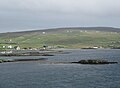
 Lerwick Harbour from Bressay Sound - geograph.org.uk - 5133994.jpg 640 × 427; 208 KB
-
 Lerwick Harbour, Hay's Dock - geograph.org.uk - 5923676.jpg 800 × 600; 527 KB
-
-
 Lerwick Harbour, Skipidock - geograph.org.uk - 5919265.jpg 800 × 600; 627 KB
-
 Lerwick Harbour, Victoria Pier - geograph.org.uk - 5134003.jpg 640 × 427; 193 KB
-

-
 Lerwick lifeboat, Michael and Jane Vernon - geograph.org.uk - 4541710.jpg 681 × 1,024; 136 KB
-
 Lerwick PillarBox.jpg 2,880 × 4,320; 5.17 MB
-
 Lerwick pilot boat Knab in Bressay Sound - geograph.org.uk - 3159001.jpg 1,024 × 681; 141 KB
-

-
 Lerwick Pilot Cutter - geograph.org.uk - 4505151.jpg 640 × 480; 152 KB
-
 Lerwick sea front - Queens Hotel - geograph.org.uk - 3787594.jpg 640 × 332; 208 KB


.jpg)


,_Lerwick_-_geograph.org.uk_-_1121939.jpg)


.jpg)


,_Small_Boat_Harbour,_Lerwick_-_geograph.org.uk_-_5812245.jpg)

,_Lerwick_-_geograph.org.uk_-_2821796.jpg)

_from_Breiwick_Road,_Lerwick_-_geograph.org.uk_-_5451487.jpg)


,_Lerwick_-_geograph.org.uk_-_3017515.jpg)
,_Lerwick_-_geograph.org.uk_-_1762426.jpg)
,_Lerwick_-_geograph.org.uk_-_1922976.jpg)
,_Lerwick_harbour_-_geograph.org.uk_-_4541847.jpg)


.jpg)
.jpg)


.jpg)


,_Lerwick_-_geograph.org.uk_-_1922959.jpg)


,_Lerwick_-_geograph.org.uk_-_1922969.jpg)


,_Lerwick_-_geograph.org.uk_-_1066214.jpg)


,_Lerwick_-_geograph.org.uk_-_1066223.jpg)
,_Lerwick_-_geograph.org.uk_-_1611569.jpg)
,_Lerwick_-_geograph.org.uk_-_1705328.jpg)
,_Lerwick_-_geograph.org.uk_-_559730.jpg)
,_Lerwick_-_geograph.org.uk_-_5873900.jpg)


,_Lerwick_-_geograph.org.uk_-_1705310.jpg)
,_Victoria_Pier,_Lerwick_-_geograph.org.uk_-_3917197.jpg)
_-_geograph.org.uk_-_559738.jpg)
,_Lerwick_-_geograph.org.uk_-_1705307.jpg)


_at_Victoria_Pier,_Lerwick_-_geograph.org.uk_-_4487343.jpg)
_at_Victoria_Pier,_Lerwick_-_geograph.org.uk_-_4487354.jpg)


,_Lerwick_-_geograph.org.uk_-_3158948.jpg)
-GB.png)


