Category:Les Borjons, Manziat (Cars de l'Ain)
Jump to navigation
Jump to search
| Object location | | View all coordinates using: OpenStreetMap |
|---|
Media in category "Les Borjons, Manziat (Cars de l'Ain)"
The following 9 files are in this category, out of 9 total.
-
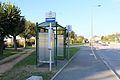
 Arrêt Borjons Manziat 1.jpg 5,184 × 3,456; 7.85 MB
-
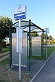
 Arrêt Borjons Manziat 2.jpg 5,184 × 3,456; 7.19 MB
-
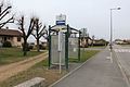
 Arrêt Borjons Manziat 3.jpg 3,456 × 5,184; 6.56 MB
-
 Arrêt Borjons Manziat 4.jpg 5,184 × 3,456; 7.28 MB
-
 Arrêt Borjons Manziat 5.jpg 5,184 × 3,456; 5.53 MB
-
 Arrêt Borjons Manziat 6.jpg 5,184 × 3,456; 5.92 MB
-
 Arrêt Borjons Manziat 7.jpg 3,456 × 5,184; 6.55 MB
-
 Arrêt Borjons Manziat 8.jpg 5,184 × 3,456; 7.13 MB
-
 Arrêt Borjons Manziat 9.jpg 3,456 × 5,184; 6.08 MB


