Category:Letterkenny
Jump to navigation
Jump to search
town in County Donegal, Ireland   | |||||
| Upload media | |||||
| Instance of | |||||
|---|---|---|---|---|---|
| Location | Donegal North–East, County Donegal, Ulster, Ireland | ||||
| Located in or next to body of water | |||||
| Population |
| ||||
| Area |
| ||||
| Elevation above sea level |
| ||||
| official website | |||||
 | |||||

Subcategories
This category has the following 12 subcategories, out of 12 total.
A
- An Grianán Theatre (8 F)
B
G
- Gortnavern (2 F)
K
- Kiltoy Church of Ireland (2 F)
L
- Líonra Leitir Ceanainn (1 F)
M
- Mondooey Upper (3 F)
- Mongorry (3 F)
P
- Polestar (sculpture) (2 F)
S
- Saint Eunan's College (8 F)
T
- Transport in Letterkenny (3 F)
Media in category "Letterkenny"
The following 200 files are in this category, out of 667 total.
(previous page) (next page)-
 'The Hiring Fair' sculpture, Letterkenny - geograph.org.uk - 5884854.jpg 2,000 × 1,500; 1.02 MB
-
 .......and into the fire^ - geograph.org.uk - 5962089.jpg 1,600 × 1,129; 1.17 MB
-

-
 An Grianán Theatre, Letterkenny (2024).jpg 4,080 × 3,060; 2.57 MB
-

-
 Anemone blanda Glenveagh - geograph.org.uk - 4436116.jpg 640 × 480; 159 KB
-
 Approach to the Harry Blaney Bridge - geograph.org.uk - 3998074.jpg 640 × 480; 215 KB
-
 Approach to the Harry Blaney Bridge - geograph.org.uk - 3998091.jpg 640 × 480; 245 KB
-
 Arch, Letterkenny - geograph.org.uk - 2604668.jpg 640 × 480; 65 KB
-

-
 Archway, Glenveagh - geograph.org.uk - 4436097.jpg 640 × 480; 167 KB
-
 Ard O’ Donnell Road, Letterkenny - geograph.org.uk - 2560301.jpg 640 × 480; 49 KB
-
 Asylum, Letterkenny, Ireland c1880-1900.jpg 580 × 431; 66 KB
-
 Atlantic Drive, Glebe - geograph.org.uk - 3197968.jpg 640 × 360; 207 KB
-
 ATU Letterkenny Campus sign (2024).jpg 3,060 × 4,080; 2.32 MB
-
 Aughnish Road - geograph.org.uk - 3196033.jpg 640 × 480; 262 KB
-
 B. McDaid ^ Sons Photographer Studio - geograph.org.uk - 4773508.jpg 1,200 × 1,027; 446 KB
-
 Baile an tSléibhe - geograph.org.uk - 3198085.jpg 640 × 360; 210 KB
-
 Ballyare Wood - geograph.org.uk - 3996261.jpg 640 × 480; 226 KB
-
 Ballymacool Street, Letterkenny - geograph.org.uk - 4773540.jpg 1,200 × 799; 237 KB
-
 Barn, Ballykenny - geograph.org.uk - 2567548.jpg 640 × 480; 74 KB
-
 Barn, Laddan - geograph.org.uk - 1928940.jpg 640 × 480; 49 KB
-
 Barrack - geograph.org.uk - 3996223.jpg 640 × 390; 223 KB
-
 Beach and houses at Doagh Bay - geograph.org.uk - 1932179.jpg 640 × 480; 83 KB
-
 Beach, Dunaff - geograph.org.uk - 4006926.jpg 640 × 360; 222 KB
-
 Beach, New Bridge Bay - geograph.org.uk - 4010539.jpg 640 × 480; 239 KB
-
 Beer delivery, Letterkenny - geograph.org.uk - 3926884.jpg 640 × 481; 171 KB
-
 Beware of Knotweed - geograph.org.uk - 5510024.jpg 4,320 × 3,240; 4 MB
-
 Bishop of Aughnish crest - geograph.org.uk - 5062473.jpg 640 × 480; 152 KB
-

-

-
 Boats, Kildrum Lake - geograph.org.uk - 1918313.jpg 640 × 480; 54 KB
-
 Bog road - geograph.org.uk - 3198133.jpg 640 × 480; 260 KB
-
 Bonagee-pitch.jpg 386 × 201; 15 KB
-
 Building at Tawny - geograph.org.uk - 1918213.jpg 640 × 480; 74 KB
-

-
 Bungalow, Crossogs - geograph.org.uk - 1975953.jpg 640 × 480; 58 KB
-
 Bunnaton More - geograph.org.uk - 1919639.jpg 640 × 480; 69 KB
-
 Bunnaton Youth Hostel - geograph.org.uk - 5288177.jpg 2,386 × 1,454; 789 KB
-
 Bus Éireann Coach on the N13 at Raymoghy - geograph.org.uk - 5658500.jpg 640 × 481; 417 KB
-
 Business Units, Letterkenny - geograph.org.uk - 2506302.jpg 640 × 480; 43 KB
-

-
 Calaghans Bar, Church Hill - geograph.org.uk - 1807278.jpg 640 × 480; 44 KB
-
 Car Park, Mulroy College - geograph.org.uk - 3196047.jpg 640 × 480; 259 KB
-
 Car park, Tra na Rossan - geograph.org.uk - 3197608.jpg 640 × 360; 213 KB
-
 Caravan graveyard - geograph.org.uk - 1932226.jpg 640 × 480; 78 KB
-
 Caravan park - geograph.org.uk - 3197516.jpg 640 × 360; 198 KB
-
 Caravan park, Melmore - geograph.org.uk - 3197510.jpg 640 × 360; 209 KB
-
 Carmel's B ^ B - Blush - Rebecca's - geograph.org.uk - 2503677.jpg 640 × 480; 49 KB
-
 Carrs of the Diamond - geograph.org.uk - 3996242.jpg 640 × 480; 232 KB
-
 Cashelshannaghan National School - geograph.org.uk - 2568271.jpg 640 × 480; 45 KB
-
 Castlegrove House - geograph.org.uk - 1970250.jpg 1,024 × 768; 154 KB
-
 Caterpillar, Glenveagh - geograph.org.uk - 4433276.jpg 615 × 640; 76 KB
-
 Cathedral Road, Letterkenny - geograph.org.uk - 2560189.jpg 640 × 480; 54 KB
-
 Cattle. Gort na Luchog - geograph.org.uk - 3197542.jpg 640 × 360; 228 KB
-
 Celtic High Cross, Letterkenny - geograph.org.uk - 2504980.jpg 640 × 480; 49 KB
-
 Celtic High Cross, Letterkenny - geograph.org.uk - 2604623.jpg 1,920 × 2,560; 2.15 MB
-
 Cement depot - geograph.org.uk - 3985286.jpg 640 × 480; 261 KB
-
 Cemetery at Leck, Letterkenny - geograph.org.uk - 1764877.jpg 640 × 480; 63 KB
-
 Charles Kelly plaque, Drummonaghan - geograph.org.uk - 2567433.jpg 640 × 480; 80 KB
-

-
 Church bell, Kilnacrenan - geograph.org.uk - 4436030.jpg 640 × 480; 166 KB
-
 Church Lane sign, Letterkenny - geograph.org.uk - 3926657.jpg 640 × 480; 142 KB
-
 Church Lane, Letterkenny - geograph.org.uk - 3926652.jpg 640 × 480; 165 KB
-
 Church Lane, Letterkenny - geograph.org.uk - 3927263.jpg 640 × 480; 158 KB
-
 Church Lane, Letterkenny - geograph.org.uk - 3989560.jpg 640 × 480; 271 KB
-
 Church ruin at Cill Mhic N-Eanian - geograph.org.uk - 1960610.jpg 480 × 640; 257 KB
-
 CIE bus, Letterkenny - geograph.org.uk - 2408618.jpg 800 × 521; 80 KB
-
 Cionn Droma Post Office - geograph.org.uk - 1917157.jpg 640 × 480; 79 KB
-
 College Road, Letterkenny - geograph.org.uk - 5859259.jpg 2,000 × 1,486; 993 KB
-
 College Row, Letterkenny - geograph.org.uk - 2560266.jpg 640 × 480; 60 KB
-
 Colm Dillon Cars, Killycreen - geograph.org.uk - 5658593.jpg 640 × 427; 319 KB
-

-
 Commemorative plaque-Letterkenny RFC - geograph.org.uk - 1499746.jpg 640 × 360; 84 KB
-
 Construction, Ballyare Glebe - geograph.org.uk - 3950547.jpg 640 × 480; 241 KB
-
 Convent Road, Letterkenny - geograph.org.uk - 5859261.jpg 2,000 × 1,500; 1,017 KB
-
 Conwal Parish Church spire Statue.jpg 187 × 305; 22 KB
-
 Conway's Bar, front door - geograph.org.uk - 5062399.jpg 640 × 480; 176 KB
-
 Coole - Cranford Community Centre - geograph.org.uk - 1929316.jpg 640 × 480; 44 KB
-
 Corner stone, Kelly's Store - geograph.org.uk - 5062375.jpg 640 × 480; 196 KB
-
 Correnagh - geograph.org.uk - 3985263.jpg 640 × 480; 273 KB
-
 Cottage at Carrowcashel - geograph.org.uk - 2566873.jpg 640 × 480; 48 KB
-
 Cottage at Rosskirk - geograph.org.uk - 1919605.jpg 640 × 480; 58 KB
-
 Cottage, Ballynacrick - geograph.org.uk - 1918729.jpg 640 × 480; 72 KB
-
 Cottage, Letterkenny - geograph.org.uk - 2560332.jpg 640 × 480; 47 KB
-
 Cottages in Letterkenny, Ireland ca 1900.jpg 600 × 461; 75 KB
-
 Creek, Ballyoghagan - geograph.org.uk - 3196215.jpg 640 × 480; 251 KB
-
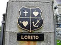 Crest, Loreto Convent - geograph.org.uk - 2604630.jpg 640 × 480; 86 KB
-
 Crockmore - geograph.org.uk - 3197977.jpg 640 × 360; 236 KB
-
 Cross, Ballyare - geograph.org.uk - 3996248.jpg 640 × 480; 262 KB
-

-
 Dalradian quartzites, Illanfreagh - geograph.org.uk - 2079924.jpg 800 × 600; 154 KB
-
 Daly Terrace, Letterkenny - geograph.org.uk - 3927078.jpg 640 × 480; 152 KB
-

-
 Deja Vu, Letterkenny - geograph.org.uk - 3927027.jpg 640 × 480; 148 KB
-
 Derelict cottage, Old Town, Letterkenny - geograph.org.uk - 5805893.jpg 2,000 × 1,514; 850 KB
-
 Derelict factory, Letterkenny - geograph.org.uk - 3927307.jpg 640 × 480; 164 KB
-
 Derelict industrial building - geograph.org.uk - 1883749.jpg 640 × 480; 87 KB
-
 Derelict limekiln - geograph.org.uk - 1883768.jpg 640 × 480; 106 KB
-
 Diamond's Spirit Stores - geograph.org.uk - 3967860.jpg 640 × 480; 279 KB
-
 Diamond's Spirit Stores - geograph.org.uk - 3967864.jpg 640 × 853; 557 KB
-
 Direction sign to garden centre - geograph.org.uk - 3842383.jpg 640 × 480; 83 KB
-
 Disused limekiln - geograph.org.uk - 1883779.jpg 640 × 480; 110 KB
-
 Disused limekiln fireplace - geograph.org.uk - 1883785.jpg 640 × 480; 108 KB
-
 Disused railway bridge over the River Swilly, Letterkenny - geograph.org.uk - 5805873.jpg 2,000 × 1,500; 1.19 MB
-
 Disused railway bridge over the River Swilly, Letterkenny - geograph.org.uk - 5884715.jpg 2,000 × 1,500; 1.01 MB
-
 Doagh Bay - geograph.org.uk - 3197974.jpg 640 × 360; 201 KB
-
 Doire Chasáin - geograph.org.uk - 3198082.jpg 640 × 360; 209 KB
-
 Donegal News - Flamingo Restaurant - geograph.org.uk - 2503664.jpg 640 × 480; 44 KB
-
 Driving off the Lough Swilly Ferry - geograph.org.uk - 4613207.jpg 640 × 480; 165 KB
-
 Dry Arch Roundabout - geograph.org.uk - 3203121.jpg 640 × 480; 249 KB
-
 Dry Arch Roundabout - geograph.org.uk - 3653041.jpg 2,592 × 1,936; 1.83 MB
-
 Dry Arch Roundabout Letterkenny - geograph.org.uk - 3792309.jpg 785 × 523; 307 KB
-
 Ducks, Mulroy Bay - geograph.org.uk - 2603200.jpg 640 × 480; 76 KB
-

-
 Dunree Head - geograph.org.uk - 4006944.jpg 640 × 360; 196 KB
-
 Dunree Head, County Donegal - geograph.org.uk - 4006322.jpg 640 × 480; 163 KB
-
 Early morning gallop - geograph.org.uk - 2608654.jpg 640 × 480; 50 KB
-
 Early morning gallop - geograph.org.uk - 2885006.jpg 640 × 480; 59 KB
-
 Eel Burn Pitch and Putt - geograph.org.uk - 1920051.jpg 640 × 480; 58 KB
-
 EGO MINEFIELD Mean Fiddler London, May 9th 1990.JPG 1,135 × 793; 146 KB
-
 Empty house - geograph.org.uk - 3989581.jpg 640 × 493; 345 KB
-

-
 End of N13-N14 Dual Carriageway - geograph.org.uk - 5658480.jpg 640 × 427; 385 KB
-
 Entrance gateway to St Eunan's College - geograph.org.uk - 5859253.jpg 2,000 × 1,500; 1.17 MB
-
 Entrance to Town Park, Letterkenny - geograph.org.uk - 5884879.jpg 2,000 × 1,500; 1.33 MB
-
 Entrance, Dave Gallaher Park - geograph.org.uk - 2567099.jpg 640 × 480; 68 KB
-
 Evergreen container, Cranford - geograph.org.uk - 1929319.jpg 640 × 480; 45 KB
-
 Ex-army truck. Letterkenny - geograph.org.uk - 1762116.jpg 640 × 480; 52 KB
-
 Falls at Drummonaghan - geograph.org.uk - 2567413.jpg 640 × 480; 81 KB
-
 Fannet Presbyterian Church - geograph.org.uk - 2603081.jpg 640 × 480; 48 KB
-
 Farewell to the Earls - geograph.org.uk - 5960845.jpg 1,063 × 1,600; 1.14 MB
-
 Farren, Mulhall, Roarty Accountants - geograph.org.uk - 2504594.jpg 640 × 480; 58 KB
-
 Fernwood building sites - geograph.org.uk - 1960764.jpg 640 × 480; 205 KB
-
 Field beside Mulroy Bay - geograph.org.uk - 3967904.jpg 640 × 480; 251 KB
-
 Field outside Letterkenny - geograph.org.uk - 3989577.jpg 640 × 480; 237 KB
-
 Fireman's helmet, Letterkenny - geograph.org.uk - 2560389.jpg 640 × 480; 67 KB
-
 Flavours Restaurant, Millview - geograph.org.uk - 1975782.jpg 640 × 480; 57 KB
-
 Flight of the Earls in bronze - geograph.org.uk - 5960841.jpg 1,600 × 1,069; 1.05 MB
-
 Floral display, Letterkenny - geograph.org.uk - 3926755.jpg 640 × 480; 171 KB
-
 Foirgneamh Líonra Leitir Ceanainn, Leitir Ceanainn, Co. Dhún na nGall (2024).jpg 4,080 × 3,060; 3.5 MB
-
 Footbridge over the River Swilly - geograph.org.uk - 4781308.jpg 1,200 × 799; 323 KB
-
 Forest at Carrickybressil - geograph.org.uk - 2059448.jpg 640 × 480; 69 KB
-

-
 Fortwell street name - geograph.org.uk - 3927198.jpg 640 × 480; 133 KB
-
 Fortwell, Letterkenny - geograph.org.uk - 3927195.jpg 640 × 480; 150 KB
-

-
 Gallens Newsagents and Supermarket - geograph.org.uk - 5460797.jpg 640 × 480; 148 KB
-
 Gallyplace.jpg 2,064 × 1,434; 342 KB
-
 Ganiamore -Gainne Mór - geograph.org.uk - 3196269.jpg 640 × 360; 216 KB
-
 Garage on the Rathmelton road - geograph.org.uk - 1937078.jpg 640 × 480; 86 KB
-
 Garage, Dry Arch - geograph.org.uk - 3196003.jpg 640 × 480; 182 KB
-
 Garage, Dry Arch - geograph.org.uk - 3196020.jpg 640 × 480; 240 KB
-
 Garda Siochana na hÉireann badge - geograph.org.uk - 4007887.jpg 640 × 481; 173 KB
-
 Garden Trail, Glenveagh - geograph.org.uk - 4436102.jpg 640 × 480; 179 KB
-
 Georgian-lk.jpg 375 × 500; 146 KB
-
 Glenmaquin National School - geograph.org.uk - 3979655.jpg 640 × 480; 232 KB
-
 Golf Course Road, Letterkenny - geograph.org.uk - 1755968.jpg 640 × 480; 56 KB
-
 Golf course, Rosapenna - geograph.org.uk - 3196246.jpg 640 × 360; 195 KB
-
 Good Luck Donegal - Limerick - geograph.org.uk - 3967907.jpg 640 × 480; 324 KB
-
 Google car, Letterkenny - geograph.org.uk - 2506332.jpg 640 × 481; 73 KB
-
 Gortlee Road, Letterkenny - geograph.org.uk - 2604997.jpg 640 × 480; 46 KB
-
 Gortlee Road, Letterkenny - geograph.org.uk - 2604998.jpg 640 × 480; 55 KB
-
 Graveyard, Stackarnagh - geograph.org.uk - 1977035.jpg 640 × 480; 61 KB
-
 Grazing sheep, Treanavinny - geograph.org.uk - 3979680.jpg 640 × 480; 248 KB
-
 Gregory Hill - geograph.org.uk - 1975677.jpg 640 × 480; 50 KB
-
 Grill, Letterkenny - geograph.org.uk - 2560576.jpg 640 × 480; 49 KB
-
 Guinness advert - geograph.org.uk - 3956383.jpg 640 × 853; 543 KB
-
 Hammering down, Ballyare Glebe - geograph.org.uk - 3996274.jpg 640 × 480; 257 KB
-
 Hazel wood, Miobhaigh - geograph.org.uk - 3196254.jpg 640 × 360; 220 KB
-
 Hedge near Milford - geograph.org.uk - 3950544.jpg 640 × 640; 392 KB
-
 Helmet sculpture - geograph.org.uk - 3989566.jpg 640 × 488; 293 KB
-
 HGV on the N13 at Treantaboy - geograph.org.uk - 5658410.jpg 640 × 481; 410 KB
-
 High Road, Letterkenny - geograph.org.uk - 2503659.jpg 640 × 480; 55 KB
-
 High Road, Letterkenny - geograph.org.uk - 2503680.jpg 640 × 480; 60 KB
-
 High Road, Letterkenny - geograph.org.uk - 2607879.jpg 640 × 480; 75 KB
-
 High Street, Letterkenny - geograph.org.uk - 3927291.jpg 640 × 480; 156 KB
-
 HighStreetLK.jpg 387 × 474; 136 KB
-
 Hiring Fair sculpture, Letterkenny - geograph.org.uk - 3926705.jpg 640 × 480; 179 KB
-
 Holiday cottages, Kinnegar - geograph.org.uk - 2602827.jpg 640 × 480; 62 KB
-
 Holy statue, Paupers graveyard - geograph.org.uk - 2604972.jpg 640 × 480; 86 KB
-
 House next to the N13 - geograph.org.uk - 5658564.jpg 640 × 427; 319 KB
-
 Illanachurry North - geograph.org.uk - 3197972.jpg 640 × 360; 224 KB
-
 Illustrated panel, Letterkenny (1) - geograph.org.uk - 2505317.jpg 640 × 480; 49 KB
-
 Illustrated panel, Letterkenny (2) - geograph.org.uk - 2505320.jpg 640 × 480; 49 KB
-
 Illustrated panel, Letterkenny (3) - geograph.org.uk - 2505322.jpg 640 × 480; 48 KB
-
 Inch Island, County Donegal - geograph.org.uk - 5460726.jpg 640 × 323; 129 KB
-

-
 Information board, Fanad Head - geograph.org.uk - 4007613.jpg 640 × 480; 186 KB
-
 Information board, Letterkenny - geograph.org.uk - 2560533.jpg 640 × 480; 81 KB
-
 Information board, Letterkenny - geograph.org.uk - 2604593.jpg 640 × 480; 54 KB
-
 Inlet, Devlinreagh - geograph.org.uk - 3968996.jpg 640 × 480; 283 KB
-
 Inlet, Mulroy Bay - geograph.org.uk - 3196055.jpg 640 × 480; 298 KB
-
 Inscribed plaque, Blacksmith's Ball - geograph.org.uk - 2502241.jpg 640 × 480; 92 KB
-
 Inscribed plaque, St Columb's Church (1) - geograph.org.uk - 5063029.jpg 640 × 480; 186 KB
-
 Inscribed plaque, St Columb's Church (2) - geograph.org.uk - 5063031.jpg 640 × 480; 150 KB
-

-
 Inscribed stone, Paupers graveyard - geograph.org.uk - 2604978.jpg 640 × 480; 77 KB
-
 Inscribed stone, Stackarnagh - geograph.org.uk - 1977038.jpg 640 × 480; 72 KB
-
 Inscription on stone, Scariffhous - geograph.org.uk - 1975767.jpg 645 × 786; 106 KB


.jpg)
_-_geograph.org.uk_-_2560353.jpg)


.jpg)


_namesign_-_geograph.org.uk_-_2560359.jpg)


.jpg)


_-_geograph.org.uk_-_2505317.jpg)
_-_geograph.org.uk_-_2505320.jpg)
_-_geograph.org.uk_-_2505322.jpg)


_-_geograph.org.uk_-_5063029.jpg)
_-_geograph.org.uk_-_5063031.jpg)


